
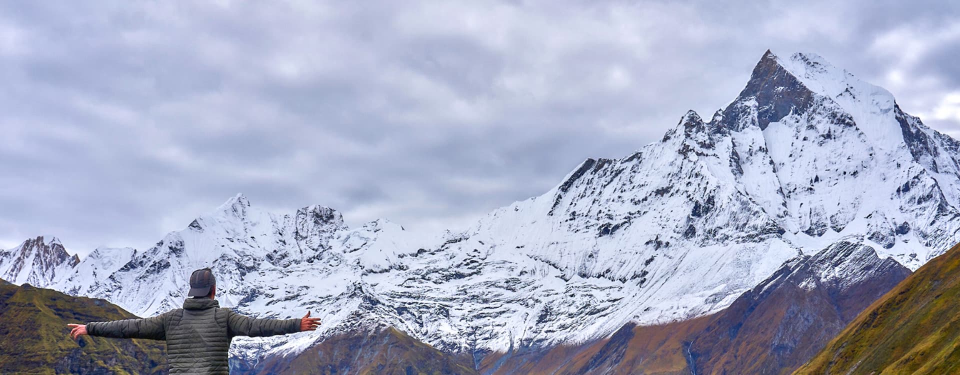
Mount Annapurna stands in north-central Nepal, in Gandaki Province, about 46 kilometers (29 miles) north of Pokhara. Its highest summit, Annapurna I, rises to 8,091 meters (26,545 feet), making it the 10th highest mountain in the world. The summit sits on the border of Myagdi and Kaski districts at 28.5961° N, 83.8203° E, and the whole mountain lies inside Nepal, not India.
The name Annapurna covers more than one peak. It refers to a massif about 55 kilometers (34 miles) long, the Annapurna Himal, which runs between the Kali Gandaki Gorge in the west and the Marshyangdi River in the east. Annapurna I became the first 8,000-meter peak ever climbed when a French team reached its summit on June 3, 1950. It also has one of the highest fatality-to-summit ratios of any 8,000-meter mountain, and the highest among Nepal's eight, which is why experienced climbers treat it with more caution than Everest.
Mount Annapurna Location and Facts at a Glance
- Country: Nepal. Annapurna is not in India.
- Province: Gandaki Province (Gandaki Pradesh)
- District: Annapurna I sits on the border of Myagdi and Kaski districts. The massif also reaches Manang and Lamjung.
- Coordinates: 28.5961° N, 83.8203° E
- Height: 8,091 meters (26,545 feet), the 10th highest mountain on Earth
- Range: Annapurna Himal, part of the Great Himalaya
- First ascent: June 3, 1950, by Maurice Herzog and Louis Lachenal of France
- Summits and deaths: 559 summits and 75 deaths as of February 2025, according to the Himalayan Database
- Protected area: Annapurna Conservation Area, 7,629 square kilometers (2,946 square miles)
- Gateway city: Pokhara, about 46 kilometers (29 miles) to the south
Where Is Mount Annapurna Located? Nepal, India, or China
Mount Annapurna is located in the Annapurna Himal of north-central Nepal, inside Gandaki Province, one of the country's seven provinces. The massif rises directly north of Pokhara, Nepal's second-largest city and the starting point for almost every Annapurna trek and expedition. In a straight line, Annapurna I lies about 177 kilometers (110 miles) west-northwest of Kathmandu.
Three natural boundaries frame the Annapurna location:
- West: The Kali Gandaki Gorge, which separates Annapurna from the Dhaulagiri range
- North and east: The Marshyangdi River valley, which the Annapurna Circuit follows
- South: The Pokhara Valley and its lakes

Which District Is Mount Annapurna In?
The summit of Annapurna I sits on the border of Myagdi and Kaski districts, according to the Nepal Himal Peak Profile published by Nepal's Department of Tourism. Its northern base camp lies in Narchyang, in Annapurna Rural Municipality of Myagdi, while the Annapurna Base Camp most trekkers visit sits on the Kaski side, at the head of the Modi Khola valley. Both districts have named a rural municipality after the mountain. The wider Annapurna massif also stretches into Manang and Lamjung districts, and the Annapurna Conservation Area adds Mustang.
Is Annapurna in India?
No. Annapurna lies entirely within Nepal, so it does not belong to any Indian state. The confusion is common because Annapurna is also the name of a Hindu goddess worshipped across India, and many Hindi speakers search for Annapurna Parvat (अन्नपूर्णा पर्वत). Unlike Mount Everest, which sits on the Nepal-China border, Annapurna has no international boundary running across it.
Exact Coordinates of Annapurna I
Annapurna I Main stands at 28.5961° N latitude and 83.8203° E longitude. Nepal's Department of Tourism lists the summit at 28° 35' 44" N, 83° 49' 21" E, which agrees to within a few hundred meters. Enter either set of coordinates into a mapping app and the pin lands on the summit ridge north of Pokhara.
Mount Annapurna on the Map of Nepal
On a map of Nepal, look to the center-west of the country, directly above Pokhara. Annapurna sits east of Dhaulagiri and west of Manaslu, the two other 8,000-meter peaks of central Nepal. The Kali Gandaki River cuts north to south along its western side, and the Marshyangdi curves around its north and east.

For a route-level view, study our Annapurna Circuit trek map, which traces the full loop around the massif, including Thorong La pass at 5,416 meters (17,769 feet).

Annapurna Himal: The Annapurna Massif and Mountain Range
The Annapurna mountain range, known in Nepal as the Annapurna Himal, is a subrange of the Great Himalaya. Most sources put the full massif at about 55 kilometers (34 miles) long, while Encyclopaedia Britannica measures its main ridge at about 48 kilometers (30 miles). Within that short distance, the Annapurna Himalaya holds one peak above 8,000 meters, 13 peaks above 7,000 meters and 16 more above 6,000 meters.
The Kali Gandaki Gorge divides the Annapurna Himal from the Dhaulagiri range to the west. Annapurna I and Dhaulagiri I (8,167 m) stand only about 34 kilometers (21 miles) apart with the river running between them, which is why the Kali Gandaki is often called the deepest gorge on Earth.

What Is Annapurna? Annapurna I vs the Annapurna Massif
The two names are easy to mix up. Annapurna I, often written Annapurna 1, is the single highest summit: the 8,091-meter peak at the western end of the massif. Its long summit ridge carries two slightly lower tops, Annapurna I Central and Annapurna I East, both close to 8,000 meters. Annapurna on its own usually means the whole massif, including Annapurna II, III, IV and the peaks around the Annapurna Sanctuary. When people talk about climbing Annapurna, they almost always mean Annapurna I.
How Many Annapurna Mountains Are There?
Six summits carry the Annapurna name:
- Annapurna I Main: 8,091 m (26,545 ft), the 10th highest mountain in the world and the western anchor of the massif.
- Annapurna II: 7,937 m (26,040 ft), the eastern anchor and the world's 16th highest peak. Richard Grant, Chris Bonington and Ang Nyima Sherpa made the first ascent on May 17, 1960.
- Annapurna III: 7,555 m (24,787 ft), one of the two peaks between Annapurna I and II. It sees few expeditions.
- Annapurna IV: 7,525 m (24,688 ft), first climbed on May 30, 1955, by a German team.
- Annapurna South (Annapurna Dakshin): 7,219 m (23,684 ft). Dakshin means south, and the peak guards the entrance to the Annapurna Sanctuary.
- Annapurna Fang: 7,647 m (25,089 ft), a sharp tooth of rock and ice beside Annapurna I with very few recorded ascents.
Other major peaks of the Annapurna range include Gangapurna (7,455 m / 24,459 ft), whose glacier hangs above Manang; Tilicho Peak (7,134 m / 23,406 ft) above Tilicho Lake; Hiunchuli (6,441 m / 21,132 ft); and Machapuchare (6,993 m / 22,943 ft), the sacred Fishtail Peak that Nepal keeps closed to climbers.

The Annapurna Sanctuary
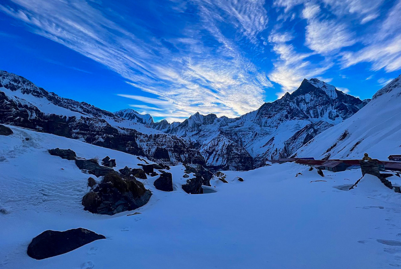
At the western end of the massif lies the Annapurna Sanctuary, a high glacial basin above 4,000 meters (13,123 feet). A ring of peaks from Hiunchuli (6,441 m) to Annapurna I (8,091 m) encloses it, and the only easy way in is a narrow gorge between Hiunchuli and Machapuchare, where the Modi Khola drains out. Annapurna Base Camp sits inside this basin, beneath the south face of Annapurna I, and the Annapurna Sanctuary trek follows this route.
Mount Annapurna Height: How Tall Is Annapurna?
Annapurna I is 8,091 meters tall, which converts to 26,545 feet. That makes it the 10th highest mountain in the world and the lowest of Nepal's eight 8,000-meter peaks. Every other Annapurna peak is lower: Annapurna II reaches 7,937 meters, and Annapurna South reaches 7,219 meters.
For comparison, Mount Everest measures 8,848.86 meters (29,032 feet), about 758 meters (2,486 feet) higher than Annapurna I. K2 rises to 8,611 meters (28,251 feet) and Kangchenjunga to 8,586 meters (28,169 feet).

Trekkers never get near that elevation. Annapurna Base Camp sits at 4,130 meters (13,550 feet), well below Everest Base Camp on the Nepal side at 5,364 meters (17,598 feet). That makes ABC one of the most accessible base camps of any 8,000-meter peak.
What Does Annapurna Mean? Origin of the Name
The name Annapurna comes from Sanskrit. Anna (अन्न) means food or grain, and pūrṇa (पूर्ण) means full or complete. Together they translate as "full of food" or "she who provides nourishment." In Nepali, the name appears as अन्नपूर्ण or अन्नपूर्णा, and locals call the range Annapurna Himal (अन्नपूर्ण हिमाल).
Annapurna, the Hindu Goddess of Nourishment
In Hinduism, Annapurna is the goddess of food and nourishment and a form of Parvati, the consort of Shiva. Hindu tradition describes Parvati as a daughter of Himavat, the king of the mountains, which ties the goddess closely to the Himalaya. For the farming communities below the massif, the snow-fed rivers that water their terraced fields give the name a literal meaning.
Devotees honor Annapurna under several names:
- Viśālākshī (विशालाक्षी): "She who possesses large eyes."
- Viśvaśakti (विश्वशक्ति): "Power of the world."
- Viśvamātā (विश्वमाता): "Mother of the universe."
- Sṛṣtihetukāvaradānī (सृष्टिहेतुकावरदानी): "She who bestows blessings for the sake of all."
- Bhuvaneśvarī (भुवनेश्वरी): "Goddess of the earth."
- Annadā (अन्नदा): "Provider of food."
Annapurna Stotram
The Annapurna Stotram is a Sanskrit hymn to the goddess, traditionally attributed to the philosopher Adi Shankara. Devotees recite it to ask for food, prosperity and wisdom, and it is closely linked to the Annapurna temple in Varanasi, India.
Geology of the Annapurna Massif
Annapurna began on the floor of an ocean. The upper part of the massif belongs to the Tethyan sedimentary sequence: layers of limestone, quartzite and shale laid down in the ancient Tethys Ocean before the Indian plate collided with Asia and pushed them skyward. The summit of Annapurna I is made of the Nilgiri Formation, a marine limestone.
Beneath these sedimentary layers lies the Greater Himalayan crystalline sequence, high-grade metamorphic rocks such as gneiss and schist. A major fault, the South Tibetan Detachment, separates the two, while the Main Central Thrust runs farther south. Geologists recognize several named formations on the massif:
- Nilgiri Limestone: Well-bedded limestone that forms the summit of Annapurna I and much of the slopes above the Marshyangdi valley near Pisang.
- North Face Quartzite: Hard quartzite layers exposed near Pisang.
- Tilicho Pass Formation: Devonian slates and siltstones in the hills south and southeast of Manang.
- Thini Chu Formation: Permian and Carboniferous sediments exposed in areas such as the Sabje Khola.
The Kali Gandaki valley shows this marine past most clearly. Its riverbed yields shaligram, black ammonite fossils that Hindus revere as a form of Vishnu, and pilgrims carry them home from the trail to Muktinath.
Climbing History of Mount Annapurna
1950: The First Ascent of an 8,000-Meter Peak
A French expedition led by Maurice Herzog made history on June 3, 1950, when Herzog and Louis Lachenal reached the summit of Annapurna I by the north face. It was the first time anyone had climbed a mountain higher than 8,000 meters, three years before the first ascent of Everest in 1953. The team also included Lionel Terray, Gaston Rébuffat, Marcel Ichac, Jean Couzy, Marcel Schatz, Jacques Oudot and Francis de Noyelle. The descent nearly killed the summit pair: Herzog and Lachenal suffered severe frostbite and both later underwent amputations. Ichac's film Victoire sur l'Annapurna recorded the expedition.
1970: First Ascent of the South Face
Twenty years later, a British expedition led by Chris Bonington took on the south face of Annapurna I, one of the hardest walls in the Himalaya. Dougal Haston and Don Whillans reached the summit, but the team lost Ian Clough to a falling serac during the descent.
1978: The American Women's Himalayan Expedition
Arlene Blum led the first all-women American team to Annapurna I. On October 15, 1978, Vera Komarkova and Irene Miller reached the summit with Mingma Tsering Sherpa and Chewang Ringjing Sherpa, becoming the first Americans to stand on top. Two team members, Vera Watson and Alison Chadwick-Onyszkiewicz, died during a second summit attempt.
1981: A New Polish Route
A Polish expedition from the Zakopane Alpine Club opened a new route on the south face to Annapurna I Central, adding another line to the mountain's hardest side.
1987: First Winter Ascent
On February 3, 1987, Polish climbers Jerzy Kukuczka and Artur Hajzer made the first winter ascent of Annapurna I, climbing through extreme cold, strong wind and short days.
2007: Tomaž Humar's Solo on the South Face
In October 2007, Slovenian climber Tomaž Humar climbed the south face alone and reached Annapurna East, a subsidiary summit on the main ridge, rather than the main summit. His line largely followed a rib that Kukuczka and Hajzer had climbed in 1988, but it remains the first solo ascent of that summit.
2013: Ueli Steck's 28-Hour Solo
On October 8 and 9, 2013, Swiss climber Ueli Steck soloed the south face by the Lafaille route and returned to his advanced base camp in about 28 hours. The climb drew wide praise and lasting debate, because Steck lost his camera on the face and could not produce a summit photo. The discussion pushed the climbing world to think harder about how it verifies bold solo ascents.
Why Is Annapurna So Dangerous?
Annapurna is dangerous because its main routes cross slopes swept by avalanches and falling ice, its weather changes fast, and its south face is among the steepest big walls in the Himalaya. For decades, those hazards gave Annapurna I the worst death rate of any 8,000-meter peak, and it still has the highest ratio among Nepal's eight.
Annapurna Death Rate and Summit Statistics
As of February 2025, the Himalayan Database, which Guinness World Records cites, counted 559 successful summits of Annapurna I and 75 deaths. That works out to about 13 deaths for every 100 summits, a fatality-to-summit ratio of roughly 13.4 percent.
The figure used to be far worse. By 2012, Annapurna I had recorded 61 deaths against 191 summits, a ratio of about 32 percent, and many older articles still quote that number. The rate has fallen mainly because commercial expeditions have put many more people on top since then, not because the mountain has become safer. Everest, by comparison, has 344 recorded deaths against more than 13,500 summits in the same database, a ratio of about 2.5 percent.
Nepal's Department of Tourism keeps its own count and reported 536 Annapurna I summiters as of June 2026. The two totals differ because the records use different methods and cut-off dates.

Avalanches, Seracs and Unpredictable Weather
Avalanches pose the greatest threat on Annapurna. The most-used routes on the north side cross broad snow slopes beneath hanging glaciers, and climbers cannot fully avoid the paths where ice and snow come down. Storms can build within hours, bringing heavy snow, high wind and near-zero visibility. Altitude adds its own risk, since altitude sickness and exhaustion hit harder above 7,000 meters.
The Steep, Technical South Face
The south face of Annapurna I rises more than 2,000 meters (6,500 feet) of rock and ice above the Annapurna Sanctuary. Climbers on it face steep ice, crevasses and unstable seracs, and the line changes from season to season as the ice shifts. On Everest, the Nepal side offers the easier route. On Annapurna, the southern side is the harder one, so most expeditions climb from the north.
Climbing Annapurna vs Trekking to Annapurna Base Camp
The Annapurna death rate applies to climbers on Annapurna I, not to trekkers. The trail to Annapurna Base Camp stays below 4,200 meters on established paths lined with teahouses, and thousands of people walk it each season. The main risks for trekkers are altitude, sudden weather and avalanche-prone stretches of the upper Modi Khola trail after heavy snow. Our Annapurna Base Camp trek difficulty guide explains how to prepare.

Some climbers who died on the mountain were never recovered and remain on its slopes. Memorials at the base camps honor those lost on Annapurna.
Climbing Annapurna I: Cost and Permits
An Annapurna I expedition demands serious money and high-altitude experience. Costs vary by operator and service level, but climbers can expect to spend between USD 30,000 and 40,000 per person. The budget typically covers:
- Climbing royalty: Since September 1, 2025, foreign climbers pay a government royalty of USD 3,000 per person in spring and USD 1,500 in autumn for 8,000-meter peaks other than Everest.
- Guides and staff: Nepal now requires at least one mountain guide or high-altitude worker for every two climbers on 8,000-meter peaks, so solo expeditions are no longer allowed.
- Conservation area permit: Every visitor also needs an Annapurna Conservation Area entry permit. Our Annapurna trek permits guide explains the current fees.
- Logistics: Transport to Pokhara and the trailhead, base camp services, food, bottled oxygen and equipment.
Climbers who want a Himalayan summit in the Annapurna region without an 8,000-meter expedition can start with a trekking peak. Pisang Peak above the Annapurna Circuit and Tharpu Chuli (Tent Peak, 5,663 m) inside the Sanctuary suit fit trekkers with basic mountaineering training.
Annapurna Base Camp and the Best Treks in the Annapurna Region
Most visitors experience Annapurna on foot. Every major route lies inside the Annapurna Conservation Area, and Pokhara serves as the gateway for almost all of them. If you are choosing between the two classic routes, read our comparison of the Annapurna Base Camp trek and Annapurna Circuit trek.
Annapurna Circuit Trek
The Annapurna Circuit trek circles the entire massif over 160 to 230 kilometers, depending on the route and how much of the road you avoid. Most itineraries take about 14 days. The trail climbs from subtropical valleys through Manang to the high, dry country on the Mustang side, and the crossing of Thorong La at 5,416 meters is the high point. A side trip to Tilicho Lake adds one of the highest lakes in the world.

Annapurna Base Camp (Sanctuary) Trek
The Annapurna Base Camp trek takes you straight into the Sanctuary to the foot of Annapurna I at 4,130 meters. The trail climbs through terraced Gurung farmland and rhododendron forest before reaching the glacial basin, where Annapurna I, Annapurna South, Hiunchuli and Machapuchare surround the camp. Most itineraries take 8 to 14 days.
Jomsom-Muktinath Trek
The Jomsom-Muktinath Trek follows the Kali Gandaki through the deepest gorge on Earth to the temple of Muktinath, a pilgrimage site sacred to both Hindus and Buddhists. Along the way, the landscape changes from green hills to the dry, Tibetan-style terrain of Mustang, home of the Thakali people.
Shorter Treks: Ghorepani Poon Hill and Mardi Himal
If you have only a week, the Annapurna region still offers close mountain views:
- Ghorepani Poon Hill (7 to 9 days): Known for the sunrise from Poon Hill (3,210 m) across the Annapurna and Dhaulagiri ranges. The trail passes through rhododendron forest and Gurung villages.

- Mardi Himal (about 8 days): A ridge trail through quiet forest to Mardi Himal Base Camp (4,500 m), with close views of Machapuchare and the Annapurna massif.

The 2014 Annapurna Snowstorm Disaster
On October 14, 2014, the remnants of Cyclone Hudhud brought a sudden snowstorm to central Nepal at the height of the autumn trekking season. Heavy snow and avalanches caught trekkers, guides, porters and herders across the Annapurna and Dhaulagiri regions, especially near Thorong La pass (5,416 m / 17,769 ft) on the Annapurna Circuit.

At least 43 people died, including at least 21 trekkers, in what became Nepal's worst trekking disaster. The victims came from Nepal, Israel, Canada, India, Poland, Slovakia and Japan, among other countries. Helicopter and ground teams worked through deep snow and broken communications, and AFP reported that 385 people had been rescued within four days. Many survivors criticized the lack of early weather warnings.
The tragedy changed how guides and operators think about mountain weather. Its lessons still apply:
- Better forecasts and communication: Trekkers and guides need accurate, timely weather information before they commit to a high pass.
- Registration and tracking: Knowing who is on the trail helps rescuers account for everyone after a storm.
- Guide training: Local guides need emergency-response training and the right equipment for sudden conditions.
- Emergency shelters: Shelters at key points on popular routes give trekkers somewhere to wait out bad weather.
For most trekkers, the best protection is timing. Our guide to the best time for the Annapurna Base Camp trek explains which months bring the most stable weather.
Annapurna Conservation Area
The Annapurna Conservation Area (ACA) protects the entire massif. At 7,629 square kilometers (2,946 square miles), it is Nepal's largest protected area and its first conservation area. The National Trust for Nature Conservation (NTNC) launched the Annapurna Conservation Area Project (ACAP) as a pilot in Ghandruk in 1986, and the government gazetted the full area in 1992, according to Nepal's Department of National Parks and Wildlife Conservation.
The ACA spans five districts (Kaski, Lamjung, Manang, Mustang and Myagdi) and climbs from 790 meters to 8,091 meters at the summit of Annapurna I. More than 100,000 people live inside it, including Gurung, Magar and Thakali communities in villages such as Ghandruk. Trekkers pay an entry fee that funds conservation work and local development.

Flora and Fauna of Annapurna
Vegetation changes with altitude: sal forest below 1,000 meters, oak and rhododendron forest between 1,000 and 3,000 meters, then juniper, alpine meadow, moss and lichen toward the snowline. North of the main ridge, in the rain shadow, the land turns to dry steppe. NTNC records about 1,352 species of flowering plants in the conservation area, and its 2024/25 annual report lists 128 mammal species, 523 bird species, 61 reptiles, 30 amphibians and 392 butterfly species.
- Mammals: Snow leopard (Panthera uncia), musk deer (Moschus chrysogaster), Tibetan argali (Ovis ammon hodgsoni), Himalayan tahr (Hemitragus jemlahicus), blue sheep and red panda.
- Birds: The Himalayan monal or danphe (Lophophorus impejanus), Nepal's national bird, and the blood pheasant (Ithaginis cruentus). The ACA is the only protected area in Nepal that holds all six of the country's Himalayan pheasant species.
- Plants: Rhododendron, Nepal's national flower, along with orchids and plants found nowhere outside Nepal.

Conservation Challenges: Roads, Cable Cars, Waste and Climate
Road building has reached deep into the region, and jeeps now cover sections of the Annapurna Circuit that trekkers once walked. To keep walkers off the dust, ACAP has marked New Annapurna Trekking Trails (NATT) that avoid the road. Our road-free NATT guide to the Annapurna Circuit shows where they run.
Cable cars are the newest flashpoint. In January 2025, Nepal's Supreme Court struck down a law that allowed infrastructure such as hotels and cable cars inside protected areas. Weeks later, the National Planning Commission granted "national priority" status to the Sikles Annapurna cable car, a 6.5-kilometer line through the conservation area, and later that year the government approved an 81-kilometer cable car to Muktinath. Environmental lawyers have challenged the Sikles project in court, and critics say both lines threaten the purpose of the conservation area.
Waste management offers a steadier story. ACAP's Jomsom office sent 22,189 kilograms of non-biodegradable waste from three rural municipalities in Mustang to a recycling center in Pokhara during the 2025/26 fiscal year, more than double the 10,190 kilograms of the year before.
Climate change adds pressure. Glaciers across the Annapurna Himal are retreating, which affects water supplies downstream; read more in our guide to the glaciers of Nepal. Shifting weather is also changing when the region is best to visit, a trend we cover in how climate change is shifting Nepal's trekking seasons.
Annapurna Cuisine: What You Eat in the Annapurna Region
Food in the Annapurna region matches the mountain's name: simple, filling and built around grain. Teahouses on every major trail serve dal bhat (rice with lentil soup and vegetable curry), which usually comes with free refills, along with momos, thukpa noodle soup and fried rice. Local specialties include Gurung bread, a fried flatbread often served with honey, and dhido, a thick porridge of millet or buckwheat flour. On the Mustang side, Thakali kitchens serve hearty set meals, and the apple orchards around Marpha supply pies, cider and brandy.
Restaurants named Annapurna in Nepal and India borrow the goddess's link to abundance, but the true Annapurna cuisine is this trail food. For menus, prices and dietary tips, see our guide to food during the Annapurna Base Camp trek.
Interesting Facts About Mount Annapurna
The first 8,000-meter peak ever climbed: Herzog and Lachenal stood on top of Annapurna I on June 3, 1950, three years before the first ascent of Everest.
A mountain you can walk around: The Annapurna Circuit lets trekkers circle the entire massif and reach 5,416 meters at Thorong La without any technical climbing.
One of the world's highest lakes: Tilicho Lake sits at 4,919 meters (16,138 feet) beneath Tilicho Peak, on a side route from the Annapurna Circuit.
A desert behind the mountains: Manang and Mustang, north of the massif, lie in a rain shadow and receive far less rain than the green southern slopes. That is why Upper Mustang looks more like Tibet than the rest of Nepal.
A sacred peak nobody may climb: Machapuchare, the Fishtail Peak, is sacred to local communities. A British team came close in 1957 but stopped short of the top, and Nepal has since closed the mountain to climbers.

Visible from Pokhara without trekking: On clear mornings, Annapurna and Machapuchare fill the skyline above Pokhara. Viewpoints such as Sarangkot give one of the easiest close-up views of an 8,000-meter massif anywhere in the Himalaya.

Large rhododendron forests: The hills around Ghorepani and Poon Hill hold some of Nepal's largest rhododendron forests, which turn red, pink and white in spring.
Frequently Asked Questions About Mount Annapurna
Is Annapurna harder than Everest?
Yes, in most climbers' view. Everest is about 758 meters taller, but its standard routes have fixed ropes, ladders, large support teams and heavy commercial traffic. Annapurna sees far fewer expeditions, its avalanche hazards are harder to avoid, and its death rate per summit is about five times higher than Everest's.
Is K2 also called Annapurna?
No. K2 and Annapurna are different mountains about 1,060 kilometers apart. K2 (8,611 m) stands in the Karakoram range on the Pakistan-China border and is nicknamed the "Savage Mountain." Annapurna I (8,091 m) stands in the Annapurna Himal of Nepal.
Why is Annapurna called the silent killer?
"Silent killer" is an informal nickname used in documentaries and climbing forums, not in any official record. It reflects how Annapurna kills: avalanches and serac falls often strike with little warning on slopes that look calm minutes before. Annapurna is also sometimes called a "killer mountain," although that name belongs more widely to Nanga Parbat in Pakistan.
How many people have died on Annapurna?
The Himalayan Database recorded 75 deaths on Annapurna I as of February 2025, against 559 successful summits. That figure covers climbers only. The 2014 snowstorm, which killed at least 43 people in the wider Annapurna region, struck trekkers and local residents rather than summit climbers.
How many people have summited Annapurna?
The Himalayan Database counted 559 summits of Annapurna I as of February 2025. Nepal's Department of Tourism, which uses its own records, reported 536 summiters as of June 2026.
Is Annapurna near Mount Everest?
No. Annapurna I lies about 310 kilometers (193 miles) west of Everest in a straight line. Annapurna is reached from Pokhara, while Everest is reached from Lukla in the Khumbu region of eastern Nepal.
Is Annapurna part of the Himalayas?
Yes. The Annapurna Himal is a subrange of the Great Himalaya, the highest section of the Himalayan mountain system, which also includes Everest, Kangchenjunga and Nanga Parbat.
Can beginners trek to Annapurna Base Camp?
Yes. The Annapurna Base Camp trek needs no climbing skills, and fit beginners complete it every season with a guide and a sensible acclimatization plan. The challenge comes from long days of stone steps and the altitude near 4,130 meters.
Plan Your Annapurna Trip with Nepal Hiking Team
Trekking in the Annapurna region brings you face to face with the 10th highest mountain on Earth, without the risks of climbing it. You can watch sunrise light Annapurna South from Poon Hill, walk into the Sanctuary beneath the south face of Annapurna I, or cross Thorong La on the full Annapurna Circuit.
Nepal Hiking Team designs itineraries for every fitness level, from short family walks to long high-pass treks. Our guides know these trails well and share the culture and traditions of the Gurung, Magar and Thakali communities along the way. Contact us to plan the Annapurna Circuit, Annapurna Base Camp, Everest Base Camp or any of our other best treks in Nepal.
Join us and let the mountains be your guide. Adventure awaits with Nepal Hiking Team.
Post a Comment