

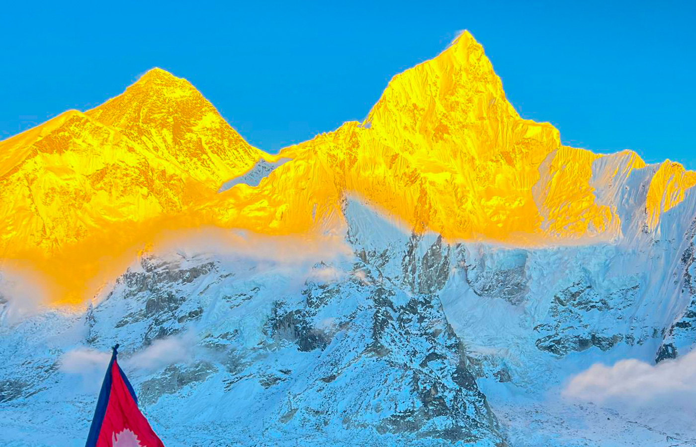
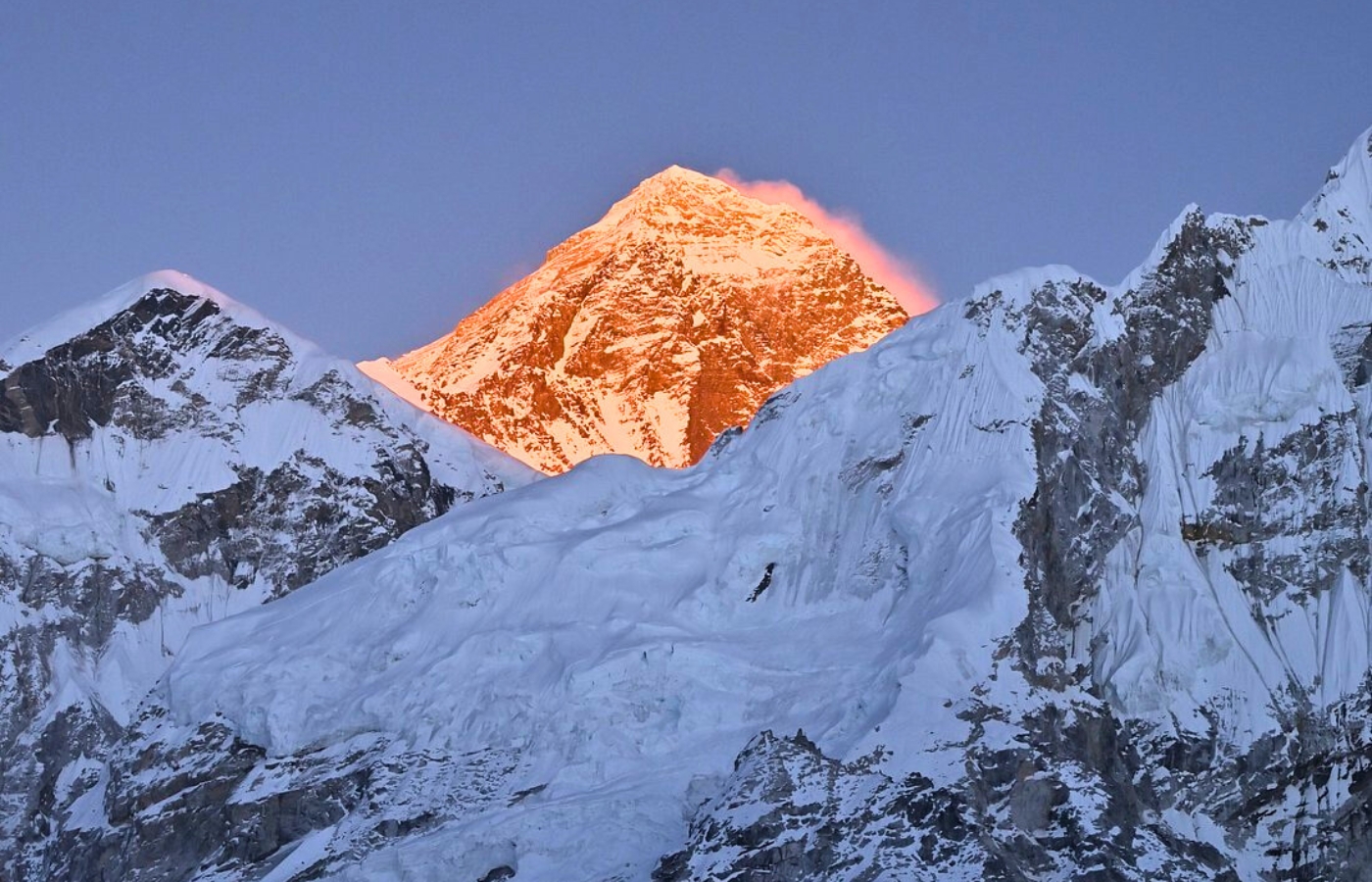
Towering dramatically into the sky, Mount Everest is celebrated as the pinnacle of our planet, representing not only the highest point on Earth but also a symbol of exploration, resilience, and breathtaking beauty. This particular peak encompasses the ultimate vantage point over Mt. Sagarmatha, or as others know it, Mount Everest, the world's sharpest incline. Standing on God's throne, Everest has a connotation behind every inch of Earth's surface. Every adventurer wishes to conquer the world's fairest!
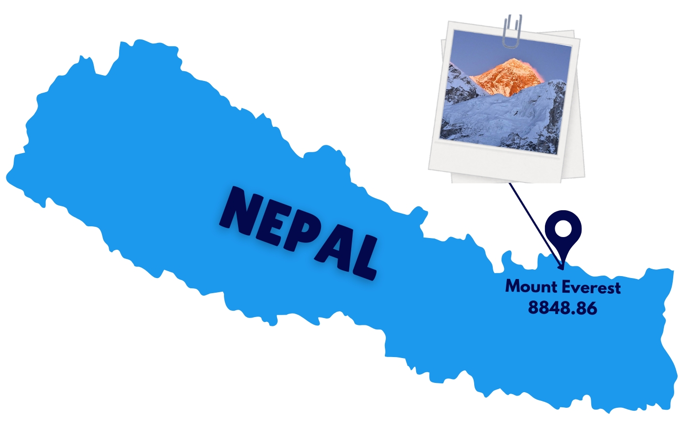
Mount Everest is located on the border between Nepal and Tibet (China), within the Mahalangur sub-range of the Himalayas. It stands on the Tibetan Plateau and is a shared natural wonder between these two regions, with the summit sitting precisely on the international border. On the Nepalese side, Mt Everest is located in the Solukhumbu District and Sagarmatha National Park, while on the Chinese side, it is in the Tingri County of the Tibetan Plateau.
| Mountain Name | Mount Everest |
| Local Name of Mount Everest | Sagarmatha, which means "Forehead of the Sky Chomolungma (or Qomolangma), meaning "Goddess Mother of the World. |
| Continent | Asia |
| Mountain Range of Mt Everest | Himalayas |
| Significance | Highest mountain in the world |
| Specific Range | Mahalangur Himal (or Mahalangur Range, sub-range of the larger Himalayas) |
| Coordinates of Highest peak | The summit is approximately 27°59′N latitude and 86°9250′E longitude |
| Country Location of Mount Everest | Border between Nepal and the Tibet Autonomous Region of China |
| On the Border | The peak of Mount Everest sits directly on the international border between the two countries |
| Nepal Side (South) | In Nepal, the mountain is in the Sagarmatha National Park, within the Solukhumbu District. The park is a UNESCO World Heritage site known for its rich biodiversity. |
| China side (North) | The northern face of Everest is in Tingri County, part of the Xigazê Prefecture in Tibet. This side is protected by the Qomolangma National Nature Preserve. |
| Park | Sagarmatha National Park of Nepal |
Wondering where Mount Everest is or which country it belongs to? You’re not alone— thousands and millions of searches like "Where is Mount Everest located?", "Mount Everest in which country?", and "Mount Everest height" are among the most frequently asked questions online.
To clarify: Mount Everest is located on the border of Nepal and the Tibet Autonomous Region of China, with its most popular access route and southern face lying entirely within Nepal.
So if you're asking "What country is Mount Everest in?", the answer is Nepal.
Known locally as Sagarmatha and standing at a breathtaking height of 8,848.86 meters and in kilometres is 8.84886 km (29,031.7 feet), Everest is more than just the world’s tallest mountain—it’s a cultural icon, a natural wonder, and a dream for adventurers. In this blog about Mount Everest, we’ll take you beyond just facts like "Everest height" or "Mt Everest country". We’ll explore its location, meaning, significance, and how you can experience it up close—right here in Nepal.
Where is Mount Everest located: Nepal, India, or China?
Which country owns Mount Everest? Everest Geographic Location: Mount Everest is located on the border between Nepal and the Tibet Autonomous Region of China, in the Mahalangur Himal sub-range of the Himalayas. Mount Everest is not located in India, and it is the truth.
Geographic Range: Part of the Mahalangur Himal range, which is a sub-range of the larger Himalayas.
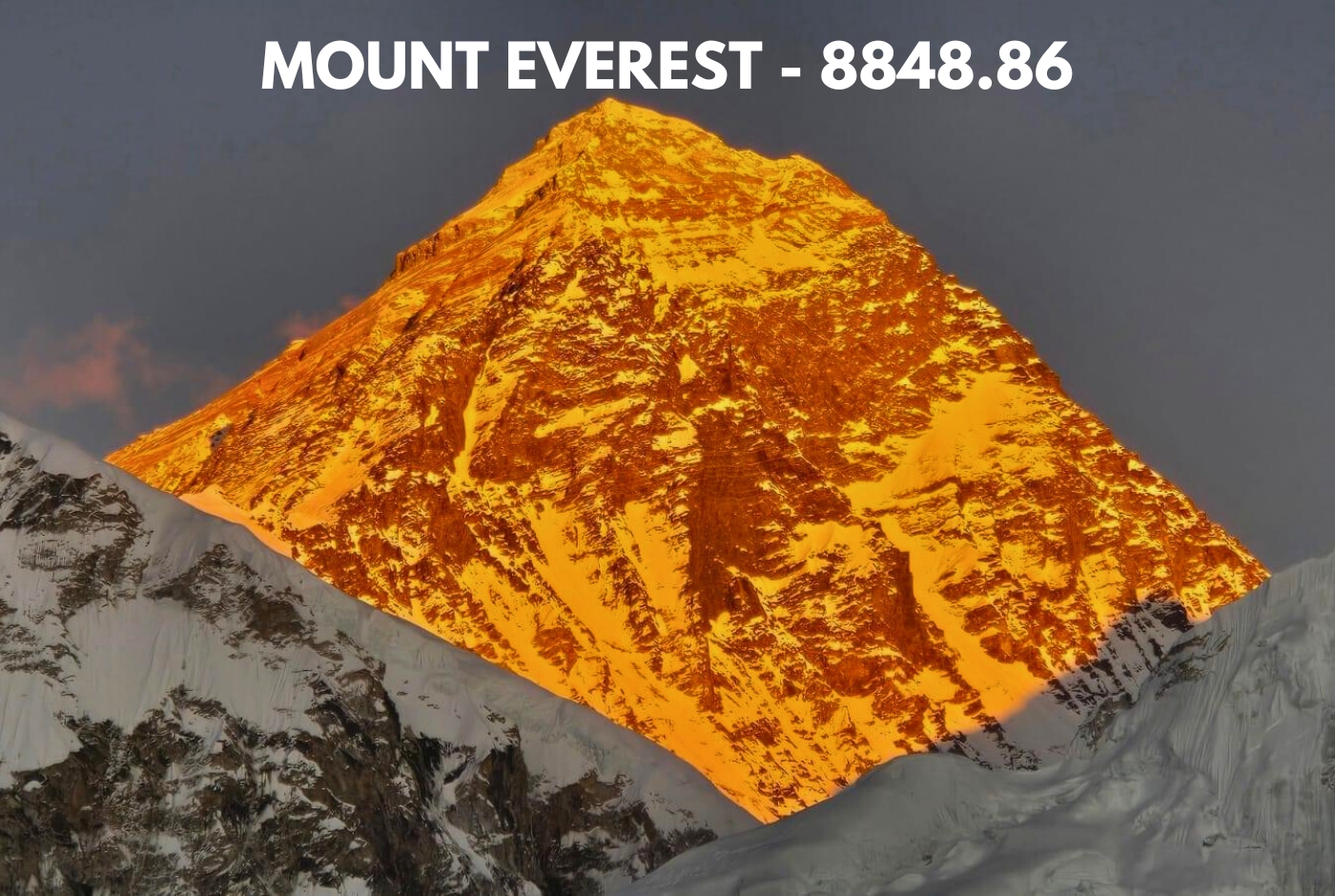
Mount Everest Elevation: Mount Everest's official height, established by a joint Nepalese and Chinese measurement expedition, is 8,848.86 meters (29,031.7 feet).
Difficulty: Mount Everest is considered a highly difficult climb due to extreme altitude, harsh weather conditions, and challenging terrain. The standard route, while technically not the most difficult, still poses significant dangers like altitude sickness, icefalls, and the risk of avalanches.
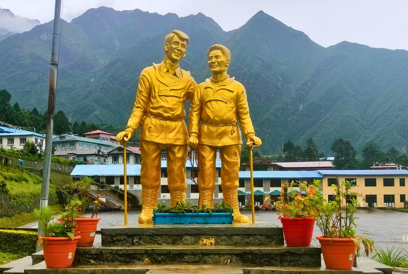
Mount Everest History: The climbing history of Mount Everest is marked by a progression of attempts and successes, culminating in the first documented summit in 1953 by Edmund Hillary and Tenzing Norgay. Before this, there were numerous British expeditions, notably those in 1921, 1922, and 1924, attempting the North Ridge route. The 1924 expedition, involving George Mallory and Andrew Irvine, is shrouded in mystery regarding their potential summit, raising questions about whether they were the first to reach the top.
Climbing Routes: Mount Everest has two main climbing routes: the South Col Route (Nepal South Base Camp) and the North Col Route (Tibet). The South Col Route, also known as the Southeast Ridge route, is the most popular and well-supported route. It starts from Nepal, passes through the Khumbu Icefall, and eventually reaches the summit via the Southeast Ridge. The North face, on the other hand, begins in Tibet and is considered more remote and wind-exposed.
Weather: Subject to extreme cold, strong winds, and rapidly changing conditions. While challenging, it is often less consistently harsh or unpredictable than K2's weather.
Fatality Rate: Lower than K2's fatality rate per attempt, but the sheer number of climbers means more absolute deaths have occurred.
Who first touched Mt Everest, First Ascent of the tallest peak: The first successful, undisputed ascent of Mount Everest was achieved on May 29, 1953, by Sir Edmund Hillary and Tenzing Norgay, via the Southeast Ridge.
Mount Everest's Exact Location and Height
Mount Everest Height: Mount Everest stands at an extraordinary height of 8,848.86 meters (29,032 feet), securing its status as the highest mountain on Earth.
Mount Everest Location: Along the border of Nepal and Tibet (China), Everest is a magnificent component of the Mahalangur Himal, a sub-range of the Himalayas. It is a remarkable link between the two nations and their rich cultural heritage.
Where is located Mount Everest? Which country is Everest in, Nepal or Tibet?
Significance
Symbol of Achievement: Mount Everest attracts adventurers worldwide, a spirit of determination, and all are eager to tackle its challenging landscape and extreme heights; many flock around during the peak seasons.
Spiritual Reverence: The local communities of the Everest region revere the mountain as Sagarmatha, which in Nepal signifies the "Forehead of the Sky" and Chomolungma, "The Goddess Mother of the World" in Tibet. Both names are profound symbols that resonate with those living in its shadow.
Geographical Location of Mount Everest: Where is Mt Everest situated?
Popularly known as the pinnacle of our planet, Mount Everest is precisely located at coordinates 27.9881° N latitude and 86.9250° E longitude. These precise figures establish it as a distinctive landmark in the majestic Himalayas' heart.
Nepal-Tibet Border:
Bordering Nepal- Mount Everest, which lies on the international border between China and Nepal, symbolizes a glaring fusion of shared cultural legacy and ecological significance.
Administrative Divisions:
In Nepal, ideally located within the Solukhumbu District, Mount Everest, a treasured part of Sagarmatha National Park, is popular for its remarkable biodiversity and breathtaking landscapes. This UNESCO World Heritage Site holds an esteemed recognition all over the world.
Mount Everest Dimensions? How high is Mt Everest?
In Tibet (China): The northern face of Everest is found in Tingri County, part of the Xigazê Prefecture, renowned for its dramatic high-altitude plateaus and striking natural scenery.
Himalayan Range: As a crown jewel of the Mahalangur Himal sub-range, Mount Everest is an integral component of the more extensive Himalayan mountain range.
Himalayan Reach: This extensive mountain range extends across five countries—Nepal, Tibet (China), India, Bhutan, and Pakistan—rendering it a remarkable international wonder and making it a truly international marvel for travelers around the globe.
Surrounding Peaks: Impressive neighbors, which include Lhotse (8,516 meters), Makalu (8,485 meters), and Cho Oyu (8,188 meters), flank Mount Everest, each adding to the majestic skyline of this awe-inspiring region.
Historical and Cultural Significance: Everest Chomolungma
The significance of Mount Everest is far beyond its national geographical stature, and it's more about the embodied rich cultural and spiritual meanings that are reflected in its local names:
Nepali: Known as Sagarmatha, which translates to "Forehead of the Sky," this name highlights the mountain's majestic height and its celestial associations.
Tibetan: Referred to as Chomolungma, or "Goddess Mother of the World," it captures the mountain's revered status among the Tibetan people.
Naming History: The Western designation of Mount Everest emerged during the 19th-century Great Trigonometric Survey of India.
Original Designation: "Peak XV" was formally identified as the tallest mountain in the world in 1852, a meticulous trigonometric calculation conducted by Indian mathematician Radhanath Sikdar.
Renaming: In 1865, the Royal Geographical Society honored Sir George Everest, a British Surveyor General of India, with the mountain's current name. Sir George, who is said to have disapproved of the conferred tribute.
Although Mount Everest transcends its status as a geographical wonder, it is a profound spiritual symbol for the indigenous communities.
Hinduism: The Nepalese Hindu community sees Sagarmatha as a sacred mountain. They believe its magnificent peaks connect them to the divine. Before setting out on journeys, the climbers and trekkers perform regular rituals and make offerings to ensure their safety.
Buddhism: The name Chomolungma is held in high esteem by Tibetan Buddhists. They pay homage to the divine spirits believed to dwell there.
Berg Everest: Where exactly is Mount Everest located? What country is Everest in?
Geological and Physical Features of Berg Everest
Mount Everest is a powerful reminder of the Earth's ever-changing geological history.
Tectonic Collision: The mountain was formed by the ongoing collision of the Indian Plate and the Eurasian Plate, a process that began about 60 million years ago during the Paleogene period.
Growth Over Time: With an average rate of 4 millimeters every year, Mount Everest, the highest peak, continues to rise due to the persistent movement of these tectonic plates.
Geological Composition
Everest has an interesting story about its geological composition; however, the physical structure of Mount Everest depicts its intricate geological heritage, which has evolved.
Where is Mount Everest:Tallest Mountain in the World
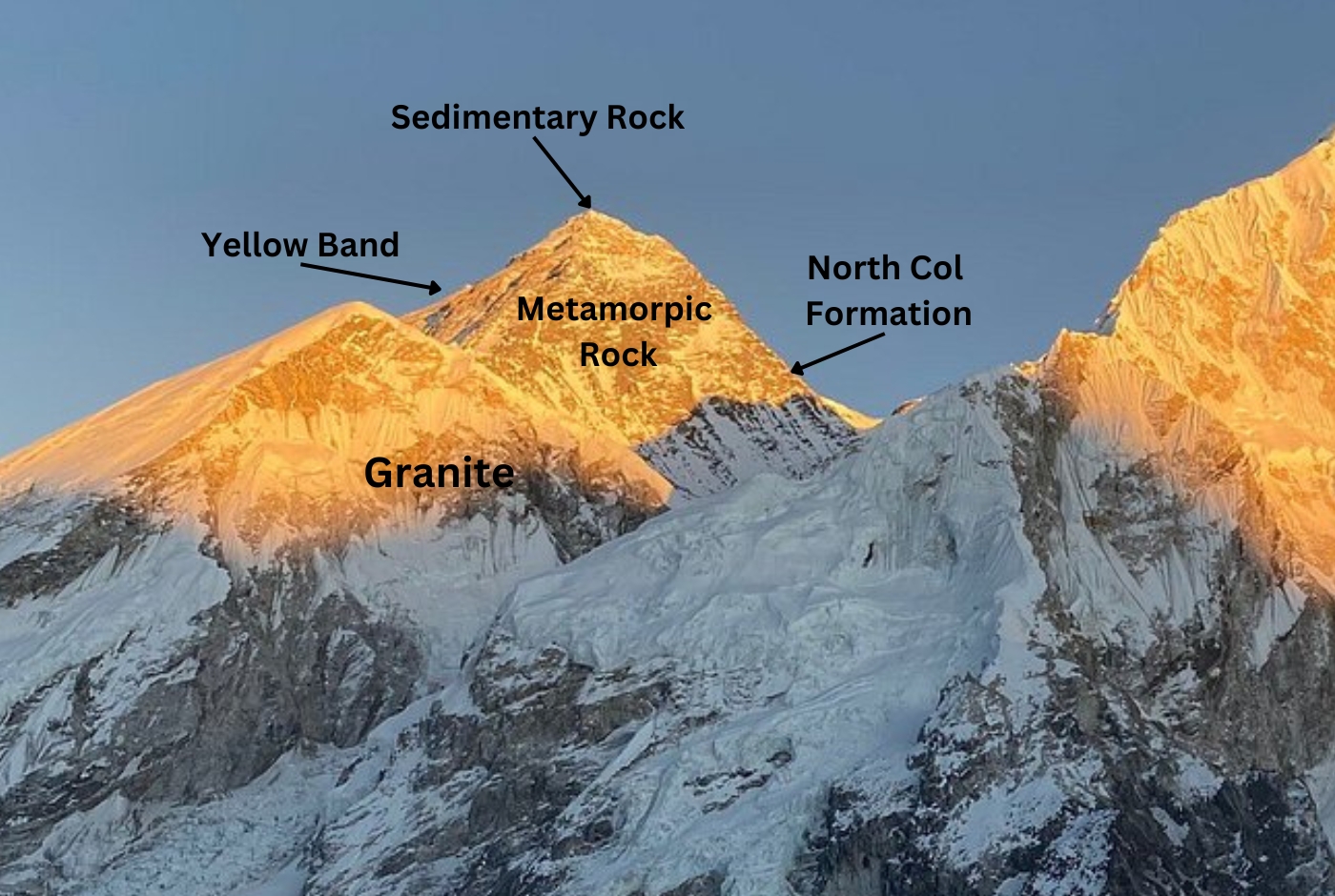
Rock Types
- Sedimentary Rocks: The combination of ancient marine limestone and shale layers of rocks found in the mountainous region are remnants of the long-vanished prehistoric Tethys Ocean that existed from the end of the Paleozoic era until the Cenozoic era.
- Metamorphic Rocks: The lower regions of Mount Everest consist of schists and gneisses, which were formed through significant heat and pressure. These lower areas are distinguished by schists and gneisses, developed under extreme heat and pressure conditions.
- Yellow Band: This distinctive layer of marbled limestone, visible just below the summit, is a notable marker for climbers and geologists.
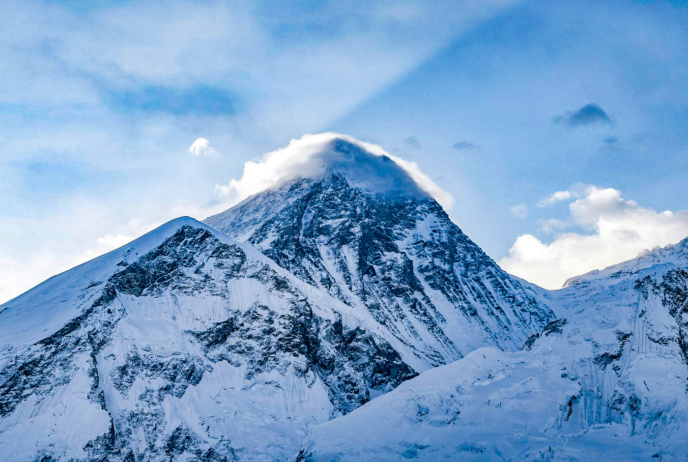
Topography
The topography of Everest is inexpressible because of its rugged topography, steep ridges, valleys, massive ice glaciers, and the surrounding mountains, which spellbind the climbers and the tourists.
Ridges:
- Southeast Ridge: A ridge popular because of the climbing route, traversing the Khumbu Icefall and climbing up to the South Col. between Mount Everest and Lhotse.
- Northeast Ridge: The Northeast Ridge, a desired route for ascent from Tibet for experienced climbers, features the demanding Second Step, a challenging pitch between 28,140 and 28,300 ft.
- West Ridge: This route is used less frequently and poses considerable technical challenges for trekkers.
Glaciers:
The icy glaciers of the Everest region, along with its surrounding landscape, are no wonder a stunning site to capture climbers. Still, they also make it challenging to ascend to higher altitudes.
Where is Mount Everest in Asia? Nepal, or Tibet
- Khumbu Glacier: Found on the southern slope of Mount Everest, this glacier supplies water to the Dudh Kosi River.
- Rongbuk Glacier: Positioned on the northern flank, it channels water into the Rong River.
Icefalls:
- Khumbu Icefall: Renowned for its large crevasses and ever-shifting ice, this section is one of the most dangerous for climbers.
- Western Cwm (Valley of Silence): A U-shaped glacial valley flanked by towering walls offers a quieter yet demanding part of the southern route.
Mount Everest Dimension: Mt Everest Elevation: 8848.86m (Height in m)
The Height of Mount Everest: How high is Mt Everest?
Height Evolution: The height has been revised over time due to technological advancements and the geological changes in the mountains.
1852: The Great Trigonometric Survey of India first determined Everest's height at 8,848 meters (29,029 feet), which has been accepted for over a century.
2020: A collaborative effort by Nepal and China established a revision of Mount Everest's new height of 8,848.86 meters (29,032 feet). The newly updated measurement of the mighty mountain considers variables such as snow cover and the thickness of the ice cap to improve accuracy.
Mount Everest Height in feet: 29,031.7 feet
Height of Mount Everest in kilometers (Km), feet(ft), and Meter
| Height of Mt. Everest in different measurements | |
| Measurement Type | Exact Height of Mount Everest in km and feet |
| Height of Mt Everest From Sea Level (Official Height) | 8,848.86 meters (8.85 km / 29,031.7 feet) |
| Mount Everest Elevation from Base (Ground Level - South Side, Nepal) | 3,500 meters (3.5 km / 11,483 feet) from the Khumbu Glacier |
| Mt Everest from Base (Ground Level - North Side, Tibet) | 5,200 meters (5.2 km / 17,060 feet) from Rongbuk Glacier |
| Height of the Highest Peak in the world above the Troposphere | Reaches into the lower stratosphere |
| Mount Everest Compared to Burj Khalifa | More than 10 times its height (828m / 2,717 ft) |
| Height of Everest Change Over Time | Rises 4 mm per year due to tectonic activity |
Mount Everest's height was officially remeasured in 2020 by Nepal and China, confirming its 8,848.86 meters height. However, due to tectonic movements and earthquakes, Everest’s height continues to change over time.
Measurement Challenges:
A project led by the Nepal government to pinpoint the accurate height of Mount Everest presented critical natural and technical difficulties as it wasn't all about measuring the top of the mountain but also finding the bottom to get a precise measurement.
Snow Cover Variability:
The changes in the snow cover, which led to seasonal fluctuation in snow and ice thickness, greatly affected the accuracy of Mount Everest's height measurements.
The year 2020 was a significant breakthrough as the height of Mount Everest was measured using advanced GPS and radar technologies to consider the depth of the snow at the bottom level.
Tectonic Activity:
The convergence of the two most extraordinary tectonic plates, the Indian and Eurasian, results in an annual rise of about four millimeters for the mountains. Predictably, seismic events like the earthquake of 2015 in Nepal can alter the mountain's height and structure.
Collaborative Efforts
The year 2020 is marked as a momentous recalibration event because the most accurate and updated measurement of Mount Everest was ensured through the collaboration of Nepal and China. This significant recalibration ensured the climbers and researchers had the latest information for their expeditions and studies.
China officially announced the first recognized formal measurement of Everest's height. The survey used GPS technology, gravity sensors, and laser theodolites to guarantee maximum precision.
Nepal Elevates Mt Everest Climbing Permit Fees by 36%- New Permit Cost
In a significant policy shift, Nepal has announced a 36% increase in permit fees for Mount Everest climbers, marking the first adjustment in nearly a decade. Effective September 2025, the cost for a spring season permit will rise from $11,000 to $15,000. Fees for the autumn season will increase to $7,500, and the winter season to $3,750.
This move aims to bolster revenue and address concerns over overcrowding and environmental degradation on the world's highest peak. The additional funds are expected to enhance safety measures and support environmental preservation efforts.
While some expedition organizers anticipated the hike, it's unclear how it will impact the number of climbers. Nepal issues approximately 300 Everest permits annually, and the increased fees may influence climbers' decisions in the upcoming seasons.
Climbing History and Routes of Mount Everest
First Successful Ascent (1953) of Mount Everest Climb:On May 29, 1953, Sir Edmund Hillary and Tenzing Norgay created history by becoming the first to conquer the summit of Mount Everest. A remarkable journey pursued by Colonel John Hunt as a part of a British expedition marked mountaineering history as a pivotal moment.
How tall is Mount Everest? How two reached the height of Mount Everest?
Key Records and Milestones:
- First ascent without supplemental oxygen (1978): Reinhold Messner and Peter Habeler created a significant event by becoming the world's first climbers to summit Mount Everest without any supplemented oxygen, which inspired many prospective climbers. Their achievement not only showcased the remarkable strength and endurance of the human spirit when they ventured into the mountain's treacherous "death zone."
- First solo ascent (1980): Messner achieved a solo climb via the North Col Route, setting a new benchmark in mountaineering.
- First female ascent (1975): Junko Tabei from Japan became the pioneer woman to stand at the summit of Mount Everest.
- Youngest climber (2010): Jordan Romero created history by ascending Mount Everest via the North Col Route at just 13 years of his age.
Climbing Routes of Mount Everest:
South Col Route (Nepal) or the South Face of Mount Everest:
The South Col Route is popular among climbers but presents challenges like the Khumbu Icefall, known for its complex crevasses. The Hillary Step, which used to require technical skills, collapsed in 2015. Despite the challenging route, many travelers choose it because of its easy, straightforward navigation and strong infrastructure.
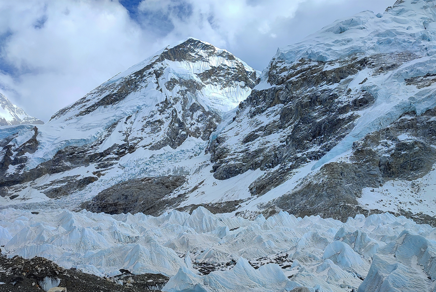
Khumbu Icefall: Khumbu Icefall, known for its intricate arrangement of crevasses and ice formations, is one of the most formidable sections.
Hillary Step: In 2015, the Hillary Step collapsed due to its ruggedness and technical climbing expertise. It has made many climbers choose their climbing experience on the South Col Route because it offers more straightforward navigation and a well-established support system.
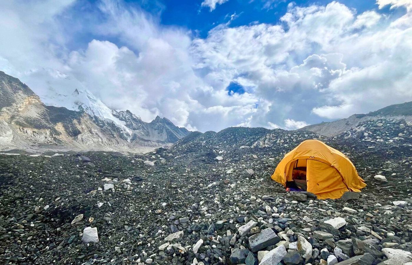
Base Camp of highest Mountain in the world: Mount Everest
North Col Route (Tibet) or North Face of Mount Everest:
Rongbuk Glacier: The journey begins here, offering beautiful views and presenting a challenging start to the Everest expedition.
Northeast Ridge: "The Second Step," a rock face known for its technical challenges, is now accessible to climbers after a fixed ladder was installed to aid smooth ascent on this route.
Challenges:
Harsh weather conditions and technical obstacles make this route less frequented but highly revered among experienced climbers.
How long does it take to climb Mount Everest?
Climbing Mount Everest typically takes around 60 to 70 days, including acclimatization and the final summit push. This extended timeframe is primarily due to the need for climbers to adjust to the high altitude and low oxygen levels gradually.
Challenges of Climbing Mount Everest:
Highest and Tallest mountain in the world: Where do we find Mt Everest?
Altitude Sickness: Climbers must confront the lethal "death zone" above 8,000 meters, where oxygen levels drop to critically low temperatures.
Unpredictable Weather: Unpredictable weather conditions may spawn life-threatening conditions, often accompanied by abrupt storms and icy weather conditions in the region.
Physical and Technical Demands: Outstanding skills and rigorous preparation in maintaining physical health are key for climbers that will enable them to navigate icefalls, steep rock walls, and treacherous ridges.
Overcrowding Risks: During peak climbing seasons, congestion may result in delays and safety concerns.
Everest Mount Everest: Where to find Mount Everest?
How many bodies are on Mount Everest?
Over 200 bodies still remain on Mount Everest due to the dangerous conditions of the high altitude and the fact that many climbers have died in the "Death Zone". Some trusted sites, like Wikipedia and the BBC, describe this as the area above 8,000 meters (26,000 feet), where low oxygen levels and harsh conditions make recovery extremely difficult. Since 1922, over 300 people have perished on the mountain, and many of their bodies remain frozen in place, often visible to passing climbers.
Safety Concerns:
- The large number of climbers can strain resources like oxygen, rope repair, and rescue services, increasing the risk of accidents and fatalities.
- Increased Waste and Pollution: The increased number of climbers leads to more waste and litter being left on the mountain, impacting the environment.
Addressing the Issue:
- Regulations: Some suggest regulations to limit the number of climbers on the mountain at any given time, or to manage the flow of climbers during the climbing season, as suggested by the Nepali government.
- Alternative Routes: Encouraging climbers to explore alternative routes or to consider climbing during less crowded periods could help reduce congestion.
- Education and Awareness: Raising awareness about the dangers of overcrowding and promoting responsible climbing practices can help to minimize the risks associated with traffic jams.
Adventure and Trekking Opportunities Around Mount Everest
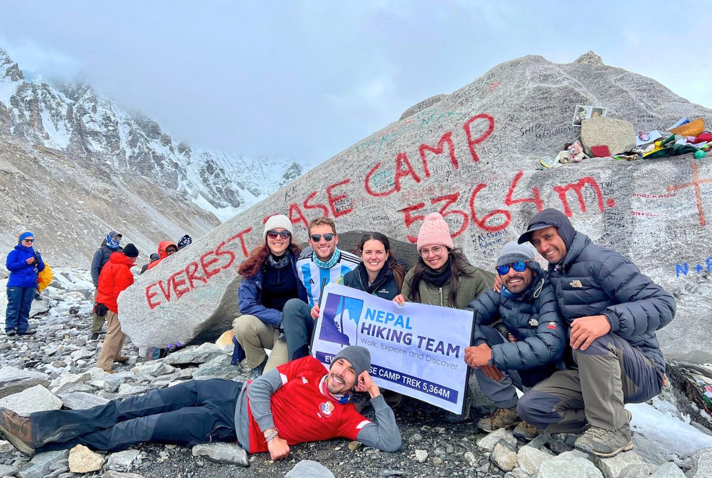
Exciting Trekking Routes of EBC with Nepal Hiking Team:
Everest Base Camp Trek (EBC):
Highlights of the trek:
- Kala Patthar: A remarkable landmark popular in the Everest region provides the most accessible close-up view of the magnificent Mount Everest and its surrounding peaks.
- Namche Bazaar: The vibrant Sherpa hub and a key acclimatization stop for travelers captivate the heart of travelers with its scenic beauty.
- Tengboche Monastery: A Buddhist monastery that reflects serenity and rich cultural and spiritual insights.
- Duration: This trek lasts 12 to 16 days, depending on how well you assimilate to altitude.
- Difficulty Level: The trek will likely be moderate to challenging, primarily due to Everest's high altitudes and rugged terrain region.
What is the tallest mountain in the world?
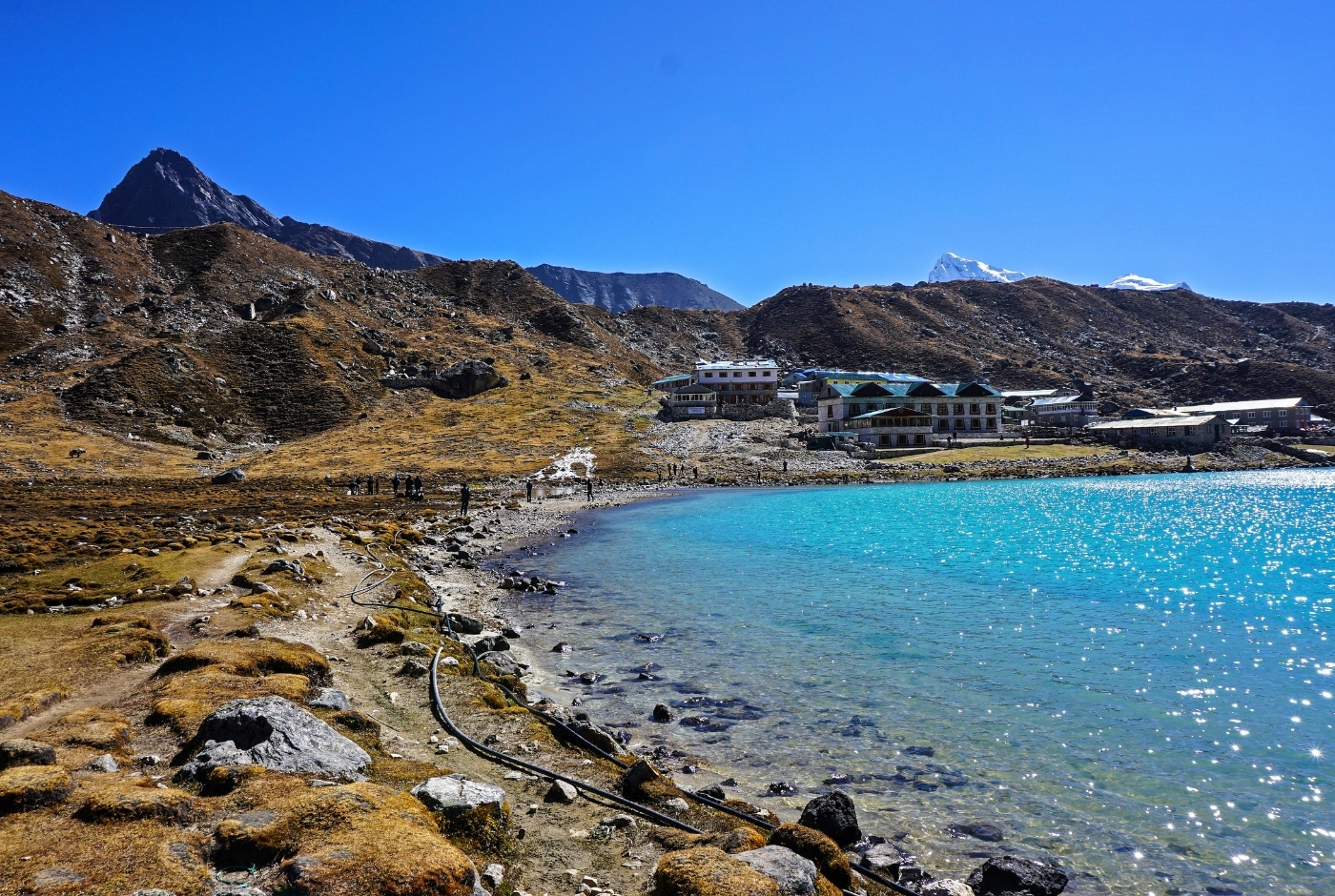
Gokyo Lakes Trek and Three Passes Trek:
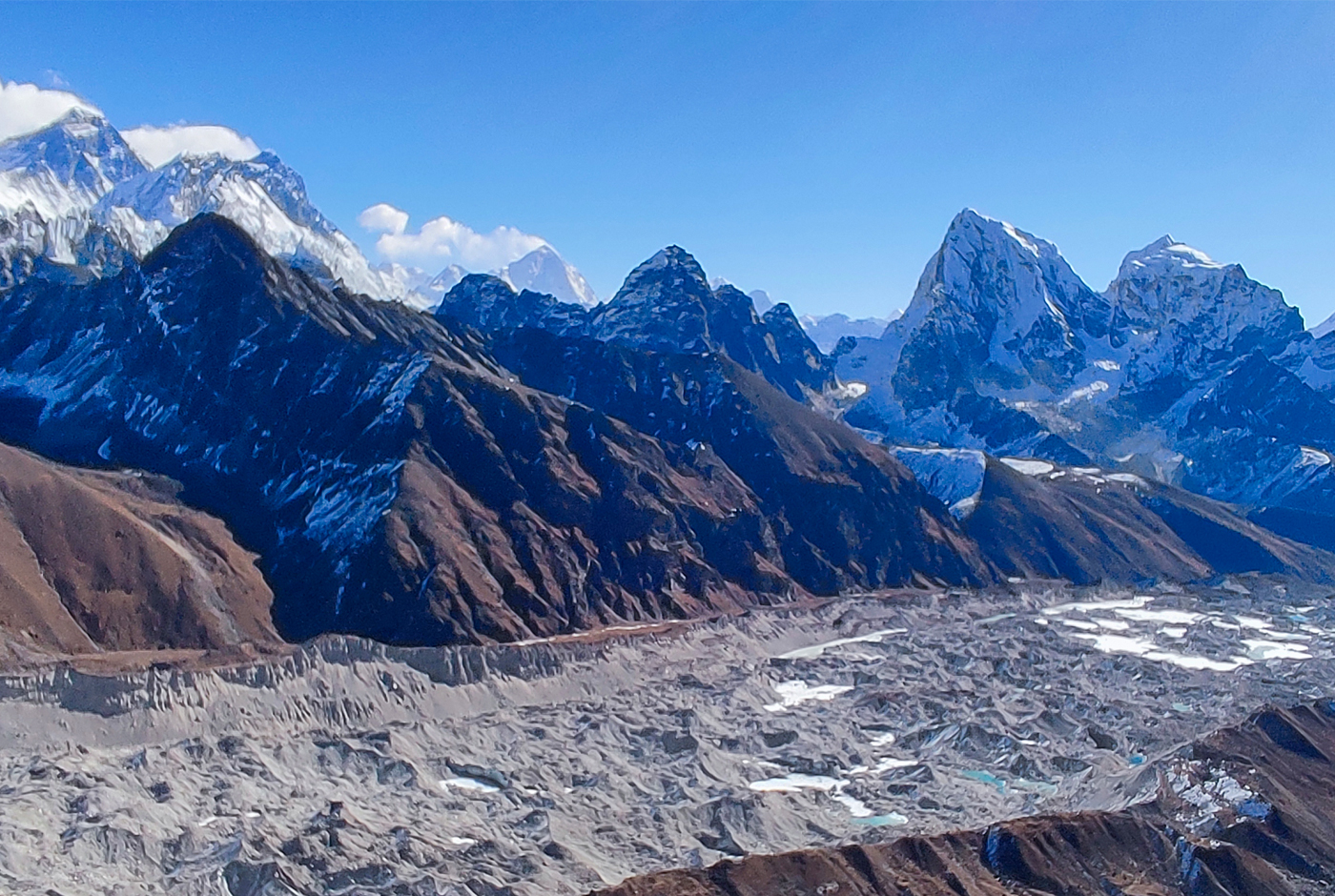
Gokyo Lakes Trek: This route showcases stunning emerald glacial lakes and includes the revered Gokyo Ri viewpoint, renowned for its magnificent views.
Three Passes Trek: This circuit involves crossing Kongma La (5,535m), Cho La (5,420m), and Renjo La (5,360m), providing a more adventurous alternative route.
Duration: An excellent choice for climbers, the Gokyo Lake trek lasts 13 to 15 days. To accomplish this trek, climbers require outstanding expertise and endurance.
What continent is Mount Everest: Where is Mt Everest
Non-Climbing Adventures:
To experience the beauty of Everest without any strenuous trekking, the non-climbing adventures of the Nepal Hiking Team promise an unforgettable experience that you'll cherish for a lifetime.
Helicopter Tours:
The helicopter tours are just an incredible experience, as you can enjoy the aerial views as you fly over the Khumbu Glacier, Everest Base Camp, and Kala Patthar, which is just beyond words. This tour is unbeatable for trekkers trying to avoid the strenuous trekking challenges and has limited time.
Cultural Immersions:
Enjoy rich Himalayan traditions by visiting Sherpa villages, monasteries, and local markets.
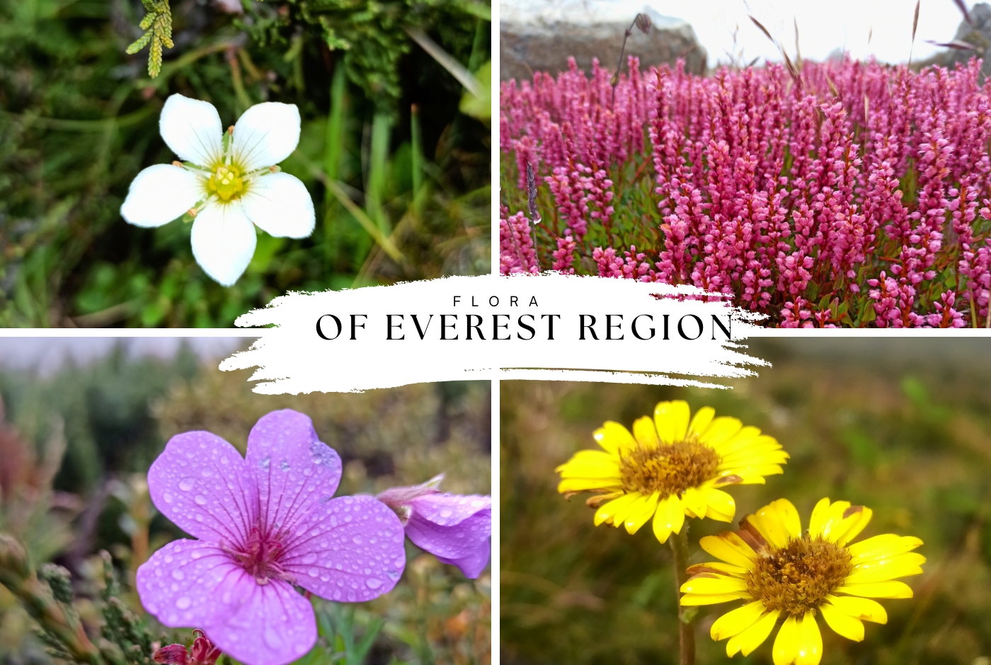
Flora and Fauna in the Everest Region
The Everest region is home to the highest peak as well as diverse species of plants and animals that have naturally adapted to extreme harsh conditions, thus creating a landscape for climbers and tourists to enjoy. The mesmerizing beauty and the rich diversity of flora and Fauna found in this challenging environment never cease to amaze those who visit.
- Rhododendrons and Junipers: These species are typically found at lower elevations, ranging from 3,000 to 4,000 meters, flourishing in the Himalayan foothills.
- Alpine Meadows: During summer, the high-altitude meadows burst into color with vibrant wildflowers such as edelweiss and blue poppies.
- Hardy Mosses and Lichens: Above 5,000 meters of sea level, hardy organisms cling to rocks, thriving in the cold and oxygen-poor conditions of the Everest region, where unique and endangered wildlife has evolved to survive in this challenging environment.
Flora around World's Highest mountain: Gunung Everest
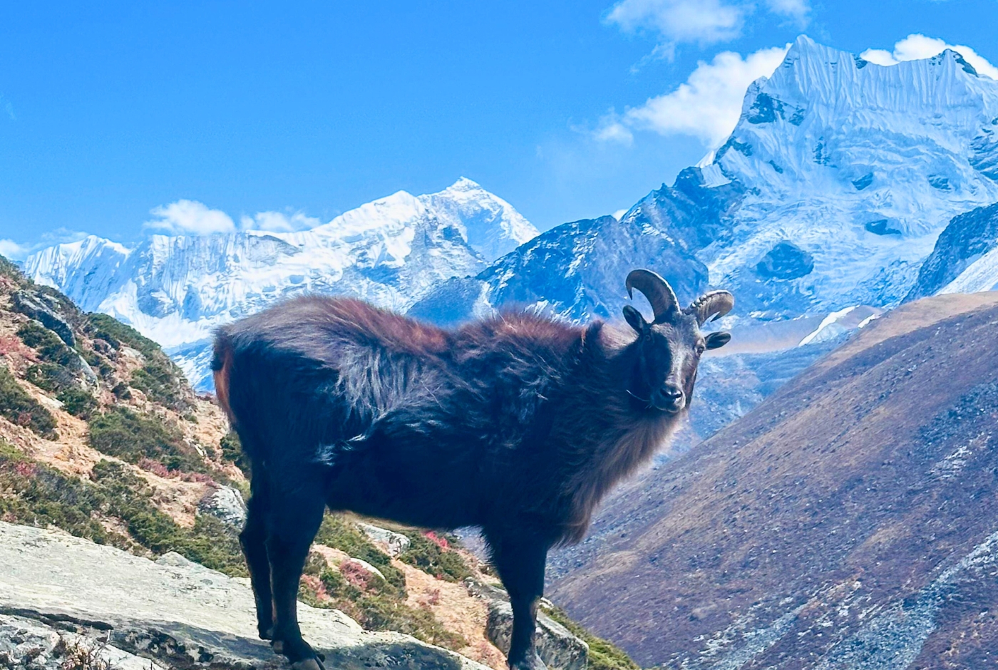
Mammals:
Snow Leopard: This rare and elusive predator represents the fragile ecosystem of the Himalayas.
Himalayan Tahr: A wild goat distinguished by its dense fur, is frequently observed traversing the cliffs of the mountainous region of Everest.
Red Panda: The most enchanting species are critically endangered in the forested lower elevations.
Fauna of the Largest mountain in the world: Berg Everest
Birds
Himalayan Monal: A pheasant native to the Himalayan mountains, it is esteemed as the national bird of Nepal and is greatly admired for its colorful plumage.
Bar-headed Geese: Famous for their remarkable capacity to soar at elevated altitudes, they are known to undertake migrations across the Himalayan mountains.
Sherpa Communities and Cultural Exploration Around Mount Everest
The Sherpa people, native to the Everest region, are the pioneers of the Himalayan trekking and mountaineering activities.
People of the tallest Mountain in the world are known as Sherpa
Guides and Contributors:
The Sherpas of the Himalayan region are vital during the Everest expeditions because of their strength, endurance, and ability to excel at high elevations. The Sherpas, traditionally known as mountain people, are well-known worldwide for their physical strength, bravery, endurance, and mountain climbing skills. The "Guardians of the Himalayas" are key people for climbers as they serve as guides, porters, and climbers for trekkers on their expedition to the Everest region. A notable example is Tenzing Norgay, who conquered Everest alongside Edmund Hillary and created a mountaineering history.
Symbiotic Relationship with Everest:
Sherpas of the Everest region are indispensable for climbers because they possess profound knowledge of the region and climbing techniques handed down through generations. The Everest region is not only a rich cultural repository that provides insights into the lifestyle of Sherpas but also reflects their spiritual ties to the mountains.
Additionally, Sherpa communities partake in festivals such as Mani Rimdu, and the prayer flags and mani walls found along trekking routes represent spiritual harmony. Visitors can experience genuine Sherpa hospitality in local teahouses and learn about traditional Sherpa livelihoods.
Environmental and Conservation Efforts in the Everest Region
Severe environmental issues: The environmental issues in the Everest region have highlighted the risks of crevasses in the mountains and the effects of severe global warming.
Glacial Retreat: The melting of ice glaciers in the Khumbu region has alteredthe landscape and the terrain, thus increasing the risk of crevasses. Glacial mass loss affects the freshwater supply for locals living in that region.
Shifting Weather Patterns: The change in the weather conditions of the Everest region has reduced snowfall and increased avalanches and rockfalls, which restrict climbers from pursuing their journeys. This kind of alteration in climatic conditions also disrupts the trekking plans of the climbers to a great extent.
Sustainability Measures in the Everest Region:
Despite the millions of climbers drawn to the breathtaking beauty of Mount Everest, serious environmental issues have emerged in the mountains. As a result, the Everest region in Sagarmatha National Park of the Solukhumbu district needs our attention to protect its landscape, which further results in crevasses. Glacial mass loss also threatens the freshwater supply for the locals who call this region their home.
Cleanup Projects: Cleanup programs are increasingly becoming crucial in the Everest region due to the influx of visitors. One of the cleaning projects, Eco Everest Expeditions, has done a notable cleaning project in the mountain region. Moreover, other ongoing awareness programs promote responsible climbing and trekking practices among climbers.
Eco-Tourism Initiatives: Eco-tourism initiatives primarily advocate sustainable trekking methods for climbers. The local tea houses and lodges in the Everest region are encouraged to use renewable energy sources so that these local businesses can increase their economy and the environment. A sustainable practice is obligatory not only for the locals living there but also for the travelers
Regulatory Frameworks on Mt Everest:
Sagarmatha National Park (Nepal): The National Park, designated as a UNESCO World Heritage Site, implements stringent rules concerning climbing permits and waste management.
Qomolangma Nature Preserve (Tibet): This preserve safeguards biodiversity and oversees tourism activities to lessen environmental impact in that region.
Call for Global Responsibility:
There is an urgent call for the globe to push for accountability to address the emerging climatic conditions in the Everest region, and this is vital for promoting a sustainable and safer future for the Everest region. Tourists and climbers are urged to adhere to Leave No Trace principles and protect the indelible environment that charms many tourists.
Where is Mount Everest located on World map? Mount Everest Himalayas Map
How high is Mount Everest? Does Mt Everest touch sky?
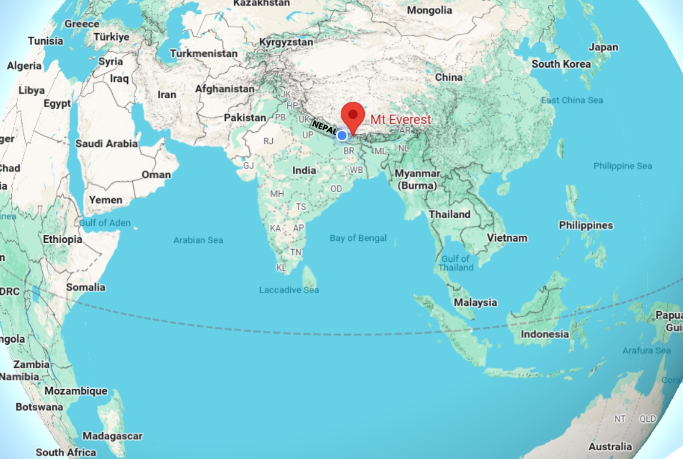
Country-wise, the southern slope or side of Everest lies in the beautiful country Nepal, while the northern slope is in Tibet. While Himalayas extend into India, Mount Everest itself is not located in this nation.
Conclusion: The Enduring Legacy of Mount Everest
The legacy of Mount Everest is indescribable, as it is not all about the height, but there's more to it; it is a complete journey marked by an interplay of geography, culture, and adventure. Mount Everest captivates many climbers and trekkers every year. Therefore, Everest serves as a poignant reminder for humans to enjoy its beauty and call for our respect and protection.
The thrill of the climbers ascending the mighty peak isn't limited to the ascent, but also the alluring beauty of Everest that it offers for trekkers around the globe to witness the verdant beauty of the surrounding area's landscape. More than just an adventure, it's a complete bliss that one experiences that touches the soul profoundly.
The Nepal Hiking Team is an exceptional travel company that you might find appealing due to our outstanding service and thoughtfully tailored packages. We strive to create experiences that genuinely resonate with our customers' desires, ensuring their journeys are not only memorable but also deeply satisfying to the heart.
Post a Comment