
The Annapurna Circuit was once the most popular trekking route in Nepal. Over the past two decades, tarmac and jeep tracks swallowed much of the route, turning long walking days into dusty slogs beside construction vehicles and motorbikes. The experience that once attracted trekkers from around the world has gradually diminished.
The NATT Annapurna Circuit Trek fixes that. Developed by Nepal's Trekking Agencies' Association (TAAN), the Natural Annapurna Trekking Trails are a formally waymarked network of road-free footpaths that restore the circuit to what it was always meant to be: a genuine wilderness walk through one of the most diverse landscapes on earth.
This guide covers everything a first-time trekker needs to know, from the full route and difficulty to permits, costs, packing essentials, and the mistakes that most beginners make.
What is the NATT Annapurna Circuit Trek?
Quick Answer: The NATT Annapurna Circuit Trek is a network of marked, road-free trekking trails designed to avoid vehicle roads along the Annapurna Circuit. It follows traditional footpaths through villages and forests, offering a quieter and more authentic trekking experience. NATT stands for Natural Annapurna Trekking Trails, developed and maintained by TAAN (Trekking Agencies' Association of Nepal).
NATT is not a separate trek. It is the Annapurna Circuit as it was originally walked, before roads arrived. The trails are marked with red-and-white and blue-and-white paint blazes on rocks, trees, and walls, similar to the GR trail marking system used across Europe.
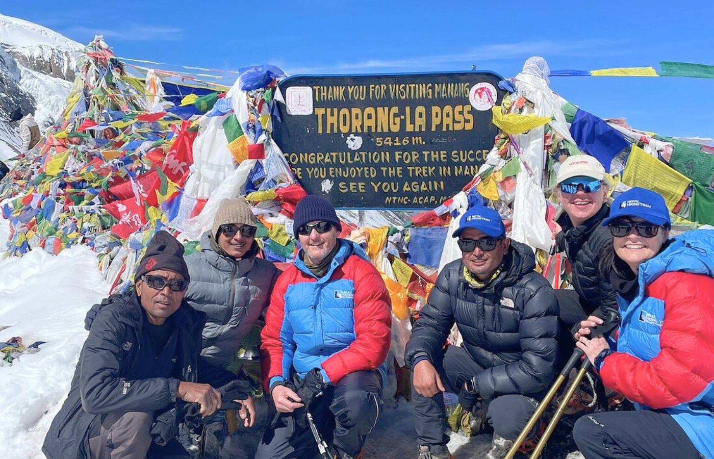
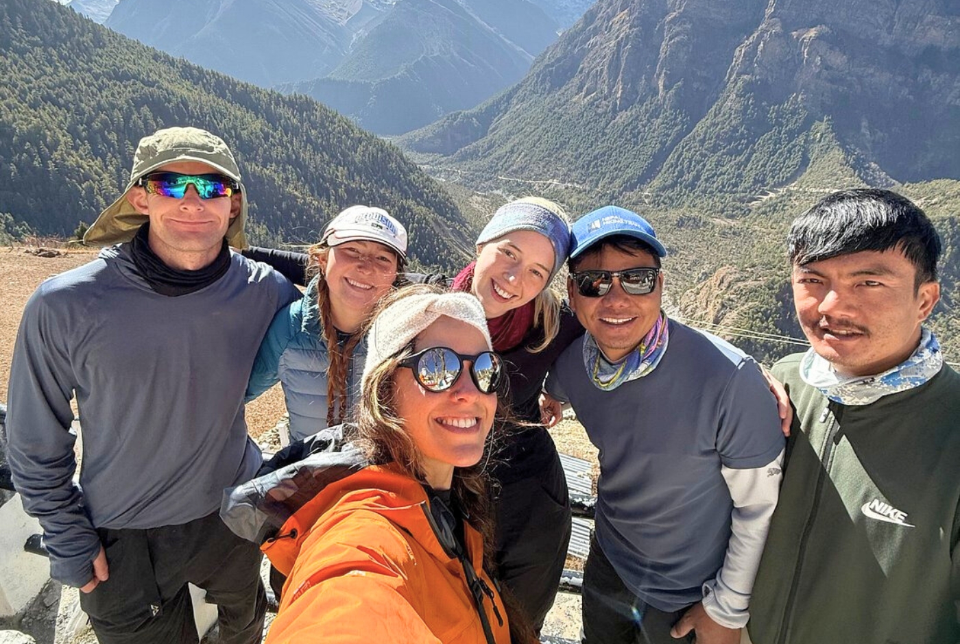
Five trekkers celebrate reaching the Thorong La Pass summit on NATT Annapurna Circuit
Why Choose the NATT Route Over the Standard Annapurna Circuit?
A True Road-Free Trekking Experience
On the standard circuit today, sections like the Marsyangdi Valley between Dharapani and Chame involve hours of walking on a gravel road shared with jeeps, motorcycles, and construction vehicles. The NATT route eliminates this inconvenience entirely. You will spend your days on dirt paths through oak and rhododendron forests, across suspension bridges, and through terraced hillside fields.
Better Scenery and Cultural Immersion
Roadside villages on the classic circuit have largely transformed into petrol stations and roadside lodges. The NATT trails pass through older agricultural villages set back from the road, places like Ngawal, Ghyaru, and Upper Pisang, where prayer flags outnumber phone signals and the cultural immersion is significantly richer.
Safer and More Enjoyable Walking
Road sections expose trekkers to vehicle traffic, unstable cuttings, and monotonous walking, which can lead to inattention. The NATT trails, designed entirely for foot travel, offer better gradients, clearer footing, and the mental engagement that comes from navigating real terrain. Forest paths are also far kinder on knees over consecutive days.
Where Does the NATT Route Start and End?
Typical start: Besisahar (860 m) or Dharapani (1,860 m)
Typical end: Jomsom (2,720 m), Tatopani (1,190 m), or onward to Pokhara
Most trekkers take a jeep from Besisahar to Dharapani or Chame to skip the heavily road-dominated lower valley. The NATT picks up its most distinct character from Dharapani onwards. Starting from Besisahar and walking the full lower section gives you the complete ecological transition from subtropical lowland to alpine terrain, which is worth the extra days if time allows.
Trek length: 14 to 21 days, depending on the start point and pace.
NATT Annapurna Circuit Trek Route Overview
The NATT route follows the Marsyangdi Valley before climbing to high ridge trails above Pisang and Ngawal, then reconnecting with the main circuit in Manang before crossing Thorong La Pass. The terrain shifts dramatically, from river valleys and pine forests in the lower sections to open ridgelines and high-altitude desert as you approach the pass.
| Stage | Altitude | Notes |
|---|---|---|
| Besisahar | 860 m | Gateway town, bus or jeep from Kathmandu or Pokhara |
| Dharapani | 1,860 m | NATT trail character begins here |
| Chame | 2,630 m | District headquarters with good facilities |
| Upper Pisang | 3,300 m | NATT high route begins; key divergence from the road |
| Ghyaru / Ngawal | 3,660 to 3,730 m | Ridge route with panoramic Annapurna II views |
| Manang | 3,519 m | Mandatory acclimatization stop; minimum one rest day |
| Yak Kharka | 4,018 m | Final settlement before high altitude begins |
| Thorong Phedi | 4,540 m | Base before the pass; start the crossing by 4 to 5 a.m. |
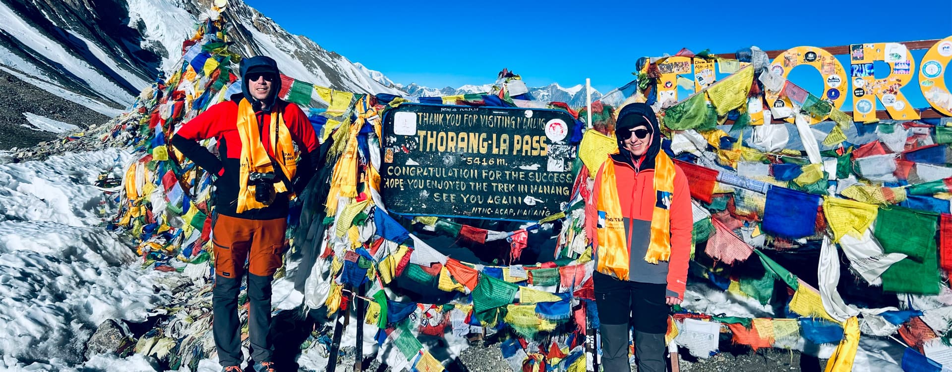
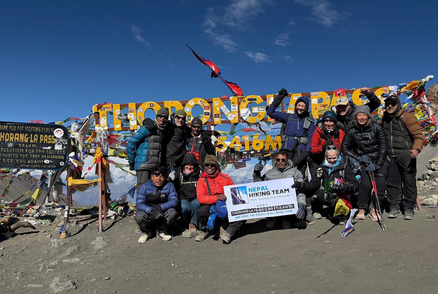
| Thorong La Pass | 5,416 m | The high point and the defining moment of the trek |
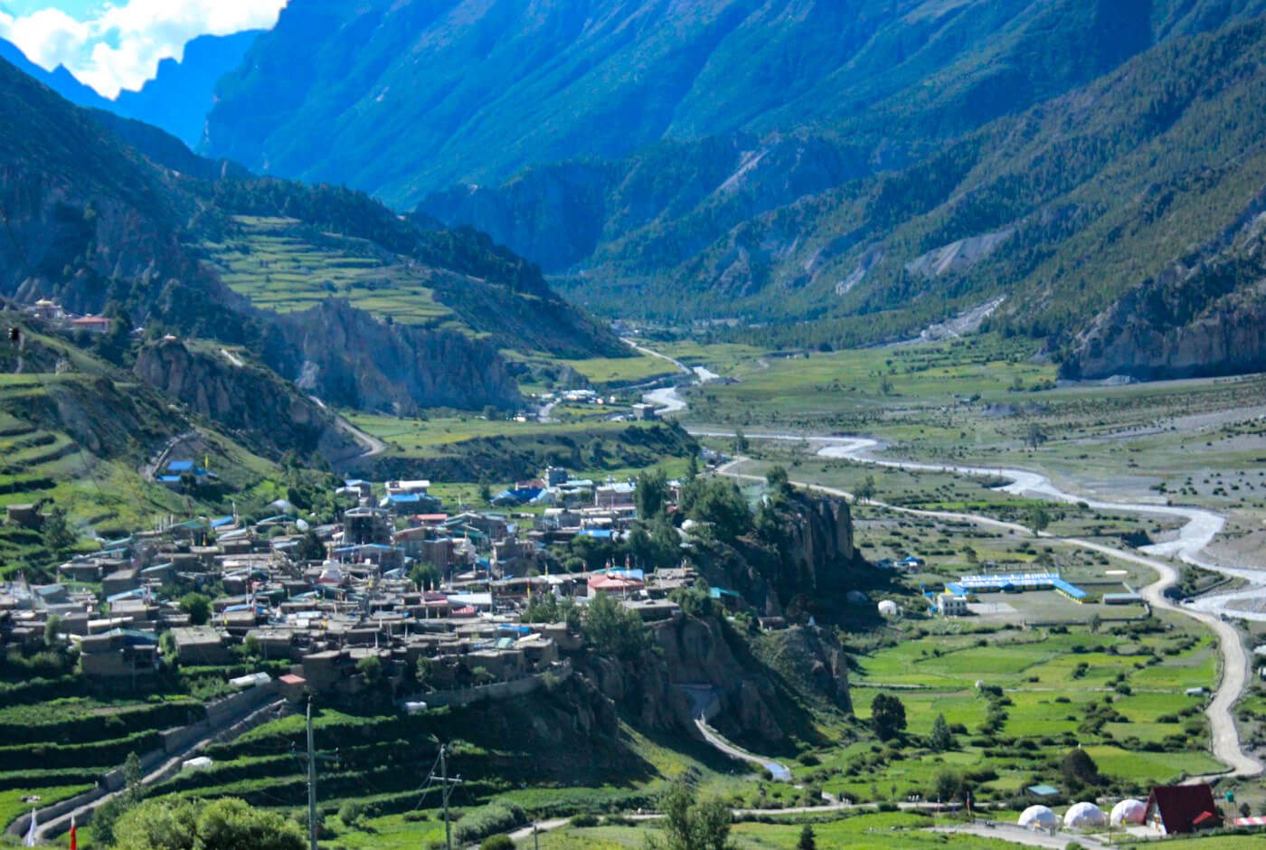
| Muktinath | 3,760 m | Sacred temple site revered by Hindus and Buddhists |
| Jomsom | 2,720 m | End point; fly or trek out to Pokhara |
Where the NATT Trail Diverges from the Road?
The Tal alternative: Between Tal and Dharapani, the NATT follows the east bank of the Marsyangdi River rather than the road on the west bank. It is quieter and significantly more scenic.
Upper Pisang high route: Instead of following the road to Lower Pisang, the trail climbs to Upper Pisang and continues along the high ridge through Ghyaru and Ngawal. These villages offer spectacular Annapurna II and Gangapurna views that most road-walkers never see. The Upper Pisang route is the key NATT section and the heart of the road-free Annapurna Circuit experience.
The Ngawal forest descent: From Ngawal, the NATT drops into Manang via a forest trail rather than the jeep track, passing through ancient mani walls and juniper stands.
Key Highlights of the NATT Annapurna Circuit Trek
- Crossing Thorong La Pass at 5,416 m, one of the world's highest trekking passes and the defining milestone of the circuit
- Extraordinary landscape diversity from subtropical rhododendron forest to alpine meadow and high-altitude Tibetan-style desert, all within a single continuous walk
- Tibetan-influenced culture in Manang and Mustang, including ancient gompas, prayer wheels, and mani walls that predate trekking tourism by centuries
- Kali Gandaki Gorge, the world's deepest gorge, flanked by Dhaulagiri and Annapurna I, both above 8,000 m
- Muktinath Temple, a site of major religious significance to both Hindus and Buddhists, where an eternal flame burns at 3,760 m
How Difficult is the NATT Annapurna Circuit Trek?
Difficulty level: Moderate to challenging
Maximum altitude: 5,416 m (Thorong La Pass)
Daily walking hours: 5 to 8 hours
Suitable for beginners: Yes, with preparation and proper acclimatization
Technical skills required: None
Physical Fitness Required
You should comfortably walk 5 to 8 hours per day over consecutive days while carrying a moderate pack of 7 to 10 kg. The NATT high routes involve more elevation gain per day than the road alternative. Build fitness over three to four months with multi-day hiking or consistent hill walks before the trip.
Altitude Challenges
Altitude is the main challenge and the primary cause of trek abandonment on the circuit. From Manang at 3,519 m upward, Acute Mountain Sickness (AMS) is a genuine risk.
Acclimatization in Manang is essential. A minimum of one full rest day is non-negotiable, not optional. Ascend slowly after Manang and descend immediately if symptoms worsen. Thorong La Pass at 5,416 m is higher than Mont Blanc. Treat it accordingly.
Daily Walking Hours
Most stages require 5 to 8 hours of walking. The Thorong La crossing from Thorong Phedi to Muktinath takes between 7 and 9 hours depending on conditions and pace. Start the pass no later than 4 to 5 a.m. to avoid dangerous afternoon winds.
Can Beginners Do the NATT Annapurna Circuit Trek?
Yes, with the right preparation. The NATT route requires good fitness and realistic expectations about altitude, but no technical skills. Spend three to four months building aerobic fitness and doing multi-day walks with a loaded pack before you go. Choose the 16 to 18 day itinerary to allow proper acclimatization time and rest days.
Best Time for the NATT Annapurna Circuit Trek
Choosing the right season makes a significant difference to your experience on the road-free Annapurna Circuit. Trail conditions, visibility, and crowd levels vary considerably across the year.
| Season | Rating | What to Expect |
|---|---|---|
| Spring (March to May) | Best | Stable weather, blooming rhododendrons, and excellent mountain visibility make this one of the best seasons for the NATT Annapurna Circuit. Crowds build through April and May but the trails remain enjoyable. |
| Autumn (Sept to Nov) | Best | Clear skies and dry trails follow the monsoon, offering the most reliable trekking window of the year. October is peak season. Book teahouses in Manang and Muktinath in advance. |
| Winter (Dec to Feb) | Possible with caution | Viable for experienced trekkers. Snow can block Thorong La Pass and temperatures drop sharply above 3,500 m. Trails are empty and mountain views can be spectacular, but flexibility is essential. |
| Monsoon (June to Aug) | Not recommended | Lower sections are wet and humid with frequent landslides. Manang and Mustang fall in the rain shadow and remain relatively dry, but the Thorong La crossing stays risky throughout this period. |
Permits Required for the NATT Annapurna Circuit Trek
Two permits are required and both are straightforward to obtain. Neither requires advance booking. You can collect them in Kathmandu or Pokhara before you depart.
ACAP (Annapurna Conservation Area Permit): Approximately NPR 3,000 (around USD 22). Mandatory for all trekkers entering the Annapurna Conservation Area.
TIMS Card (Trekkers' Information Management System): Approximately NPR 2,000 (around USD 15). Covers safety registration and contributes to trail maintenance funding.
Where to get them: Nepal Tourism Board offices in Kathmandu or Pokhara, or through a licensed trekking agency. Bring passport photos and your original passport.
Do I Need a Guide to Trek the NATT Annapurna Circuit?
Nepal introduced regulations in 2023 requiring foreign solo trekkers in most regions, including the Annapurna area, to trek with a licensed guide. Beyond the regulatory requirement, a guide who knows the NATT trails is strongly recommended for practical reasons: the trail marking is still inconsistent at key junctions, and a guide provides real-time acclimatization monitoring, cultural interpretation, and teahouse logistics. Verify current requirements with the Nepal Tourism Board or your agency before finalizing your plans.
Accommodation on the NATT Route
The Annapurna Circuit runs entirely on a teahouse system. These are small, family-run guesthouses providing dormitory or private rooms and cooked meals. On the NATT high routes through Upper Pisang and Ngawal, teahouses are smaller and more basic than those on the main road. This is part of the appeal, as you encounter genuinely local family hospitality rather than the increasingly commercial offerings along the jeep road.
Accommodation quality increases significantly in Manang and Jomsom, where you will find solar-heated water, better WiFi connectivity, and menus that include apple pie and Tibetan bread. Expect to pay NPR 300 to 800 per room per night. Most teahouses offer low room rates on the understanding that you eat your meals with them.
Food and Water on the Trail
Dal Bhat, the combination of lentil soup, rice, and vegetable curry, is the definitive trekking meal. At NPR 500 to 900, it typically comes with unlimited refills and provides the sustained energy required for long days at altitude. As you ascend, the menu narrows to potatoes, noodle soups, and fried rice, but caloric content remains adequate.
For water, avoid single-use plastic bottles. They are expensive, environmentally damaging, and entirely unnecessary. Bring a water filter such as the Sawyer Squeeze, or carry iodine tablets. Most teahouses can provide boiled water for a small fee, and filtered water stations operate at several points along the route, including the ACAP checkpoint in Manang.
NATT Annapurna Circuit Trek Cost Breakdown
Costs vary depending on whether you trek independently or through a full agency package, and whether you hire a guide, a porter, or both. The estimates below are based on a 14-day independent trek with a licensed guide.
| Item | Estimated Cost |
|---|---|
| Permits (ACAP + TIMS) | ~USD 37 |
| Licensed guide (14 days) | USD 200 to 280 |
| Porter, optional (14 days) | USD 140 to 200 |
| Teahouse accommodation (14 nights) | USD 70 to 140 |
| Food and drink (14 days) | USD 200 to 350 |
| Transport: jeep or bus plus return flight Jomsom to Pokhara | USD 120 to 180 |
| Travel insurance with helicopter evacuation cover | USD 80 to 150 |
| Total estimate (independent trek with guide) | USD 850 to 1,340 |
Full agency packages that include accommodation, guide, porter, and transfers typically start at around USD 1,200 to 1,600 for the full circuit. This is a practical option for first-time trekkers to Nepal who prefer not to manage logistics independently.
Do You Need a Guide for the NATT Route?
Yes, practically speaking, and not only for regulatory reasons. A licensed guide who knows the NATT trails will navigate route splits that are not always obvious, monitor your acclimatization in real time, liaise with teahouses, and provide the cultural context that transforms a scenic walk into a genuine encounter with Himalayan life.
Beyond navigation, a good guide is your best protection against the altitude-related decisions that go wrong. These include the instinct to push through early symptoms, starting the pass crossing too late in the morning, or underestimating the long descent to Muktinath.
Can You Do the NATT Annapurna Circuit Without a Guide?
Solo trekking regulations in Nepal have changed. Since 2023, foreign trekkers in most Himalayan regions, including the Annapurna area, are required to be accompanied by a licensed guide. Trekking without one may result in fines or being turned back at checkpoints.
Beyond regulations, navigating the alternative Annapurna Circuit route independently is genuinely challenging. The NATT trail diverges at key points such as Upper Pisang and Ngawal where wrong turns are easy and the consequences of going off-route at altitude are serious. A local guide is both a practical and safety investment.
NATT Route vs Classic Annapurna Circuit
| Feature | NATT Route | Standard Road Route |
|---|---|---|
| Trail surface | Natural paths, forest, ridgeline | Mix of footpaths and gravel or tarmac roads |
| Vehicle traffic | None on trail sections | Significant on several stages |
| Scenery quality | High-altitude villages, ridgeline views | River valley, roadside settlements |
| Cultural experience | Authentic farming villages and older communities | Roadside lodges with increasing commercialisation |
| Navigation | Waymarked, but a guide is recommended | Follow the road; simpler to navigate |
| Overall experience | Significantly higher | Reduced by road sections |
Common Mistakes Beginners Make on the Annapurna Circuit
1. Skipping acclimatization days. A rest day in Manang is not optional. AMS at altitude can escalate to life-threatening HACE or HAPE within hours. Do not push through symptoms.
2. Over-packing. Every extra kilogram becomes a burden above 4,000 m. Aim for a 7 to 9 kg base weight. Hiring a porter is affordable and worth every rupee.
3. Underestimating altitude's effect. Trekkers who feel fine at 3,000 m are often surprised at how differently their bodies respond at 4,500 m. Headaches, nausea, and disrupted sleep are warning signs to take seriously.
4. Choosing too short an itinerary. A 12-day circuit is physically possible but leaves no room for rest or acclimatization issues. A 16 to 18 day itinerary is safe, enjoyable, and allows for worthwhile side trips such as the Ice Lake hike above Manang.
5. Travelling without helicopter evacuation cover. Helicopter evacuation from altitude costs USD 2,000 to 5,000. Your travel insurance must explicitly cover high-altitude helicopter rescue. Check this before you leave home.
Essential Packing List for the NATT Annapurna Circuit Trek
Clothing
- Down jacket, 600 fill or above
- Waterproof shell jacket and trousers
- 3 to 4 moisture-wicking base layer tops
- Fleece mid-layer
- 2 pairs of trekking trousers
- Thermal base layers, top and bottom
- Warm hat, sun hat, and gloves
- 4 to 5 pairs of merino wool hiking socks
Footwear
- Waterproof mid-cut trekking boots, fully broken in before the trip
- Camp sandals or lightweight shoes
- Trekking poles are strongly recommended
- Gaiters, useful for the Thorong La crossing
Health and Safety
- Diamox (acetazolamide), consult your doctor in advance
- First aid kit including blister treatment
- Water filters, such as the Sawyer Squeeze, or iodine tablets
- High-SPF sunscreen and lip balm
- UV400 sunglasses
- Pulse oximeter
Gear and Essentials
- Sleeping bag rated to minus 10 degrees Celsius or below
- Headtorch with spare batteries
- Trekking pack of 40 to 50 litres
- Pack rain cover
- Dry bags for electronics
- Portable battery pack or power bank
- Offline maps downloaded before departure, such as Maps. me or Gaia GPS
Planning Your NATT Annapurna Circuit Trek
The logistics of the NATT route are more complex than those of a standard point-to-point trek. You need to coordinate permits in Kathmandu or Pokhara, arrange transport to the trailhead, book a guide who specifically knows the NATT divergence points, and plan your itinerary around proper acclimatization days rather than simply covering distance.
For first-time trekkers to Nepal, working with a locally experienced trekking team that knows the NATT trail system firsthand significantly reduces planning burden and improves safety. A reputable agency handles permits, guide assignments, teahouse reservations in peak season, and contingency planning if the pass closes or you need to adjust the itinerary due to altitude symptoms.
Whether you plan independently or through an agency, the key is to prioritise time over speed. The NATT Annapurna Circuit rewards trekkers who allow themselves to move slowly through one of the world's most spectacular high-altitude landscapes.
Is the NATT Annapurna Circuit Trek Worth It?
Without qualification, yes. The NATT route restores to the Annapurna Circuit what road construction had eroded: the sense of genuine wilderness travel, the cultural intimacy of remote villages, and the unobstructed experience of walking through one of the most diverse landscapes on earth.
It remains one of the world's great long-distance treks. A single continuous journey through subtropical forest, alpine meadow, high-altitude desert, and a 5,416 m pass, all while passing through living Himalayan culture. The NATT simply makes it what it was always meant to be.
For any trekker who wants an authentic Nepal experience rather than a scenic drive with some walking attached, the road-free Annapurna Circuit is the right choice.
Final Tips for First-Time Trekkers
Walk at your own pace. The single biggest pressure on the circuit is keeping up with other trekkers or with an overambitious itinerary. Your pace and your acclimatization are what matter. Start walking by 7 a.m., and you will have comfortable afternoons.
Drink more water than you think you need. Dehydration at altitude accelerates the effects of AMS. Aim for at least three litres per walking day, filtered or boiled.
Listen to your guide on altitude symptoms. A good guide notices changes in your colour, gait, and alertness before you do. If they say to descend, descend.
Respect the culture. Walk clockwise around mani walls and stupas. Ask before photographing people, especially monks and elderly villagers. Remove your boots before entering gompas. These are active religious spaces, not tourist attractions.
Post a Comment