
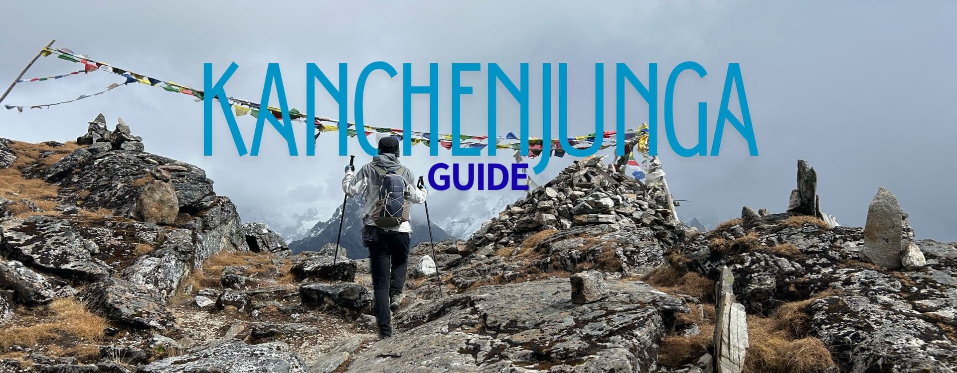
The Kanchenjunga Circuit Trek is ranked among Nepal's best wilderness treks. It is an epic combination of two standalone treks - the Kanchenjunga North Base Camp Trek and the Kanchenjunga South Base Camp Trek. This fantastic trek takes you around the north and south base camps of Kanchenjunga, the third-highest mountain in the world, with a thrilling crossing over a series of high mountain passes.
Covering the circuit on foot, you hike into a pristine corner of the Himalayas while experiencing a profound connection with nature and unique Himalayan cultures. The trail is remote from commercial trekking routes, making it a top choice for serious adventurers. Experience untouched landscapes, glacial valleys, diverse forests, and breathtaking vistas of Kanchenjunga and other high peaks.
The trail to the Kanchenjunga Circuit is practically empty, especially compared to the well-trodden paths around Annapurna and Everest. This off-the-beaten-path trek is an excellent choice for those who want to explore less-traveled routes and enjoy an authentic Himalayan trekking experience.
Considering the sheer volume of information on Everest and Annapurna treks on the internet, the search results for the treks in the Kanchenjunga region are near empty when you try to find practical, up-to-date guides on the internet. While you might find some information, many of these sources may be outdated, inaccurate, or in a local language that you may find hard to understand.
For those planning to walk the Kanchenjunga Circuit, we have compiled a comprehensive Kanchenjunga Circuit Trek Guide to help you understand what to expect and how best to prepare for your adventure. Here in this guide, you can find the latest information about the Kanchenjunga Circuit Trek, from trail conditions to teahouses along the trail. So, ladies and gentlemen, buckle up your seatbelts and read on to find out what awaits you at one of the wildest trekking circuits in Nepal.
Location of Kanchanjenga Circuit Trek
Taplejung, a remote mountainous district in eastern Nepal, is home to the Kanchenjunga Circuit trekking trail. The trail meanders near the far northeast of Nepal, bordering the Tibet Autonomous Region of China and the Indian state of Sikkim. This circuit winds through the Kanchenjunga Conservation Area, a protected area home to endangered Himalayan wildlife, including the snow leopard, red panda, and blue sheep.
Learn more about where Mount Kanchenjunga is located.
How to reach the Kanchenjunga Circuit Trail starting point?
To reach the Kanchenjunga Circuit trekking trailhead, you first fly from Kathmandu to Bhadrapur (Chandragadhi Airport), then take a long jeep or bus ride through the tea gardens of Kanyam in Ilam to Taplejung, a bustling town largely inhabited by the Limbu ethnic community.
A direct flight from Kathmandu to Bhadrapur takes approximately 45 minutes. The overland journey from Bhadrapur to Taplejung will take approximately 9-10 hours. From Taplejung, you will take a local jeep and then a 5-6-hour ride to the trailhead (Ranipul, Sekathum, or Yamphudin).
A direct flight from Kathmandu to Suketar provides the fastest access to Taplejung, but it is unpredictable due to inconsistent schedules and weather disruptions.
If you plan to skip the flight and take an overland route, you can hire a jeep in Kathmandu and travel directly to Taplejung. There is no direct bus service from Kathmandu to Taplejung. If you plan to travel by bus, take a bus to Birtamode in Jhapa, then board a bus or jeep to Taplejung from Charali.
Those relying on public transport (shared jeeps and buses) to reach Taplejung can take it from Charali, a small town near Bhadrapur. The journey from Charali to Taplejung roughly takes 9-10 hours.
You can also break your journey and stay at one of the stops along the way to Taplejung. You can stay at Kanyam in Ilam or Phidim in Paanchthar, which lie about 2 and 7 hours away from Charali.
The road from Charali to Taplejung is mainly paved, but heavy rainfall can damage sections of the highway. From Taplejung, the road gets bumpier and rougher. After an overnight stay in Taplejung, you can either head to Yamphudin, the trailhead to the Kanchenjunga South Base Camp, or to Sekathum or Ranipul, the trailheads to the Kanchenjunga North Base Camp.
While most trekkers prefer to complete the Kanchenjunga Circuit from north to south to allow for acclimatization, one can also take the south-to-north route.
Kanchenjunga stands among Nepal’s most rewarding trekking routes, renowned for its remoteness and raw Himalayan beauty. Explore the best treks in Nepal here.
Kanchanjunga Circuit Trekking Route
From North to South Base Camp
Your trek will begin from Sekathum or Ranipul. Ranipul lies farther downstream from Sekathum and is where the Tamor and Ghunsa Rivers meet. After Sekhatum, you will walk past the villages of Itahari, Jaubari, Lamatar, and Amjilosa. The trail through these settlements takes you through several cardamom plantations and into a dramatic little canyon. En route, there are several river crossings via suspension bridges and mesmerizing views of waterfalls. The dense forest between Amjilosa and Thangyam is home to the red panda and the Himalayan black bear.
The next stage takes you to Gyabla, one of the most significant settlements on the route and a great overnight stop. About three to four hours' walk from Gyabla is the Tibetan refugee village of Phale. From there, it’s just another hour and a half hike to Ghunsa, the largest village on the route at 3400 m.
Ghunsa, like Namche Bazaar and Manang, is a great place to take a rest day for acclimatization. While in Ghunsa, you can visit one of the oldest Buddhist monasteries in eastern Nepal, hike to Yamatari Glacier and Dudh Pokhari, or simply explore the village and interact with local villagers.
From Ghunsa onward, your daily stages are pretty much set, as there are no further villages but rather a strategically placed cluster of lodges. In Kambachen, you can stop for an acclimatization break and check out the impressive Jannu Viewpoint. You will be standing in front of three massive mountains, with Jannu itself measuring 7,800 meters.
Lhonak is the last settlement with open teahouse infrastructure. From there, it’s a mere day hike to Pangpema, the Kanchenjunga North Base Camp, and back. Due to unstable glacier moraines and several landslides, this trail is significantly more difficult.
Most trekkers need between four and five hours to reach Pangpema and another four to return to Lhonak. Weather permitting, Pangpema offers mind-blowing views of the Kanchenjunga North Face.
Later, you will return to Ghunsa and hike south, climbing steeply through a beautiful rhododendron and pine forest. At an altitude of roughly 4000 meters, you will leave the forest and enter a high alpine shrub landscape.
After a four- to five-hour walk from Ghunsa, you will reach Selele Phedi, a cluster of two or three basic teahouses. From Selele Phedi, you cross the high mountain passes of Selele La, Mirgin La, and Sincholela and descend to Cheram. Later, you will travel to Oktang or Kanchenjunga South Base Camp via Ramjer, then return to Cheram. From Cheram, you will descend to the Simbuwa River canyon via Torongden. Your trek will finally end once you reach the jeep stop at Ranipul.
From South to North Base Camp
The trek from the south side usually begins in Yamphudin, in the Kabeli Khola Valley. From Yamphudin, you will walk past an isolated route filled with yak pastures and seasonal camps of yak herders. Compared to the northern trail, there are hardly any villages along this route. The overnight stops along this route include Torongdin, Cheram, and Ramjer, which are not actual settlements but just clusters of teahouses.
From Ramjer, you will make your way towards Oktang, the Kanchenjunga South Base Camp. Later, you will cross a series of high mountain passes, including Selele La Pass and Mirgin La, and descend to Selele Phedi. From there, you will trek to Ghunsa and later head to Pangpema (Kanchenjunga North Base Camp) via Kambachen and Lhonak. You will retrace your steps to Ghunsa, then descend to the lower Ghunsa River Valley via Ghyabla, Amjilosa, and Lamatar, and finally end your trek at Sekathum.
Kanchenjunga Circuit Trek Distance and Duration
The Kanchenjunga Circuit Trek typically takes between twenty-two and twenty-six days, with an estimated total of twelve to fifteen days devoted to trekking alone. Some adventure-focused itineraries extend the trip to as long as twenty-eight days, allowing for slower acclimatization, cultural explorations in highland villages, and an unhurried approach to the passes.
On the other hand, strong and experienced high-altitude trekkers may attempt a shorter journey of fourteen to eighteen days. However, shortening the trek can be risky, and it is recommended only for those accustomed to steep elevation gains and long trekking days.
Trekking time varies slightly from trekker to trekker, as individual fitness, trail conditions, and weather can affect how each stage unfolds. Most Kanchenjunga Circuit trekking itineraries include ample acclimatization days and a steady altitude progression, which is why this journey often stretches over three weeks rather than being rushed through in a shorter window.
Those completing the entire circuit or the north–south loop cover approximately 175 to 200 kilometers on foot, a distance that feels immersive rather than exhausting when spread over multiple days with plenty of rest stops.
Kanchenjunga Circuit Trek Overview
Trek Information
| Description | Total Walking Distance |
| Average Daily Walking Time | 6 to 7 hours of trekking each day |
| Longest Walking Days | 9 to 10 hours on the Pangpema and Selele La Pass crossing days |
| Highest Elevation Reached | 5,200 to 5,143 meters at Pangpema, North Base Camp |
| Southern High Point | 4,620 to 4,730 meters at the Oktang viewpoint, South Base Camp |
| Lowest Altitude on Trail | 1,576 meters at Shekathum on the north side and 1700 meters at Yamphudin on the south side. |
| Cumulative Elevation Gain | More than 7,000 vertical meters gained throughout the trek |
| Cumulative Elevation Descent | More than 7,000 vertical meters descended toward the final lowland exit |
| Steepest Ascending Sections | Sekathum to Gyabla, Ghunsa to Kambachen, and the approach to Pangpema |
| Steepest Descending Sections | Ramjer down to Torongden and the final drop toward Hellok or Yamphuden |
| Trail Character | Forested valleys, suspension bridges, rocky moraine paths, alpine meadows, and dramatic high passes |
| Overall Difficulty | Demanding and challenging, requiring endurance and acclimatization at high altitude |
Highest Point of the Kanchenjunga Circuit
The highest point on the Kanchenjunga Circuit is roughly 5200 m, reached while crossing the final landslide zone before Pangpema. The highest night you will spend on the trek will be in Lhonak at 4780 meters.
Pangpema, the Kanchenjunga North Base Camp, at approximately 5,143 meters, is the second-highest point on the route. Pangpema offers stunning, close-up views of the formidable north face of Mount Kanchenjunga (8,586 m), the world's third-highest mountain, along with other towering peaks like Tent Peak and the Twins. Trekkers typically hike to Pangpema as a challenging day trip from the nearby settlement of Lhonak and return to Lhonak for the overnight stay, as there are no teahouses at the base camp itself.
The high-altitude passes, including the Selele La Pass, Mirgin La, and Sinelapche Bhanjyang, that connect the northern and southern base camp areas are also some of the highest points on the route.
The Kanchenjunga South Base Camp (Oktang viewpoint) is at an elevation of approximately 4,730 meters.
How difficult is the Kanchenjunga Circuit Trek?
The Kanchenjunga Circuit Trek is one of the most demanding treks in Nepal. The circuit is challenging not because of a single factor, but because multiple demanding factors combine to make it an arduous Himalayan journey.
High altitude is one of the biggest challenges trekkers face, as the trail gradually climbs above 5,100 meters. Spending multiple days walking at elevations above 3,500 meters physically and mentally strains the body. Keeping a slow pace and acclimatizing properly while completing the Kanchenjunga Circuit will help keep trekkers safe.
The trek's duration also contributes to its difficulty. This trekking adventure lasts more than three weeks, and even experienced trekkers can’t escape the fatigue from consecutive 6- to 8-hour hiking days, steep climbs, and long downhill sections.
The terrain itself is rugged and untamed. The trail meanders through dense forests, deep ravines, rock-strewn valleys, narrow ridgelines, and glacial debris-filled fields. The slippery, uneven ground requires strong legs, balance, and focused concentration with every step.
Another factor making this trek challenging is the lack of villages in the higher reaches. While in the Everest region, there are plenty of villages en route, and you can keep your itinerary flexible; this is not the case in the Kanchenjunga region. Due to a lack of lodges in the upper valleys of the Kanchenjunga circuit, your itinerary is fixed from the moment you leave Ghunsa.
During peak seasons, a few standalone tea shops along the trail to Pangpema and Oktang (the north and south base camps) sell tea and snacks but do not offer sleeping accommodations for trekkers, unlike teahouses.
Kanchenjunga is highly remote, and that remoteness shapes the route's character. Unlike the busier regions, trekkers here will encounter very few other travelers. Lodging options are limited, resupply points are scarce, and outside support is minimal. When you are on the trail, you are genuinely in one of Nepal’s most isolated mountain areas.
The day hike to Pangpema, Kanchenjunga North Base Camp, is one of the main challenges trekkers face on the circuit. The hike is challenging, and there are several landslides along the route. One must climb steep slopes at elevations of 5000 meters or higher. Crossing the high passes (Selele La, Mirgin La, Sinelapcha La, and Sinion La) is also challenging. There are also steep ascents in the lower Ghunsa Valley and arduous descents in Tortong (Torongden), which make the circuit difficult.
Weather conditions create additional challenges. Even within a single day, the sky can shift from clear and sunny to cloudy with icy wind and even snowfall. Temperature differences between night and day are considerable, particularly in the higher sections of the trek, which increase overall difficulty.
Given these factors, a high level of physical fitness is required to complete this trek. Before embarking on this journey, one should realize that completing the Kanchenjunga Circuit is not a short Himalayan walk. It is a long, tedious mountain hike that can leave you physically and mentally exhausted.
The Kanchenjunga Circuit is for individuals who are prepared, understand their capacity at high altitude, and seek a serious high-mountain adventure rather than a casual hike.
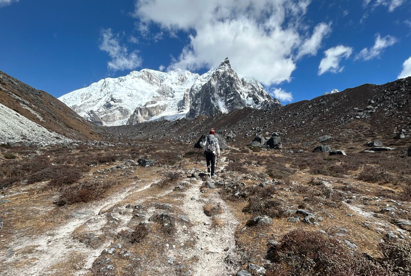
Terrain and Trail Conditions of the Kanchenjunga Circuit Trek
The Kanchenjunga Base Camp route has a constantly changing trail profile. The route moves through dense forests, high ridges, river canyons, glacier flats, and rocky alpine expanses. This is one of the most varied trekking terrains in Nepal and demands steady footwork, balance, and awareness of environmental conditions.
Trail Condition
The lower section of the trek features well-trodden dirt paths, stepping stones, and gently rising forest tracks. As you walk higher toward Ghunsa and above, the trail becomes narrower, rockier, and more exposed. In high-altitude sections around Kambachen, Lhonak, and Pangpema, the route transitions to rugged, uneven ground with stretches of loose stones and moraine, where trekking poles become essential.
Glacier Experiences
Above Lhonak, trekkers navigate terrain bordering the Kanchenjunga Glacier. The surface is often mixed with ice-covered stones, gravel, and shifting debris, giving the sensation of walking on a frozen ancient glacier. There is no steep glacier scaling like mountaineering, but the environment is raw and heavily shaped by ice. Near Pangpema, along the Yalung Glacier on the south side, trekkers come into proximity of deep ice flows, creaking and shifting beneath the mountains.
Rock and Scree Sections
Several sections of the trail require careful stepping over unstable rock beds, especially between Kambachen and Lhonak and around landslide-prone slopes. These screed sections require careful stepping, as the stones can shift underfoot. In some sections, the trail crosses steep rocky ledges that require balance and attention, especially when you are struggling at high altitude.
Forest and Suspension Bridges
The routes from Sekathum to Gyabla and from Torongden to Yamphudin pass through dense forests of pine, bamboo, rhododendron, and mixed hardwood. These areas feel deeply wild and humid in spring and early autumn. Multiple suspension bridges cross the Ghunsa Khola and Simbuwa Khola rivers. These long, swaying bridges offer a dramatic view of roaring turquoise glacial rivers below.
Snow-Condition Expectations
In spring, snow patches linger above 4,200 meters, especially along the Selele La ridge and near Sinelapche La. By late autumn, frost is frequent, and snow is common at the highest passes. Winter conditions make many sections icy or fully snowbound, while the monsoon season sees the least snow presence but the most slippery mud and cloud cover. On clear days, snow contrasts sharply with black rock and turquoise ice, enhancing the dramatic scenery.
The Kanchenjunga Circuit Trek is one of Nepal’s true off-the-beaten-path adventures, offering solitude and untouched Himalayan landscapes. Learn more about off-the-beaten-track treks in Nepal here.
Major Passes of Kanchenjunga
The Kanchenjunga Circuit includes one of the most dramatic high-mountain traverses in Nepal, linking the towering glaciers of the north with the lush valleys of the south. This crossing is not a single pass but a continuous series of high saddles and ridgelines that together form the “Selele La pass system.” These passes are the key to completing the full Kanchenjunga Circuit without backtracking, making them one of the most essential and memorable parts of the whole Kanchenjunga Circuit trekking experience.
Selele La Pass—Connecting Ghunsa and Cheram
Selele La serves as the key pass between the northern and southern sections of the Kanchenjunga Circuit. The ascent begins gradually from Ghunsa, then rises sharply toward the alpine meadows and onto the exposed ridge. The pass sits in a terrain that is often snow-covered, especially in spring, and is known for strong crosswinds funneled between the mountains. Standing here, trekkers gain their first sweeping view of the upcoming ridge journey, marking the beginning of the great high-pass section.
Mirgin La Pass – Panoramic Himalayan Vantage Point
Mirgin La is one of the most visually rewarding passes of the trek. From this saddle, trekkers enjoy views that stretch across deep valleys and out toward some of the region’s most iconic giants: Jannu’s sharp peak, Kanchenjunga’s expansive ridge, and subtle glimpses of Makalu in the distant skyline. The terrain here is rugged yet stable, giving the impression of standing on a massive natural balcony overlooking both the north and south approaches to the circuit.
Sinelapche La Pass – Highest and Most Dramatic Crossing
Sinelapche La is the highest pass. Here, the air is noticeably thinner, and the horizon appears overwhelmingly vast. From this point, trekkers gain an unobstructed view of Rathong Peak, Kabru, and the southern ice basins below Kanchenjunga. The sense of elevation here is extreme, and the vast scale of Kanchenjunga’s glacial systems can be fully seen. Many trekkers describe the view from this pass as one of the best of the entire circuit.
Sinion La Pass – Aerial Views Toward Ghunsa Valley
Sinion La lies among the chain of saddles that form the ridge, offering a steep, scenic crossing with commanding views into the Ghunsa Valley. This pass makes you feel as though you are hovering above the northern terrain, with a vertical drop along the valley below. It is a beautiful transition point that connects the north side of the circuit to the final push over the ridge and toward the southern landscape.
Tamo La – Minor Scenic Saddle
Tamo La is a locally referenced pass that is not officially marked on most maps but is recognized by experienced guides and longtime locals. This smaller saddle offers some beautiful views and provides a slightly easier path among the major passes. The views here are gentle and broad, often framed by rolling ridgelines rather than steep cliffs, making them a quieter visual contrast to the larger, more dramatic passes.
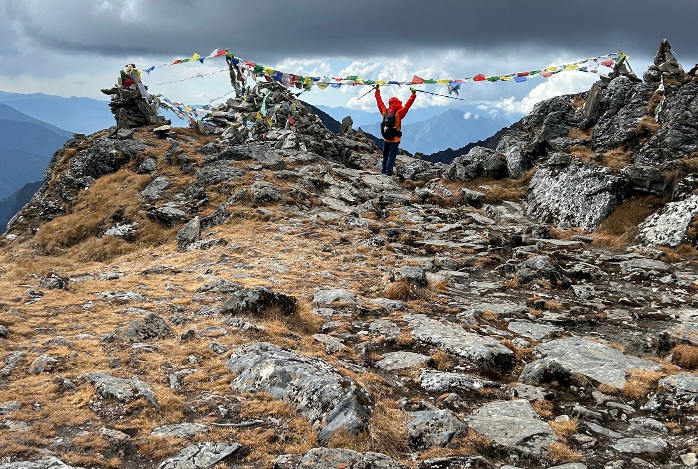
Unnamed La—Local High Points Along the Ridge
Along the route between passes, there are additional unnamed high spots that function as micro-passes or transitional ridge crests. These spots are sometimes called “La” (mountain pass in the local language) by locals, even though they do not have formal names or recorded elevations. They provide short breaks between major crossings, often marked by cairns or prayer flags, and contribute to the sense of continuous travel along the spine of the mountains.
| Pass Name | Elevation | Function on Route | Views and Highlights |
| Mirgin La | 4,633 meters | One of the main ridge crossings linking north to south. | Offers striking views of Jannu, Kanchenjunga, and glimpses of Makalu |
| Selele La | 4,355 meters (listed at 4,290–4,355 depending on source) | Primary connector from the Ghunsa side toward Cheram | Known for deep snow accumulation and exposed winds |
| Sinelapche La | 4,700 meters | Often regarded as the highest and most dramatic crossing | Stunning outlook of Kanchenjunga, Rathong, Kabru, and the Yalung Glacier basin |
| Sinion La | Frequently cited between 4,600–5,500 meters (varying references) | Additional crossing along the ridge linking the passes | Offers aerial views down into Ghunsa Valley and across the northern peaks |
| Tamo La | Elevation not formally documented | Local route saddle referenced by some trail variations | Scenic views of lower valleys and connecting slopes |
| Unnamed La | Local reference title rather than official pass | Used as a descriptive term for minor ridgeline crossings | Involves smaller saddles between the major passes |
Excited? Learn more about Nepal’s mountain passes here.
Rivers, Mountains, Lakes, and Glaciers on the Kanchenjunga Circuit
Rivers: The drive from Taplejung passes near the Tamor River, a major river in eastern Nepal. In the northern section of the circuit, the trail follows the Ghunsa River, while in the southern section, the trail runs along the Simbuwa Khola and the Kabeli River.
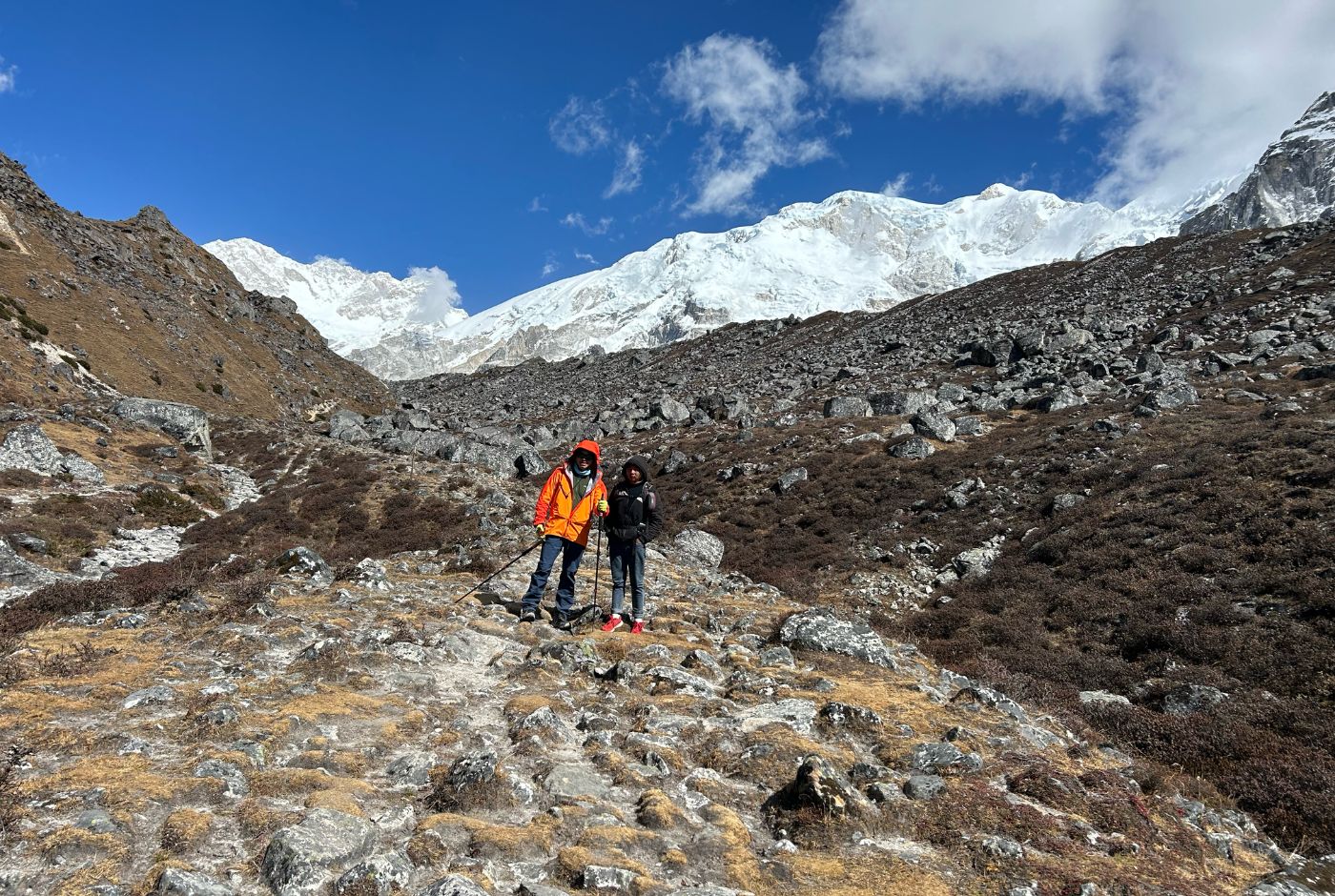
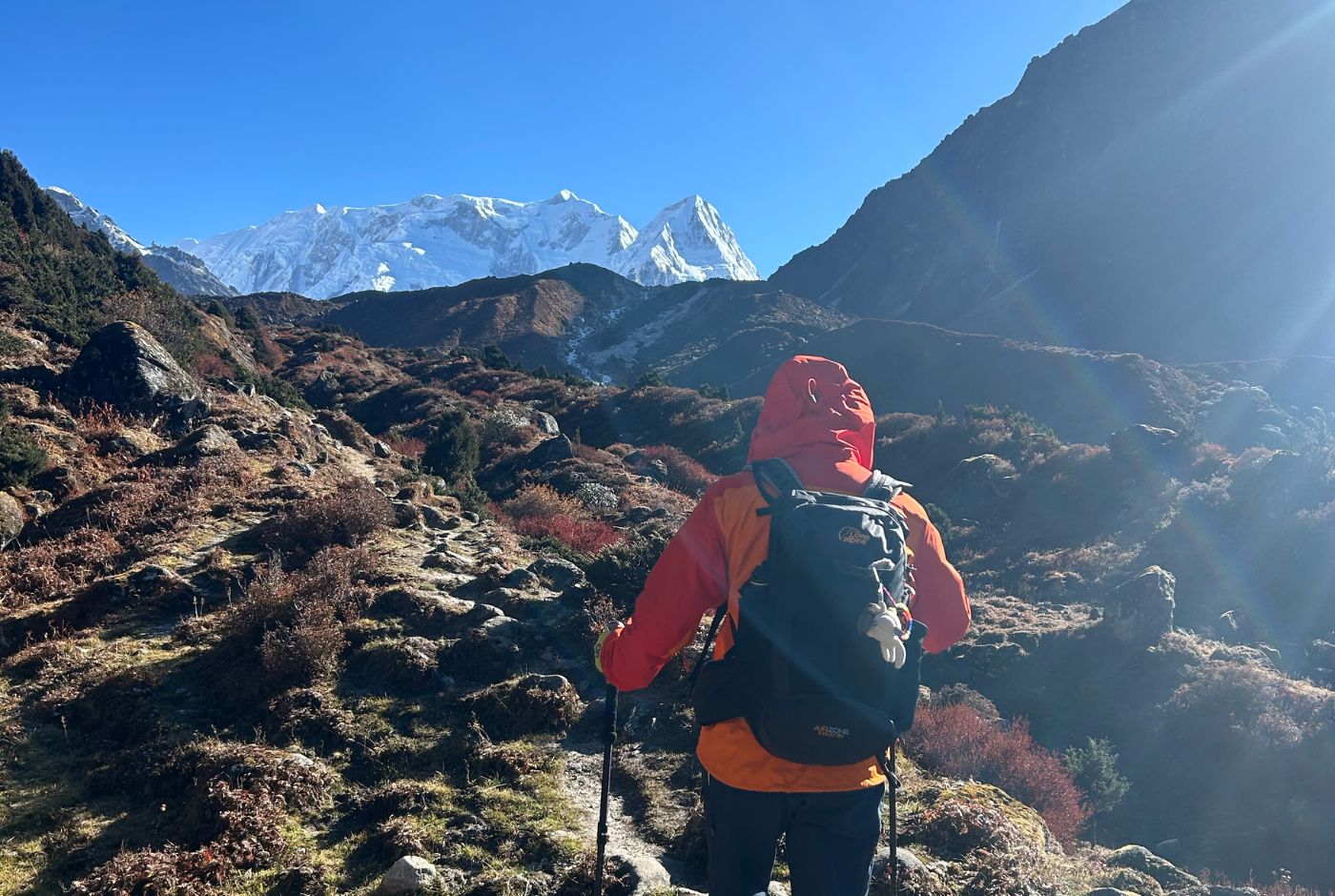
Mountains: The Kanchenjunga Circuit Trek offers the best close-up views of Mount Kanchenjunga available to any trekker or non-mountaineer. You can enjoy close-up views of the entire Kanchenjunga Massif (Kanchenjunga main summit (8,586 m), Kanchenjunga Central (8,473 m), Kanchenjunga South (8,476 m), and Yalung Kang or Kanchenjunga West (8,586 m)). Besides the mighty Kanchenjunga, you can also spot other giants like Mount Everest, Makalu, Mt. Jannu (Kumbakarna), Nepal Peak, Wedge Peak, the Twins, Kirat Chuli, Kabru, Rathong Peak, Talung Peak, etc.
Glaciers: From the north base camp, the glaciers visible include the Kanchenjunga Glacier and the Jannu Glacier. From Oktang, or the south base camp, one gets a fantastic view of Yalung Glacier, which is the source of the Tamor River.
Glacial Lakes: Glacial lakes on the northern route include Lhonak Lake and Dudh Pokhari (which lies close to Ghunsa, a few hours' hike away from the main trekking route). While crossing the Selele La Pass, one comes across Anda Pokhari, a high-altitude alpine lake. On the southern side, there’s Lapsang Pokhari and Ramjer Pokhari en route to Oktang or Kanchenjunga South Base Camp.
Local Villages on the Kanchenjunga Circuit
The Kanchenjunga Circuit passes through picturesque villages, beginning in warm hill regions and gradually moving into high-alpine settlements influenced by Tibetan culture.
Low Elevation Villages
Phikkal and Kanyam: Tea-growing hilly villages inhabited mainly by the Rai community, located en route to Taplejung. These villages are known for their scenic tea estates and mild climate.
Taplejung: The main gateway town, where trekkers finalize supplies and meet their local crew before the start of the trek. Taplejung is the stronghold of the Limbus.
Chirwa: A riverside market village with accessible local produce and fertile fields.
Yamphudin: A culturally mixed settlement with terraced fields and lush forest, marking the southern transition into higher terrain.
Sekathum: The commonly accepted trekking start point, where driving stops and walking begins.
High Elevation Villages
Amjilosa: A small hamlet known for its cardamom plantations, quiet atmosphere and wildlife.
Gyabla (Kyapra): A peaceful village with Tibetan influence and simple teahouse facilities.
Ghunsa: The cultural and acclimatization center of the trek, home to monasteries, yak husbandry, and friendly Sherpa-Tibetan communities.
Kambachen: A high-altitude stop used for acclimatization before reaching glacier terrain.
Lhonak: A remote, wind-exposed settlement that serves as the final staging point for reaching Pangpema, the North Base Camp.
Other Settlements
Tortong(Torongden): A rest village during the descent from the southern glacier region.
Khebang: Often the final trekking village on foot, marking the transition back toward the road network and return journey.
Best Seasons for Kanchenjunga Circuit Trek
The best time to trek along the Kanchenjunga Circuit is during spring (March to May) and autumn (October to November). In spring, the lower valleys around Taplejung, Chiruwa, and Sekathum remain pleasantly warm, and the forests between Amjilosa and Gyabla burst with blooming rhododendrons.
As trekkers move higher toward Ghunsa, Kambachen, and Lhonak, the temperatures cool, but the weather is generally stable. Snowfields around Pangpema and Oktang may persist into early spring.
Autumn is considered the best season for mountain clarity. After the monsoon clears the air, the skies between Ghunsa and the northern viewpoints are obvious and blue.
The high mountain passes between the north and south routes, especially the Selele La and Mirgin La, offer some of the best long-distance views of the Kanchenjunga range during this period. Nights grow colder at altitude, but the weather remains consistent and predictable.
Month-Wise Conditions
March–April: Cold mornings, stable daytime weather, and generally clear views.
May: Warmer valley climate with some haze; spring flowers at lower elevations.
June–August: Monsoon brings heavy rain, slippery trails, and cloud cover.
September–October: Ideal trekking season with crisp air, clear vistas, and stable weather.
November: Dry and beautiful, but nights become very cold at altitude.
December–February: Deep winter; harsh cold and snowfall make high passes difficult or unsafe.
Weather and Temperature Conditions
Expected Daytime Conditions
Daytime temperatures vary with altitude. In the lower valleys, you can expect warm conditions from 10°C to 20°C, while higher elevations usually remain cold, ranging from about 0°C to 10°C. The sun can feel strong at altitude, but shade and wind quickly cool the air.
Expected Nighttime Lows
Night temperatures drop significantly. In mid-altitude villages, evenings often fall to around 5°C to –3°C. Near the base camps and high passes, temperatures can plunge to –10°C or lower, especially during late autumn and winter.
Wind Exposure at High Altitude
Wind becomes a dominant factor above 4,000 meters. Exposed ridgelines and high passes like Mirgin La and Sinelapche La frequently experience strong gusts that can make the air feel sharply colder. Good wind protection is essential in these zones.
Permits for Kanchenjunja Circuit Trek
The Kanchenjunga region is officially designated as a restricted trekking area, requiring trekkers to hold the appropriate permits and be accompanied by a registered Nepali guide. For the whole circuit, two permits are needed: the Kanchenjunga Conservation Area Project (KCAP) Entry Permit and the Restricted Area Permit.
The KCAP permit is issued at NPR 2,000 per person and is valid without a time limit, while the Restricted Area Permit is priced at USD 10 per person per week for sections within Tapethok and Yamphudin VDC. These permits can only be issued through a government-registered trekking agency and require a minimum group size of two trekkers.
Standard documentation includes a valid passport (valid for 6 months), a Nepal visa, an agency application, passport-sized photos, and proof of the guide's insurance coverage. These regulations help maintain safety and support responsible trekking in this remote Himalayan region.
Minimum Group Size Requirements
The Kanchenjunga Circuit trekking trail lies within a restricted area where solo or independent trekking is banned. You need to trek with a licensed local guide and should have at least two trekkers in your group. A trekking permit is issued only to groups, not to solo trekkers.
The ban on solo trekking has been implemented to ensure the safety of tourists in the wilderness. Ending solo trekking reduces accidents, injuries, and search-and-rescue operations caused by trekkers getting lost in the wilderness or facing health emergencies such as altitude sickness without a guide. This step also aims to support the local economy by creating more jobs for licensed guides.
Travel Insurance
You need to purchase suitable travel insurance for your Kanchenjunga Circuit Trek well before your departure. Make sure the insurance policy you are buying covers high-altitude trekking, emergency helicopter evacuation, medical expenses, trip cancellation/interruption, and lost gear. Please confirm that the policy covers the highest point on your specific Kanchenjunga route.
Generic policies often don't cover high altitudes, so you must ensure that "high-altitude trekking" and "helicopter rescue" are included, as medical emergencies at high elevations, such as AMS, often require costly airlifts. Always check policy exclusions and claim procedures with your provider before your trip.
Accommodation on the Kanchenjunga Circuit
Accommodation along the Kanchenjunga route is authentic, rustic, and deeply tied to the local environment. You stay mainly in simple teahouses and family-run lodges, with camping as a flexible backup at high altitude. Facilities get sparser and more rustic as you gain elevation, especially above Ghunsa.
Teahouses and Lodges on the Trail
Most of the trek can now be completed using basic teahouses in key villages, including Sekathum, Amjilosa, Gyabla, Ghunsa, Kambachen, Lhonak, Cheram, Ramjer, Torongden, and Yamphudin.
Rooms are generally on a twin-sharing basis, with wooden beds, thin mattresses, and basic blankets. Heating is typically limited to a central stove in the dining area in the evenings, while bedrooms remain cold. Toilets are shared, and styles range from western-style commodes and simple squat toilets to fundamental outdoor units at higher altitudes. Bringing your own sleeping bag significantly improves warmth and comfort.
Village-by-Village Accommodation
Taplejung and Lower Settlements: Accommodation here is the most comfortable on the trek. Small hotels offer private rooms, thicker mattresses, attached bathrooms in some cases, occasional Wi-Fi, and easier access to food supplies.
Mid-Altitude Villages (Sekathum, Amjilosa, Gyabla, Yamphudin) : Teahouses become simpler. Rooms are smaller, insulation is thinner, and facilities are more modest. Hot water may be provided by bucket for an additional fee. Electricity is often limited to solar power with restricted charging availability.
High-Altitude Villages (Ghunsa, Kambachen, Cheram, Ramjer, Lhonak): Ghunsa has the best infrastructure among the mountain villages, with several guesthouses, electricity, occasional Wi-Fi, and open bakeries in peak season. There is also a health post, a police station, the Kanchenjunga Conservation Area office, and a monastery in the village. Higher still, places like Kambachen, Cheram, and Ramjer have fewer teahouses but remain functional and welcoming. Teahouses at Lhonak are extremely basic, often with just a few stone shelters, minimal toilet facilities, and high exposure to wind and nighttime cold.
Camping in Pangpema: Because Pangpema has minimal or unreliable lodging, most trekkers make the base camp a day trip from Lhonak and return to sleep there. If staying overnight at Pangpema, trekking teams set up tents and carry their own kitchen and support equipment. Camping remains a strategic option in extreme weather or outside peak seasons.
Toilets, Showers, and Charging
As altitude increases, facilities decrease. Toilets may shift from basic flush or squat systems at lower altitudes to simple pit-style facilities higher up, with limited privacy and no fixed water supply. Hot showers, if available, usually require payment and are often just a bucket of heated water. Charging electronics is possible in some lodges, but often at a cost and only during limited hours. Carrying a power bank and spare batteries is advisable.
Food on the Kanchenjunga Trek
Food on the Kanchenjunga Circuit Trek is simple, hearty, warm, and energy-focused rather than gourmet or diverse. The region is remote, and supplies must be carried up by porters or mules; thus, ingredients are limited, and meals become more rustic as you gain altitude. Prices also rise the higher you go, so it’s best to expect simple but nourishing food that’s designed to keep you strong through long trekking days.
Breakfast on the Trail: Breakfast items are typically carb-rich, providing a strong start for the trail. Everyday breakfast items include Tibetan bread with jam or honey, porridge with nuts, roasted barley (tsampa), chapati (Indian flatbread) with peanut butter, or eggs prepared in various styles. Tea is served everywhere, along with instant coffee. In Tibetan-influenced areas, you may find butter tea, which is salty, warm, and surprisingly energizing at altitude.
Lunch and Dinner Options: Lunch and dinner are generally repetitive but satisfying, with dal bhat as the staple—rice, lentils, vegetables, and pickle—often with free refills. Warm soups such as thukpa, steamed dumplings (momo), and simple dishes like fried rice, noodles, or potatoes are also common. These dishes provide the calories and warmth your body needs to recover after a tough day of hiking.
Snacking Between Meals: Carry your favorite snacks to munch on the trail. Between meals, you will depend heavily on snacks, especially during steep ascents and long days above Ghunsa. Most trekkers carry nuts, chocolate, dried fruits, or energy bars from Kathmandu or Taplejung. Local snacks such as popcorn or boiled potatoes with butter are sometimes available at teahouses.
Water and Hydration
Hydration is crucial at high altitude. Bottled water is available, but it becomes expensive as you head higher. Boiled water is available at teahouses and can be purified with tablets. Many trekkers use filtration bottles.
Hot drinks—especially ginger tea, lemon tea, and milk tea—help maintain hydration while warming you in the chilly environment of higher camps. While local alcohol, or raksi, is available at teahouses, our advice for trekkers is to stay away from alcoholic drinks. At the same time, on the trail, as this will only cause unwanted health issues.
Vegetarian, Vegan, and Meat Considerations
Vegetarian options are readily available, as most meals served on the trail are plant-based (rice, lentil soup, or dal and vegetable curries). But vegans should be careful, as dairy products like butter and milk are liberally used in Nepali and Tibetan dishes.
If you are a vegan, make sure to communicate clearly with your guide and teahouse owners to avoid dairy products (such as ghee, clarified butter, and cheese) in your food while dining at teahouses.
Yak meat is widely available along the route, but freshness and storage are unreliable, so many trekkers avoid meat entirely on the trail.
What to expect overall?
Overall, meals on the Kanchenjunga trek are wholesome but straightforward. There is limited variety, and the meals are not elaborate, but one can expect freshly prepared, nutritious meals during the trek, ideal for endurance and acclimatization.
Having the right expectations—simple food, repetitive menus, basic cooking—helps you appreciate the warmth and hospitality of local teahouse families who cook for trekkers in one of Nepal’s most isolated mountain environments.
Kanchenjunga Circuit Trek Cost Breakdown
As of 2025, the total cost for the Kanchenjunga Circuit Trek typically ranges from $1,500 to $3,000 per person. The price is determined by factors such as group size, service level, and trekking season. Solo trekkers will pay more, while larger groups receive a lower per-person price.
Longer itineraries cost more due to additional food, lodging, and staff fees. Trekking in larger groups reduces individual cost. The required permits include the KCAP permit and the Restricted Area Permit, which together form a part of the total expense.
Transportation typically involves a flight from Kathmandu to Bhadrapur, followed by a jeep ride to Taplejung and to the trailhead.
Accommodation in Kathmandu ranges from basic to comfortable hotels. While on the trail, trekkers stay in basic tea houses costing roughly USD 5–15 per night. Meals typically cost USD 5–10 per dish, with prices increasing at higher elevations.
Hiring a guide costs around USD 30–35 per day, and a porter around USD 25 per day; combined guide-porter options are available. Extra costs include insurance, charging, hot showers, Wi-Fi, and emergency funds.
In total, the Kanchenjunga Circuit Trek generally costs USD 1,500-3,000 per person, depending on service level and season.
Joining a group, travelling in the off-season, carrying snacks, renting equipment, refilling water, and using local services are all effective ways to keep costs lower. The better the planning, the smoother the overall budget experience for this remote Himalayan journey.
People and Culture on the Kanchenjunga Circuit
The Kanchenjunga region is home to several ethnic groups, including Limbu, Rai, Sherpa, Lepcha, and Tibetan communities, each with its own culture, traditions, and languages, primarily of Sino-Tibetan origin. The lower valleys are dominated by Limbu and Rai agricultural societies, while the higher Himalayan settlements reflect strong Tibetan cultural influence, especially among Sherpa and Lepcha populations.
In the lower villages, the Limbus and the Rais follow a mix of animism and Hinduism. They worship their ancestors and nature. For Limbus and Rais (collectively known as Kiratis), the mountains are the sacred resting places of their ancestors.
Lifestyle and Local Economy
Most families combine agriculture, livestock rearing, and small trade to sustain themselves. Fields of barley, wheat, buckwheat, and potatoes form the agricultural backbone, while rearing yaks, sheep, and goats are common at higher elevations. In villages such as Amjilosa, Lamatar, Gyabla, and Ghunsa, many locals operate teahouses and depend on regional tourist footfall for their livelihoods.
Architecture and Settlement Pattern
Village structures range from stone-built mountain houses with wood-beam roofing in the highlands to traditional terraced settlements in lower valleys. High-altitude houses are designed for insulation and wind protection, while lowland homes are more open and adapted to warmer conditions.
Cultural Identity and Regional Connection
Geographically positioned between Nepal, Tibet, and Sikkim, the Kanchenjunga region reflects a cultural blend of Nepali and Tibetan elements. Tibetan Buddhist traditions remain strong among the high-altitude mountain communities. At the same time, the Limbus and Rais of the lower valleys follow a mix of Hinduism and animism, with worship of ancestors and nature forming their cultural framework.
Monasteries of the Kanchenjunga Region
The Kanchenjunga Circuit area is home to some of Nepal's oldest monasteries. One can feel the Tibetan-Buddhist spirituality, with ancient monasteries, prayer walls, and sacred sites scattered across high mountain villages. These ancient monasteries, unlike the grand, mammoth monasteries in Kathmandu, are active yet straightforward spiritual centers that provide support and guidance to local communities.
Ghunsa Monastery (Tashi Chhyoling Monastery): Located in Ghunsa at approximately 3,500 m, this monastery is believed to be nearly a thousand years old and is regarded as one of the most historically significant in the region. It continues to serve as a spiritual home for the local community, hosting prayers, festivals, and daily rituals. Trekkers often stop here for blessings and a moment of quiet reflection before continuing toward higher altitudes.
Phale Monastery: Situated in the village of Phale, this monastery is directly linked to Tibetan heritage. It was built by Tibetan refugees who crossed over to Nepal decades ago, bringing their religious and cultural traditions with them. Today, monks continue to practice Nyingma Buddhism here, and visitors often describe Phale as one of the most peaceful sections of the entire trek.
Olangchung Gola Monastery (Deki Chholing Gompa): Although the village of Olangchung Gola does not fall on the Kanchenjunga Circuit route, it is nevertheless one of the essential Buddhist villages inside the region. In the remote settlement of Olangchung Gola, the Walung community has preserved the ancient Tibetan Buddhist customs. Their monastery—about 450 years old—remains a focal point of worship and celebration. The village historically served as a trade route between Nepal, Tibet, and Sikkim, and the monastery reflects this long cultural exchange.
Ramdang Monastery: Located along the high-altitude trekking section between Kambachen and Lhonak, this lesser-known monastery feels isolated and mystical, surrounded by glacier terrain and snow-covered ridges. Its location offers trekkers a quiet spiritual retreat within one of the route's most dramatic landscapes.
Monasteries Beyond Nepal—Pemayangtse (Sikkim): Although not on the Nepal trekking trail, this 17th-century monastery in India’s Sikkim region is historically tied to Kanchenjunga’s spiritual legacy. From its hilltop location, Pemayangtse provides clear views of Kanchenjunga and remains one of the most respected Buddhist monasteries in the Eastern Himalaya.
Wildlife and Vegetation
The Kanchenjunga Circuit lies within the Kanchenjunga Conservation Area, which is home to the endangered snow leopard, red panda, Himalayan black bear, blue sheep, and a variety of birds. You will also get to share the trail with yaks and mules.
On your way to Taplejung, you will enjoy picturesque views of Illam’s emerald tea gardens, neat terraces of paddy fields, and lush tropical forests. As you begin your trek, you will walk past the rich cardamom plantations of the lower Ghunsa River Valley and later enter the rhododendron and pine forests of Ghunsa. Beyond Ghunsa, the landscape turns barren and dry.
Final Preparation for the Kanchenjunga Circuit Trek
- Build fitness through stair climbing, hiking, and long walking sessions.
- Break in your trekking boots to prevent blisters on the trail.
- Pack layered clothing suitable for both warm valleys and freezing high passes.
- Include a sub-zero sleeping bag and pack essential trekking gear (backpack, poles, rain cover).
- Prepare a personal first-aid kit with altitude medication.
- Bring water purification tablets or a filter for safe hydration.
- Keep all required permits, passport copies, and insurance documents ready.
- Carry sufficient cash in local currency for remote settlements.
- Bring lightweight, high-energy snacks for long trekking days.
- Pack hygiene essentials: sanitizer, wipes, toilet paper, and biodegradable soap.
- Carry sunscreen, lip balm with SPF, sunglasses, a hat, and gloves.
- Save emergency contacts and trek operator numbers on your phone.
- Travel with a licensed guide and minimum group size as required.
- Adopt a “leave no trace” mindset: pack out all waste and respect the environment.
Some Excellent Wilderness Trekking Options
Some of the wilderness treks in Nepal that offer a similar vibe to the Kanchenjunga Circuit include the Makalu Base Camp Trek, Everest High Passes Trek, Rolwaling Tashi Lapcha Pass Trek, Ganesh Himal Trek, and the Upper Dolpo Trek.
If you have already done the Kanchenjunga Circuit, then we suggest you try out one of these treks that lie off the beaten path.
Concluding Notes
The Kanchenjunga Circuit Trek is a rare Himalayan journey that combines rugged adventure, raw nature, and deep cultural connection. It’s demanding yet deeply rewarding, offering remote landscapes, authentic mountain villages, and an intimate relationship with one of the world’s most significant mountain regions. With the proper preparation, realistic expectations, and respect for altitude and local culture, trekkers return not only with memories of mountain grandeur but also with a personal sense of achievement and transformation.
If you plan to make this epic journey, then do it with a trusted local outfitter like the Nepal Hiking Team. The guides at Nepal Hiking Team have safely led several international trekking teams through the twin base camps of Kanchenjunga and back. From trekking permits to accommodation and transportation, you will face no hassle while trekking with Nepal Hiking Team. If you are considering walking the entire circuit or only part of the route (Kanchenjunga Base Camp Trek), please contact us. Our guides will help you chart out the best plan for your adventure.
Post a Comment