

Upper Mustang is a high-altitude, desert-like area in Nepal, at elevations of around 3,800 m and 4,000 m, with Lo Manthang (mainly the Chogo La Pass at 4,280 m) as its highest point. The Upper Mustang altitude and unique Himalayan terrain make it one of the most fascinating remote trekking regions in Mustang Nepal.
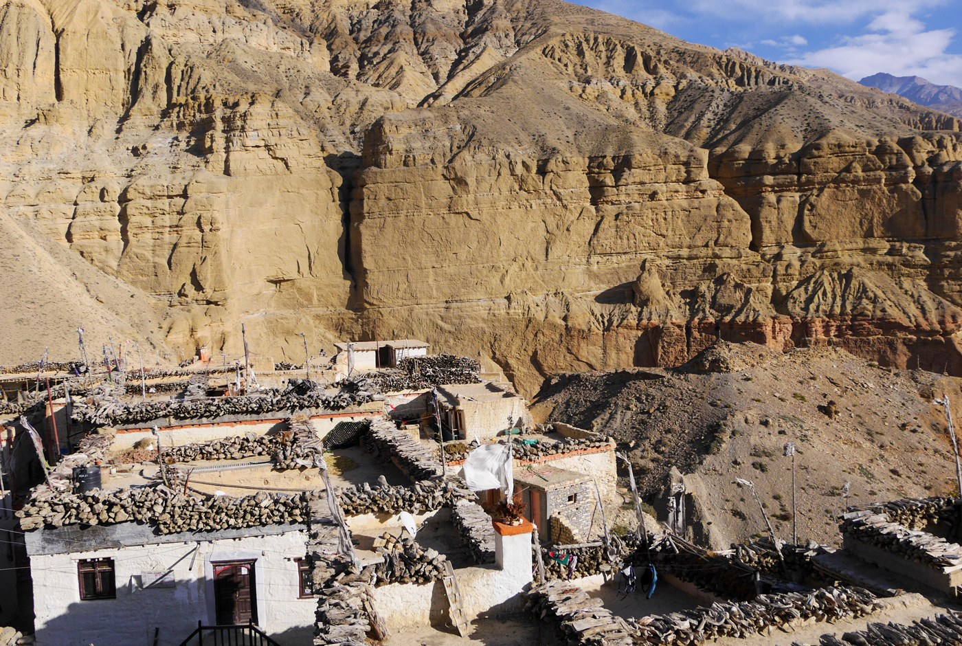
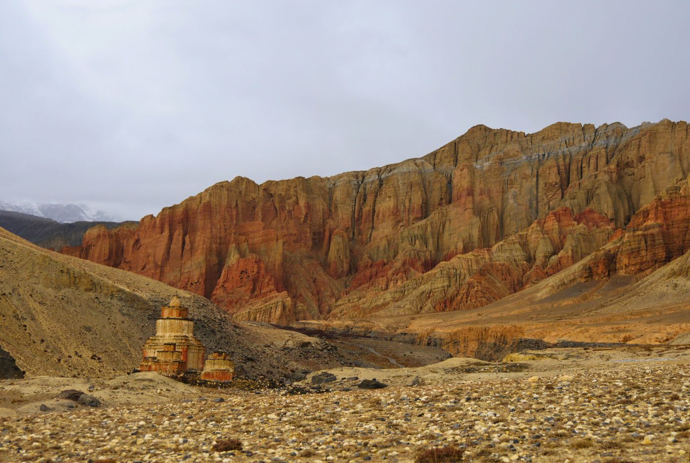
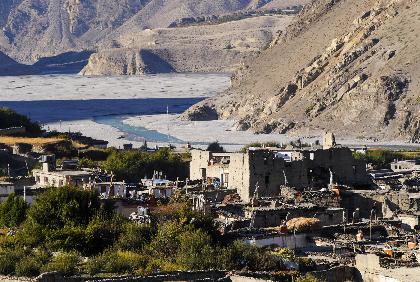
The region offers unique landscapes, culture, and traditions, with clear views of surrounding peaks, including Nilgiri, Annapurna, and Dhaulagiri. The off-the-beaten trail leads trekkers from lush greenery in Kagbeni, ancient villages like Chele and Geling, to the ancient walled city of Lo Manthang. The Upper Mustang Nepal landscape is famous for its desert valleys, red cliffs, Tibetan Buddhist culture, and ancient monasteries.
In this blog, we will cover Upper Mustang height, elevation gain, weather of Upper Mustang, and altitude for travellers planning an Upper Mustang trek in this remote Himalayan region.
Upper Mustang Height from sea level: How high is it?
The remote region of Upper Mustang sits at an average elevation of 3,800-4,000 m (12,500-13,100 ft) above sea level. Likewise, its district headquarters, Lo Manthang, lies at approx 3,840 m (12,598 ft). The height of Upper Mustang and the altitude of Upper Mustang make it one of the highest inhabited trekking regions in Nepal.
Throughout the journey, the terrain’s elevation varies, ranging from roughly 2,750 m in the lower valleys to over 6,000 m at mountain passes and peaks along the Tibetan border. The Mustang altitude in feet changes significantly throughout the journey depending on the route and elevation gain.
Moreover, Upper Mustang is a part of the rain shadow of the Himalayas. It offers almost desert-like scenery, similar to that of the Tibetan Plateau across the border. This unique geography is one reason why Upper Mustang is restricted and requires a special Upper Mustang trek permit for foreign travellers.
What is the average Elevation of Upper Mustang?
The average elevation of Upper Mustang, also known as the Forbidden Kingdom of Lo, is 3,800 - 4,000 m. Here is a full breakdown of elevations across key locations, from the starting point to the highest accessible terrain throughout the Upper Mustang trek itinerary:
|
Location / Point |
Elevation (m) |
Elevation (ft) |
Zone |
|
Beni (trek start) |
830 m |
2,723 ft |
Low |
|
Jomsom (gateway to Mustang) |
2,743 m |
8,999 ft |
Low Mustang |
Kagbeni (Lower / Upper Mustang border) |
2,810 m |
9,219 ft |
Entry point |
|
Chele |
3,050 m |
10,000 ft |
Mid |
|
Syangboche Pass |
3,800 m |
12,467 ft |
Mid |
|
Ghami |
3,520 m |
11,549 ft |
Mid |
|
Tsarang (Charang) |
3,560 m |
11,680 ft |
Mid |
|
Lo Manthang (capital of Upper Mustang) |
3,840 m |
12,598 ft |
Upper Mustang |
|
Dhi Village |
4,010 m |
13,156 ft |
High |
|
Nyi La Pass (near the Tibet border) |
4,960 m |
16,273 ft |
High Pass |
|
5,416 m |
17,769 ft |
High Pass |
|
|
Himalayan peaks (border zone) |
6,000+ m |
19,685+ ft |
Peak |
What is the highest point reached on a standard Upper Mustang Trek?
The highest point reached during a standard Upper Mustang trek is Chogo La Pass (also known as Dhiga La) at 4,280 m (14,042 ft). This pass is located on the way to the walled city of Lo Manthang.
In addition, some itineraries include Nyi La Pass (aka Dhi La Pass) at approx. 4,960 m (16,273 ft), located between Geling and Ghami village, and Lo La Pass at 4,080 m (13,386 ft), near the Tibet border above Lo Manthang.
On Upper Mustang:
- Standard high point: 4,960 m (Nyi La/ Dhi La Pass)
- Most visited high point: 3,840 m (Lo Manthang capital)
- Near-Tibet border pass: 4,080 m (Lo La Pass)
- Altitude gain (Jomsom-peak): 2,217 m (total ascent)
When is the best time to reach the highest point in Upper Mustang?
The best time to reach the highest point in Upper Mustang, Nyi La Pass, is from late March to May in spring and from September to early November in autumn. These months offer stable weather, safe pass conditions, and excellent visibility. Many travellers consider this is the best time to visit Nepal Upper Mustang because of the comfortable temperatures and clear mountain scenery.
As the region is a rain-shadow region, trekking is possible during monsoon (June-August); however, passes can be snowy in early spring. Furthermore, the Upper Mustang trek is one of the very few Himalayan treks that can be completed during the monsoon. The Mustang weather during summer remains relatively dry compared to other trekking regions of Nepal.
Difficulty: How hard is the Upper Mustang Trek?
The Upper Mustang trek is classified as moderately challenging, suitable for both beginners and hikers with a good fitness level. Though it is not a technical climb, the high altitude, long walking distances, remote terrain, and basic teahouse facilities make it more demanding than a standard Himalayan foothills trek. Overall, the Upper Mustang trek difficulty is considered moderate compared to Everest Base Camp or other high Himalayan treks.
Also, the strong afternoon wind can be another challenging factor during the journey. The winds are fierce and consistent, typically reaching 40 to 60 km/h, creating intense, dusty conditions that require mouth/nose protection. Upper Mustang temperature and weather conditions can also vary greatly between daytime and nighttime.
Nonetheless, with proper preparation, fitness training, gear, and acclimatisation, travellers with no prior trekking experience can also complete the journey safely.
Is there a risk of altitude sickness in Upper Mustang?
Yes, there is a risk of altitude sickness in the Upper Mustang region, as many parts of the trail lie above 3,000 m. Key stops such as Kagbeni, Geling, Ghami, Tsarang, and Lo Manthang expose trekkers to lower oxygen levels and thinner air.
Although the trek is moderate, the dry climate, strong winds, and gradual elevation gain can trigger AMS if acclimatisation is ignored. Some common symptoms of altitude sickness include headache, dizziness, nausea, fatigue, and shortness of breath.
Compared to high-altitude treks like the Everest Base Camp or Annapurna Base Camp, the Upper Mustang trek has a lower risk of AMS. However, the risk can increase if trekkers ascend too quickly, get dehydrated, and continue without enough rest days.
What to pack for the Upper Mustang Trek?
While planning the Upper Mustang trek, packing your gear appropriately is essential, as the region experiences strong winds, cold mornings and nights, dry weather, and limited facilities in remote villages.
Here are some essential items to pack for the Upper Mustang trek:
- Layered clothing: base layer, fleece layers, and waterproof outer shell
- Comfortable and sturdy trekking boots
- Sleeping bag rated up to -20 degrees Celsius
- Reusable water bottle and water purification tablets
- Headlamp, power bank, and biodegradable toiletries
- Carry trekking poles, gloves, a mask, and a warm hat
- Copies of permits, travel documents, and cash
As the Upper Mustang region is a high-altitude rain-shadow area of the Annapurna region, temperatures vary significantly between day and night. The Upper Mustang temperature today may differ greatly depending on the season, altitude, and weather patterns across Mustang Nepal.
Conclusion
The Upper Mustang height ranges from 2,800 m at Kagbeni to over 4,200 m near the high passes around the border. This makes altitude an important part of the trekking experience. Understanding the Upper Mustang elevation, Mustang height from sea level, and changing altitudes helps trekkers prepare for colder temperatures, high-altitude terrain, and thinner air throughout the journey.
Despite changing altitudes, the Upper Mustang trek remains manageable for most trekkers with a steady pace, fitness preparation, and proper acclimatisation. Our Nepal Hiking Team organises safe and well-planned Upper Mustang treks for trekkers of all experience levels.
From permit arrangements, accommodations, experienced guides, and comfortable transportation, we handle all and ensure a rewarding adventure through the remote terrain of Upper Mustang. We also assist trekkers with information regarding the Upper Mustang permit cost for foreigners, Upper Mustang trek permits, transportation from Kathmandu to Mustang, Pokhara to Upper Mustang distance, Upper Mustang trek route map, Upper Mustang trek map, and customised Upper Mustang trek itinerary planning.
Post a Comment