
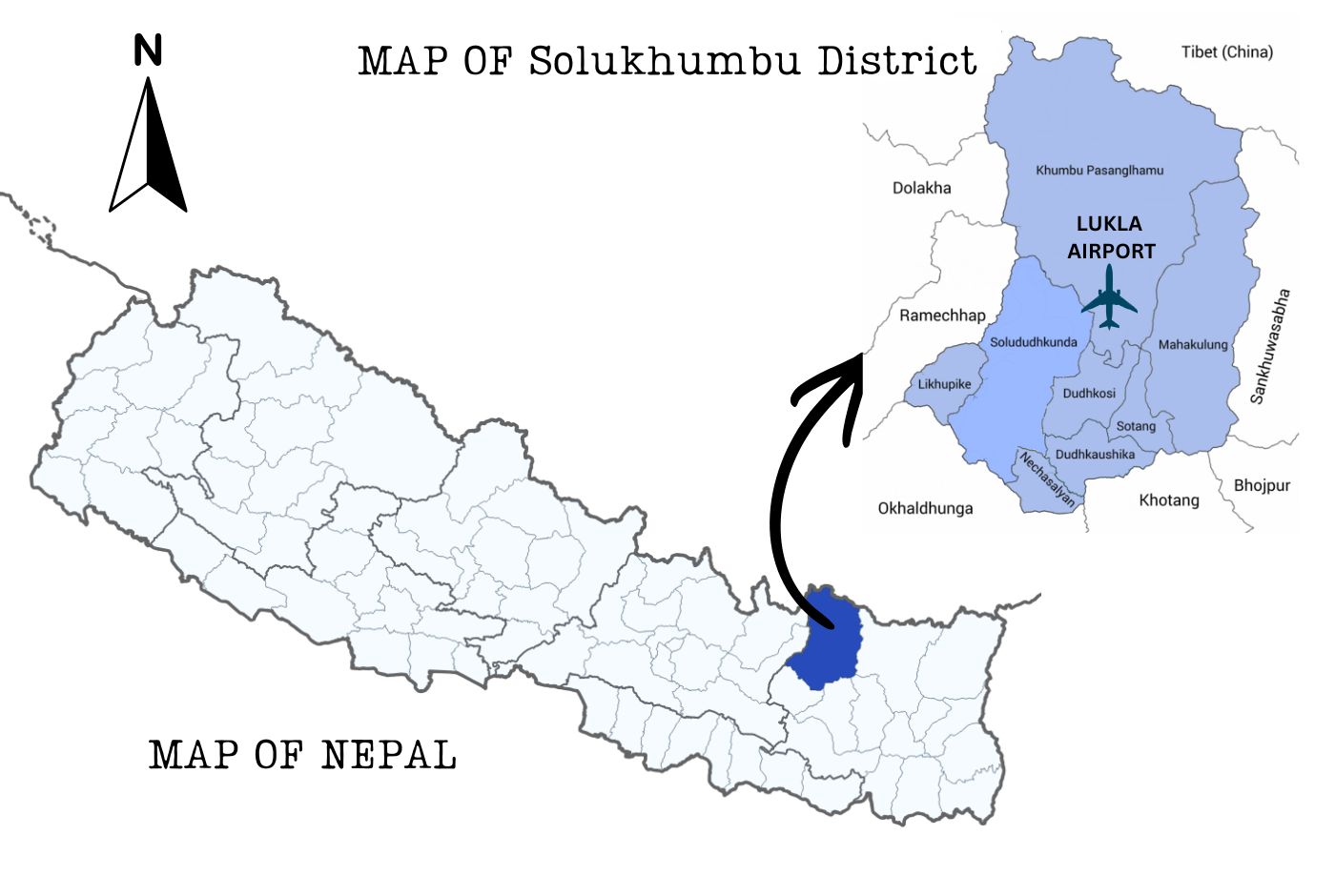
Lukla Airport, officially known as Tenzing-Hillary Airport, is a high-altitude mountain airport located in Khumbu Pasang Lhamu Rural Municipality-2, Solukhumbu District, Koshi Province, Nepal. It sits at an elevation of 2,846 meters (9,337 feet) above sea level and serves as the primary gateway for trekkers heading to Everest Base Camp and other destinations across the Khumbu Valley. The airport is known worldwide for its short sloping runway, surrounding mountain terrain, and rapidly changing weather conditions that make every flight operation technically demanding.
For anyone planning an Everest region trek, understanding how this airport operates, what to expect from flights, and how weather affects departures and arrivals is an important part of preparation. This guide covers airport facts, altitude, runway details, safety context, flight delays, crash history context, and practical advice for travelers passing through Lukla.
Lukla Airport Quick Facts
| Official Name | Tenzing-Hillary Airport |
| Common Name | Lukla Airport |
| Country | Nepal |
| Location | Khumbu Pasang Lhamu Rural Municipality-2, Solukhumbu District, Koshi Province, Nepal |
| IATA Code | LUA |
| ICAO Code | VNLK |
| Elevation | 2,846 m / 9,337 ft |
| Runway Dimension | 527 m x 20 m |
| Runway Designation | 06/24 |
| Runway Surface | Bituminous paved / asphalt concrete |
| Traffic Type | Visual Flight Rules (VFR) |
| Status | In operation |
| Operations Started | September 1971 |
| Main Use | Gateway airport for Everest Base Camp treks and Everest region travel |
What Is Lukla Airport?
Lukla Airport is the common name for Tenzing-Hillary Airport, a small mountain airport in the Solukhumbu District of eastern Nepal. It is the primary point of entry for trekkers and climbers heading into the Khumbu Valley, including those bound for Everest Base Camp, the Gokyo Lakes, the Three Passes route, and other high-altitude destinations in the Everest region.
The airport operates with small fixed-wing aircraft and helicopters. Scheduled services connect Lukla to Kathmandu and, during peak trekking seasons, to Ramechhap (Manthali Airport) and Phaplu. All flights operate under Visual Flight Rules, meaning pilots require clear, direct visual contact with the runway and surrounding terrain throughout every approach. This requirement is the primary reason delays and cancellations are common at this airport.

Beyond its role in trekking, the airport serves local communities who depend on it for supplies, medical transport, and connectivity to the rest of Nepal. Every year, tens of thousands of travellers pass through Lukla on their way to and from the Khumbu Valley.
Where Is Lukla Airport Located?
Lukla Airport is located in Nepal, within Khumbu Pasang Lhamu Rural Municipality-2, Solukhumbu District, Koshi Province. Solukhumbu is the district that encompasses the Khumbu region, the high-altitude area surrounding the southern approaches to Mount Everest. The airport lies at the southern edge of the Sagarmatha National Park buffer zone, within the broader Everest region.
Lukla itself is a small mountain town perched on a ridge. The surrounding landscape is steep and forested at lower elevations, giving way to high alpine terrain as the valley rises toward Namche Bazaar and beyond. The town has no road connection to Nepal's national highway network, which makes the airport the primary access point for the community and for trekking operations across the Khumbu.
To answer a common search question directly: Lukla Airport is located in Nepal. It is not near Kathmandu. Kathmandu and Lukla are approximately 140 kilometers apart by air, with a flight time of roughly 35 to 45 minutes depending on the aircraft and conditions.
Lukla Airport Code: LUA and VNLK Explained
Lukla Airport uses two standard aviation codes. The IATA code is LUA, which is the identifier used by airlines, booking platforms, and passenger-facing systems. The ICAO code is VNLK, which appears in flight planning documents, air traffic control systems, and technical aviation references. The "VN" prefix in VNLK designates Nepal within the ICAO global coding structure.
Travelers researching Lukla flights may encounter either code depending on the source. Flight tracking tools, maps, and airport databases may display LUA or VNLK. Both refer to the same airport: Tenzing-Hillary Airport in Lukla, Solukhumbu District, Nepal. Searching for the Tenzing-Hillary Airport code will return these same identifiers.
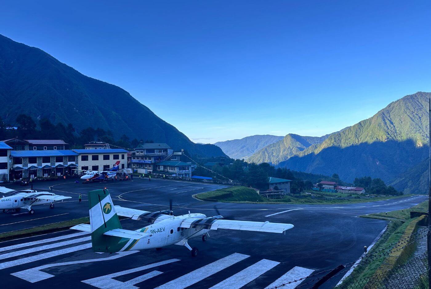
Lukla Airport Altitude, Elevation, Co-ordinates and Runway Facts
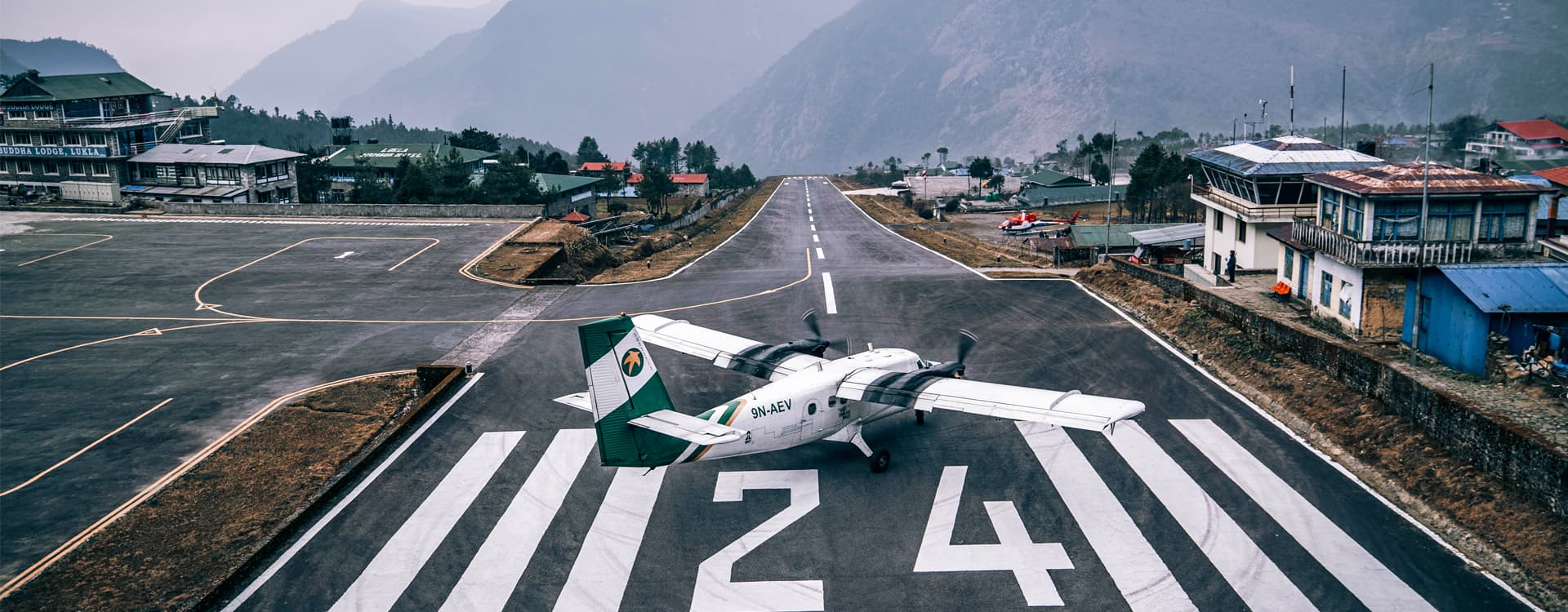
Tenzing-Hillary Airport sits at an elevation of 2,846 meters (9,337 feet) above sea level. This places it among the higher-altitude commercial airports in the world and already above the threshold at which altitude begins to affect human physiology. Travelers arriving by air at Lukla are at a significant elevation before taking their first steps on the trail.
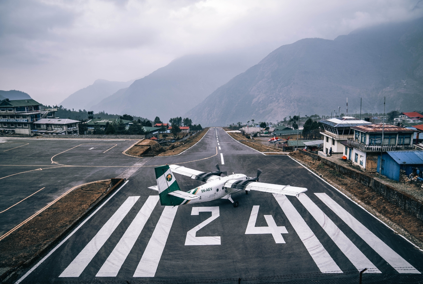
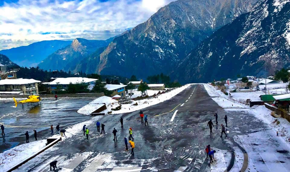
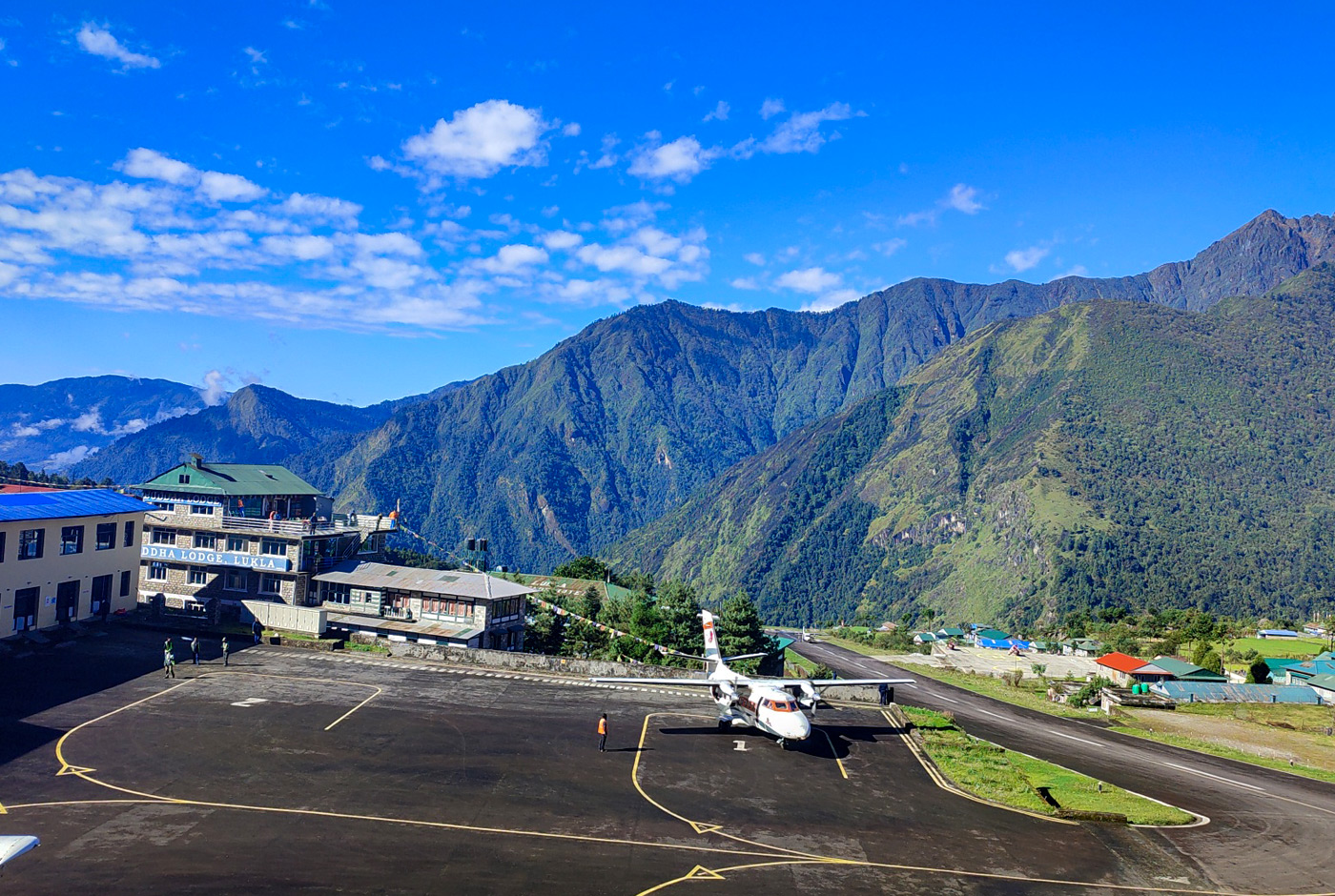
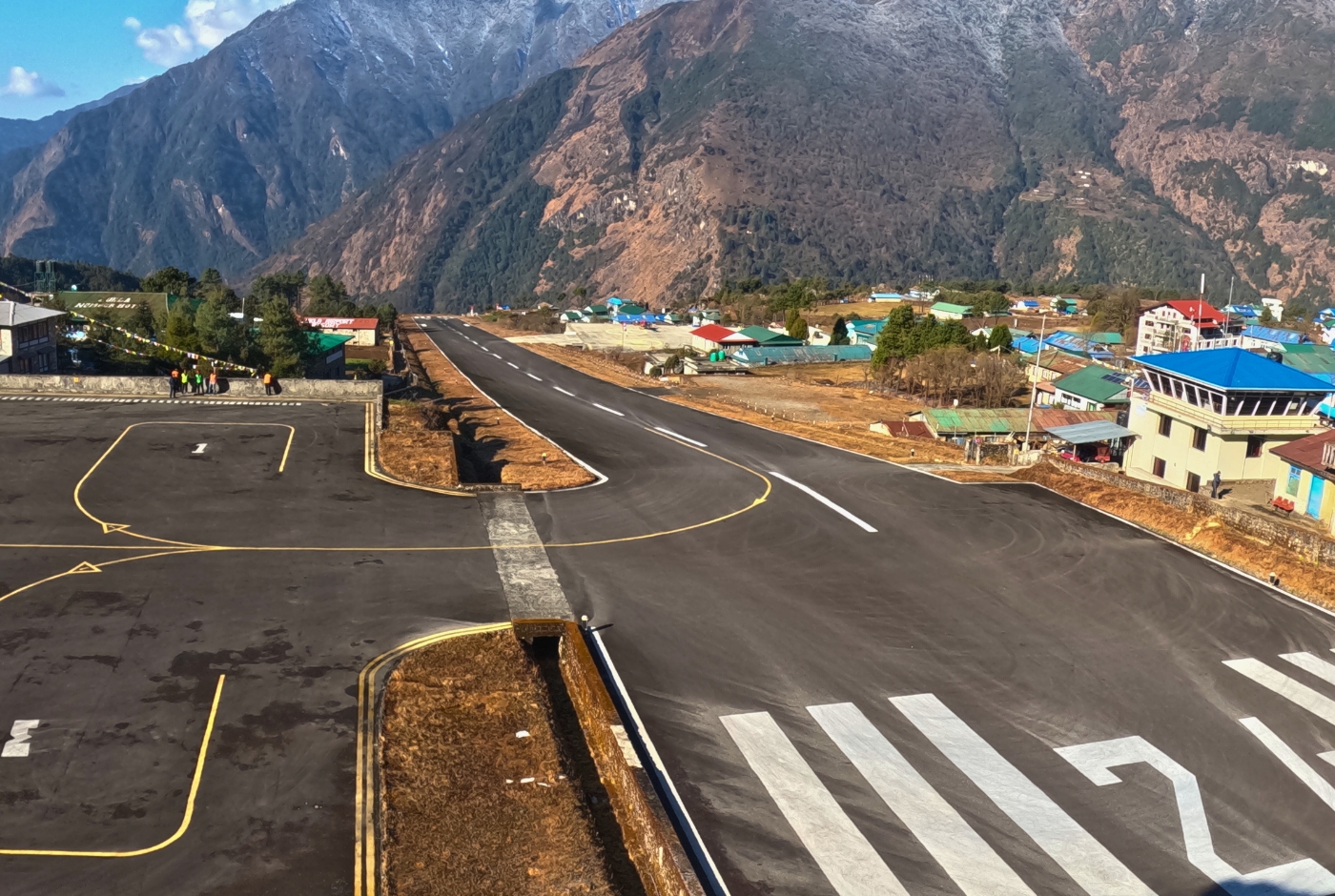
The runway at Lukla is 527 meters long and 20 meters wide, with a runway designation of 06/24 and a bituminous paved asphalt concrete surface. The runway slopes at approximately 12 percent, with one end sitting noticeably higher than the other. Aircraft land uphill, which assists with deceleration on the short surface. Aircraft depart downhill, using the gradient to assist with acceleration before becoming airborne.
Tenzing-Hillary Airport (Lukla Airport) in Nepal is located at approximately 27°41′16″N 86°43′53″E.
At the lower end of the runway, the ground drops steeply into a valley. At the upper end, a rock face defines the boundary of available space. These physical constraints, combined with the altitude and surrounding terrain, define the operational character of Tenzing-Hillary Airport and demand a level of precision from pilots that exceeds the requirements of most commercial airports.
Why Is Lukla Airport Considered Dangerous?
Lukla Airport is frequently described as one of the most challenging airports to fly into in the world. The word "dangerous" appears widely in searches and travel media, though a more accurate description is that it is a highly technical mountain airport that demands specific pilot qualifications, certified aircraft, and favorable weather conditions for every operation.
You can check on the thrilling Lukla take-off flight scene on our YouTube Channel.
Several factors contribute to its demanding reputation:
- Short runway: At 527 meters, the usable runway length leaves very little margin for error on approach or during the takeoff roll.
- Sloping runway surface: The approximately 12 percent gradient assists in slowing arriving aircraft and accelerating departing ones, but it also means approach angles and visual reference points differ significantly from standard flat runways.
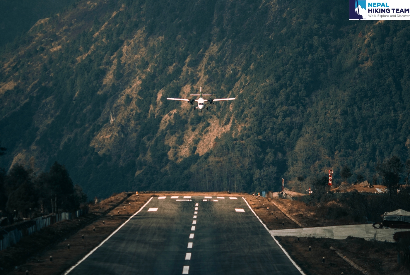
- No go-around option: Once an aircraft commits to landing at Lukla, the terrain on both sides of the approach path leaves no standard escape route if the approach does not proceed correctly. Pilots must complete the landing successfully on the first attempt.
- Mountain terrain: Surrounding peaks and ridges constrain the flight path and limit the angles from which the airport can be approached.
- Rapidly changing weather: Visibility, cloud cover, and wind conditions in the Himalayas can shift within minutes, sometimes faster than the flight time from Kathmandu.
- Visual Flight Rules only: Flights cannot proceed on instruments alone. Pilots must maintain clear visual contact with the runway and terrain throughout the entire approach.
- Small aircraft operations only: Only aircraft certified for short takeoff and landing (STOL) operations are permitted. Pilot qualifications include a mandatory minimum number of supervised Lukla flights before independent operation is authorized.
These factors together explain why Lukla receives so much attention in aviation circles and travel media. They also explain why the Civil Aviation Authority of Nepal has put strict requirements in place for pilots and aircraft operating at this airport.
Is Lukla Airport Safe for Everest Trekkers?
This is one of the most important questions travelers ask when planning an Everest region trek, and it deserves a clear and honest answer.
Lukla Airport is challenging, and its operational environment is more demanding than most airports travelers will encounter. Flights to Lukla operate within a structured safety framework. The Civil Aviation Authority of Nepal (CAAN) sets specific qualifications for pilots flying to Lukla, including a minimum number of supervised flights to the airport and documented STOL experience in Nepal. Only aircraft certified for short takeoff and landing operations are permitted.
Flights are planned predominantly in the early morning hours when mountain weather is typically most stable. When conditions deteriorate or visibility drops below acceptable minimums, airlines delay or cancel flights rather than proceed. This is a deliberate safety decision, not a failure of the system. Delays and cancellations are common precisely because flight operators take weather conditions seriously.
It would not be accurate to say that Lukla flights carry no risk. Mountain aviation anywhere in the world carries inherent risk that standard commercial aviation does not. What can be said is that flights operate under consistent weather-based safety protocols, that pilots are specifically experienced in this environment, and that the decision to delay or cancel is made in favor of safety rather than schedule adherence.
For trekkers, the practical takeaway is to plan with flexibility. Build buffer days into the itinerary, particularly at the end of the trek, and travel with a trekking agency that has the experience and local contacts to adjust logistics when delays occur.
Why Are Lukla Flights Delayed or Cancelled?
Flight delays and cancellations at Lukla Airport are a normal part of trekking in the Everest region. Understanding why they happen helps travelers plan more effectively and respond calmly when they do occur.
The primary cause is weather. The Himalayan environment produces rapid and unpredictable changes in cloud cover, wind speed, and visibility. What begins as a clear morning in Kathmandu or Ramechhap can become unsuitable flying conditions at Lukla within a very short window of time. Because all flights to Lukla operate under Visual Flight Rules, the moment visibility drops below required minimums the flight cannot safely proceed.
Flights are scheduled in the early morning when conditions are most favorable. Flights are not operated after 12pm. Strong afternoon winds and increased cloud buildup are common from midday onward, which is why very few Lukla flights operate after mid-morning. Even during good trekking seasons, several consecutive clear days can be followed by one or two days of disruption.
The monsoon season, from approximately late May to early September, brings the highest frequency of delays. However, disruptions can occur in any season. Spring and autumn, the two main trekking seasons, generally offer better flying conditions but are not immune to weather-related cancellations.
Travellers should plan at least one or two buffer days at the end of the trek to account for possible delays on the return flight from Lukla. This is standard advice from experienced trekking operators and should be treated as an essential part of itinerary planning.
Is Lukla Airport Open Today?
To find out whether Lukla Airport is open on a specific day, travelers should contact their airline directly, speak with their trekking agency or local representative in Nepal, or check with their flight operator. It is worth noting that the airport may be officially open while individual flights are still delayed or cancelled due to localized weather conditions at Lukla, at the departure airport, or along the flight route.
For the live Tenzing-Hillary Aeroporto Lukla weather update, you can check the 24/7 live Lukla airport forecast.
Lukla Airport operations depend on more than Lukla weather condition. The weather in Kathmandu and along the en route must also be suitable for a flight to proceed safely. Technical problems in flight can also delay the flight.
Lukla Airport Crash History: What Travelers Should Know
Lukla Airport has experienced accidents over its operational history, and this is a fact that travelers understandably want to understand before flying. The airport's combination of short runway, mountain terrain, limited approach options, and rapidly changing weather creates conditions where the consequences of any error are significant.
Rather than focusing on specific accident counts, which vary across sources and definitions, it is more useful for travelers to understand the systemic context. The Civil Aviation Authority of Nepal has introduced increasingly strict qualification requirements for pilots flying to Lukla in direct response to the operational challenges of this airport. Aircraft type restrictions, mandatory supervised flight minimums, and weather-based cancellation protocols are all part of how the aviation system works to manage risk at this location.
Delays and cancellations, which can feel frustrating in the moment, are part of the safety management process. A flight that does not depart because of poor visibility is the system working as intended.
For travelers, the most practical steps are:
- Book early morning flights when available, as conditions are generally more stable in the first hours of the day.
- Build buffer days into the itinerary, particularly at the end of the trip.
- Travel with a trekking team experienced in adjusting logistics and managing delays without disrupting the overall trek.
- Monitor flight status through the airline and trekking agency rather than through informal or social media sources.
Can You See Mount Everest from Lukla Airport?
Mount Everest is not directly visible from Lukla Airport in the way many travelers expect. The terrain around Lukla does not provide a clear line of sight to the summit of Everest, which lies further north and is obscured by intervening ridges from most vantage points in and around Lukla town.
What travelers can see from Lukla and during the flight are impressive Himalayan peaks and ridgelines that form part of the broader Everest massif. The approach into Lukla, in particular, offers views of snow-covered terrain that give a strong first impression of the scale of the Khumbu region.
Clear views of Everest itself typically come further along the trek. From vantage points above Namche Bazaar, along trail sections approaching Tengboche, and most directly from Kala Patthar at approximately 5,545 meters, trekkers gain the unobstructed views the region is known for. Lukla is the starting point of that visual progression, not the destination for Everest views.
Don't be sad; if you are in Lukla, you are surely aiming for Everest Base Camp. Here are the top 10 Magnificent Peaks as You Go to the EBC.
Lukla Airport Viewpoint: Where to See the Runway
A number of travelers and photographers are interested in observing the Lukla Airport runway from ground level rather than as a passenger. This is a reasonable interest given how well-known the runway is, and there are positions around Lukla village where parts of the airport activity are visible from publicly accessible areas.
The layout of Lukla town means that certain areas near the upper village offer sightlines toward the runway approach end and surrounding terrain. Morning hours are the most productive time to observe aircraft movement, as that is when the bulk of flight operations take place.
Travelers should not attempt to access the airport perimeter or any area marked as restricted. Safety zones exist around the operational area and must be respected. Viewing from publicly accessible areas within the village is the appropriate approach. Some guesthouses near the airport area may also offer incidental views of aircraft movements from their upper floors or rooftop areas.
Why Is Lukla Airport Important for Everest Base Camp Treks?
Lukla Airport dramatically reduces the time needed to reach the Khumbu Valley and begin trekking. Without air access, reaching Namche Bazaar from Kathmandu on foot would require well over a week of additional walking through lower-altitude terrain. By flying to Lukla, trekkers can begin the Everest region trail within hours of leaving Kathmandu, making standard trek itineraries practical within typical vacation or expedition timeframes.
From Lukla, trekkers typically walk to Phakding on the first day, then continue to Namche Bazaar, the main acclimatization hub for the upper Khumbu. Beyond Namche, trails branch toward Everest Base Camp, the Gokyo Lakes, Cho La Pass, Renjo La, and other high-altitude destinations that define the Everest region trekking experience.
The airport also supports the broader logistics of Everest expeditions, with cargo flights bringing supplies and equipment that would otherwise require lengthy overland transport. For the communities of the Khumbu Valley, the airport is an essential infrastructure link. For the Everest Base Camp trek, Lukla Airport is simply the practical beginning.
How Do Trekkers Reach Lukla Airport?
Most trekkers reach Lukla by fixed-wing aircraft or helicopter departing from either Kathmandu (Tribhuvan International Airport) or Ramechhap (Manthali Airport). During peak trekking seasons in spring and autumn, the majority of scheduled flights operate from Ramechhap to reduce air traffic congestion at Kathmandu, which requires an early morning road transfer before the flight. Outside peak season, direct flights from Kathmandu are more readily available. Phaplu Airport and overland routes combined with trekking are additional alternatives for travelers with more time.
For a complete breakdown of all route options, read our guide on how to get to Lukla from Kathmandu.
A Brief History of Tenzing-Hillary Airport
Tenzing-Hillary Airport began operations in September 1971, established to serve the growing number of mountaineers and trekkers entering the Khumbu Valley. Sir Edmund Hillary was involved in the development of the airport, which was constructed on a natural terrace above the Dudh Koshi river valley. The runway surface was improved over the years as traffic increased and aircraft requirements evolved.
In 2008, the airport was officially renamed Tenzing-Hillary Airport in honor of Tenzing Norgay Sherpa and Sir Edmund Hillary, the two climbers who made the first confirmed ascent of Mount Everest on 29 May 1953. The renaming recognized their historic achievement and the enduring cultural significance of the Khumbu region to Nepal and to the global mountaineering community.
The airport operates under Visual Flight Rules and serves scheduled passenger and cargo flights to and from Kathmandu, Ramechhap, and Phaplu. Since opening, it has functioned as the primary gateway to the Everest region and has seen substantial growth in traffic as trekking and expedition activity in the Khumbu Valley has expanded over the decades.
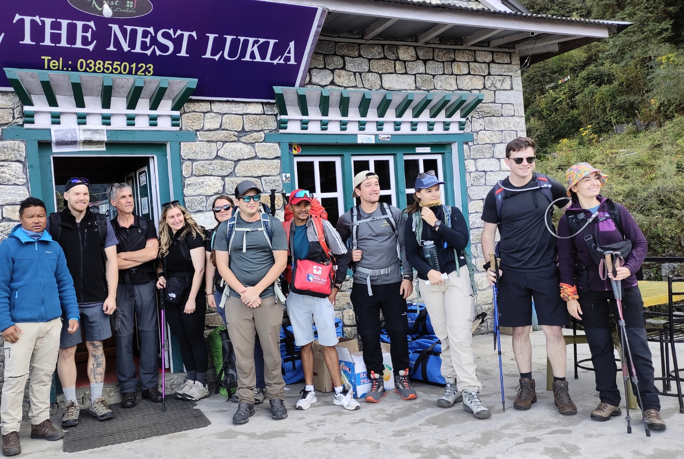
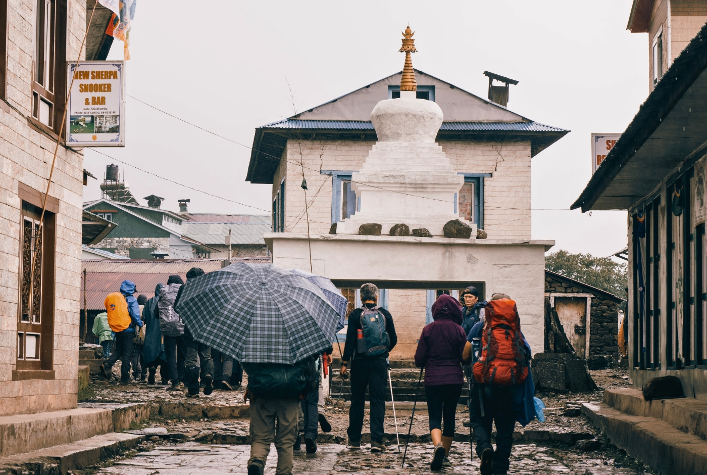
Lukla Village: The Gateway Town of the Everest Region
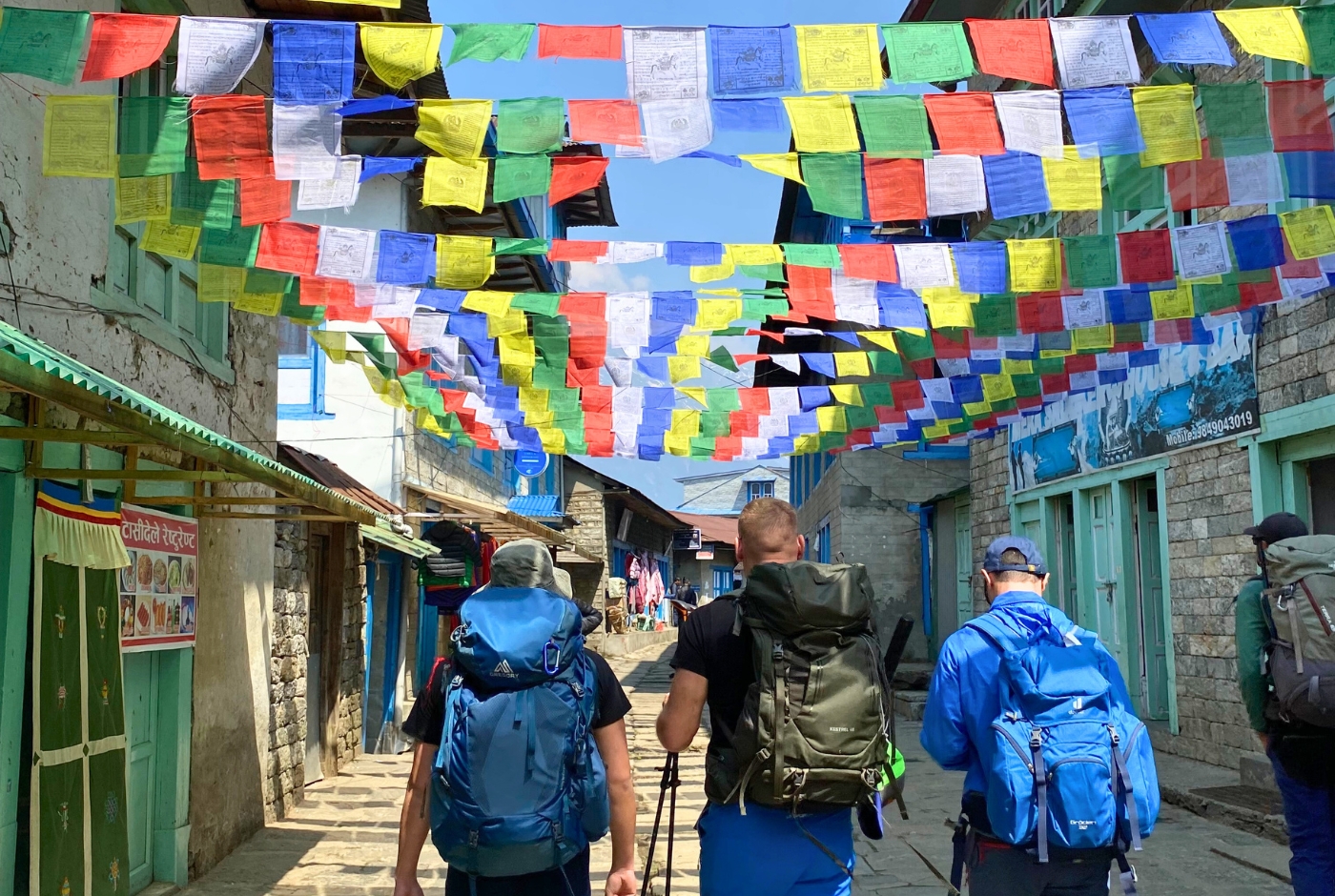
Lukla is a small mountain town built on a narrow ridge in the Solukhumbu District, functioning as the main hub at the start and end of nearly every Everest region trek. The town is compact, with guesthouses, lodges, restaurants, equipment shops, and porter services concentrated along the main trail running from the airport toward the lower Khumbu Valley.
The population of Lukla is predominantly Sherpa community, and the town reflects the cultural traditions of this community through its monasteries, prayer flags, chortens, and the rhythms of daily life shaped by altitude and the trekking calendar. The Sherpa cultural presence is visible in architecture, food, and local practice throughout the town and the wider valley.
Lukla has grown considerably since the airport opened, transforming from a small agricultural settlement into a regional service center for the trekking industry. The town sees significant seasonal fluctuation, with peak periods in spring (March to May) and autumn (September to November) bringing large numbers of trekkers through in short windows of time.
Things to Do in Lukla Before or After Your Trek
Most trekkers spend limited time in Lukla, typically one evening before beginning the trail or a night at the end of the trek while waiting for a return flight. The time available is short, but there are a few worthwhile things to do in and around the town.
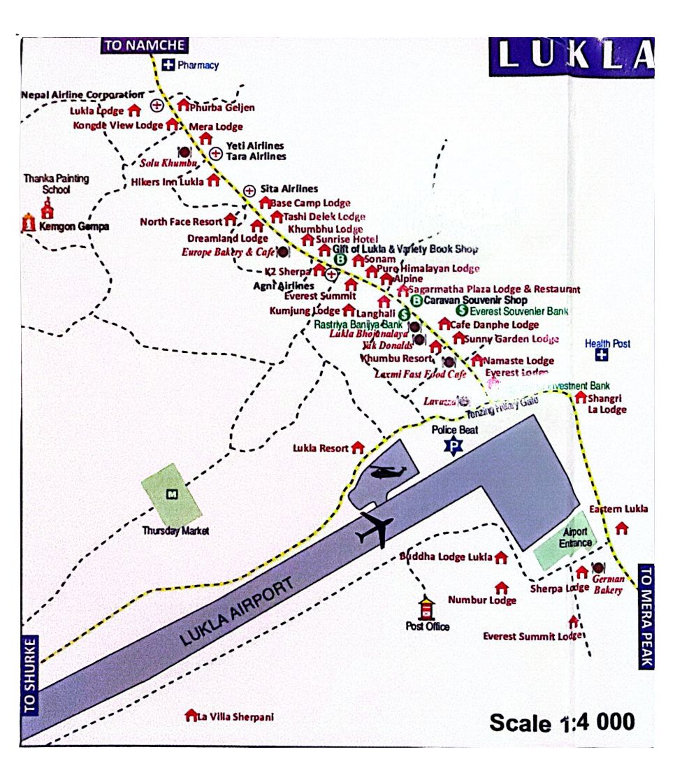
Walk Around Lukla Village
The main street of Lukla runs parallel to the airport and is lined with lodges, teahouses, and small shops. Walking this area in the early morning or evening gives a clear sense of the town's scale and character. The surrounding views of forested hillsides and distant ridgelines are pleasant, and the activity near the airport provides an interesting backdrop during flight operations.
Visit Local Monasteries
Lukla is home to the Kemgon Monastery, one of the older religious sites in the area and open to respectful visitors. The monastery contains traditional Buddhist artwork, thangka paintings, and ritual objects. It sits close to the airstrip and is a short walk from the main guesthouse area. Smaller shrines and chortens are also scattered through the village and worth observing as part of a walk through town.
Experience the Dumji Festival If Your Dates Match
The Dumji festival is an important Sherpa celebration held annually in the Khumbu region, typically in June. It marks the birth anniversary of Guru Rinpoche Padmasambhava and is observed with ritual ceremonies, mask dances, music, and community gatherings. Lukla hosts its own celebration, and travelers whose trek dates coincide with the festival have the opportunity to observe a significant cultural event. The festival is also held in other Khumbu villages including Khumjung, Namche Bazaar, Thame, and Phortse.
Explore Nearby Villages Such as Chaurikharka and Surke
The villages of Chaurikharka and Surke lie within a short walk of Lukla and offer a quieter setting away from the main trekking hub. Both have Sherpa cultural character, surrounding agricultural land, and views of the forested lower valley. They are accessible on foot and provide a pleasant addition to a morning or afternoon in Lukla when waiting for a flight or acclimatizing before beginning the trail.
Other Names People Use for Lukla Airport
Lukla Airport is officially called Tenzing-Hillary Airport. Travelers also search for it as Tenzing Hillary Airport, VNLK Airport, LUA Airport, Lukla airstrip, or Aeroporto Lukla. These names all refer to the same airport in Lukla, Solukhumbu District, Nepal. The spelling variation between "Tenzing-Hillary" and "Tenzing Hillary" appears in both formal and informal usage, and both forms refer to the same facility.
Final Thoughts on Flying to Lukla Airport
Tenzing-Hillary Airport occupies a distinctive place in mountain aviation. It is technically demanding, weather-dependent, and unlike any airport that most travelers will have encountered before. It is also the starting point for one of the most significant trekking routes in the world, and passing through it is part of what defines an Everest region experience.
Good planning makes a meaningful difference. Booking early morning flights, building buffer days into the itinerary, staying flexible on departure timing, and traveling with a team that understands local logistics all reduce the stress that flight uncertainty can create. Delays happen, and having the structure in place to absorb them without affecting the broader trek is what separates a well-prepared trip from a difficult one.
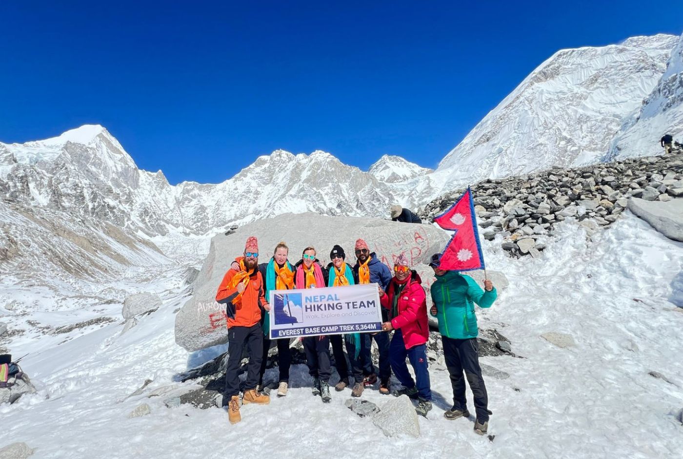
Nepal Hiking Team operates Everest region treks with ground teams experienced in managing flight changes, adjusting timing, and keeping trekkers moving through the Khumbu on itineraries built around the realities of mountain travel.
Post a Comment