

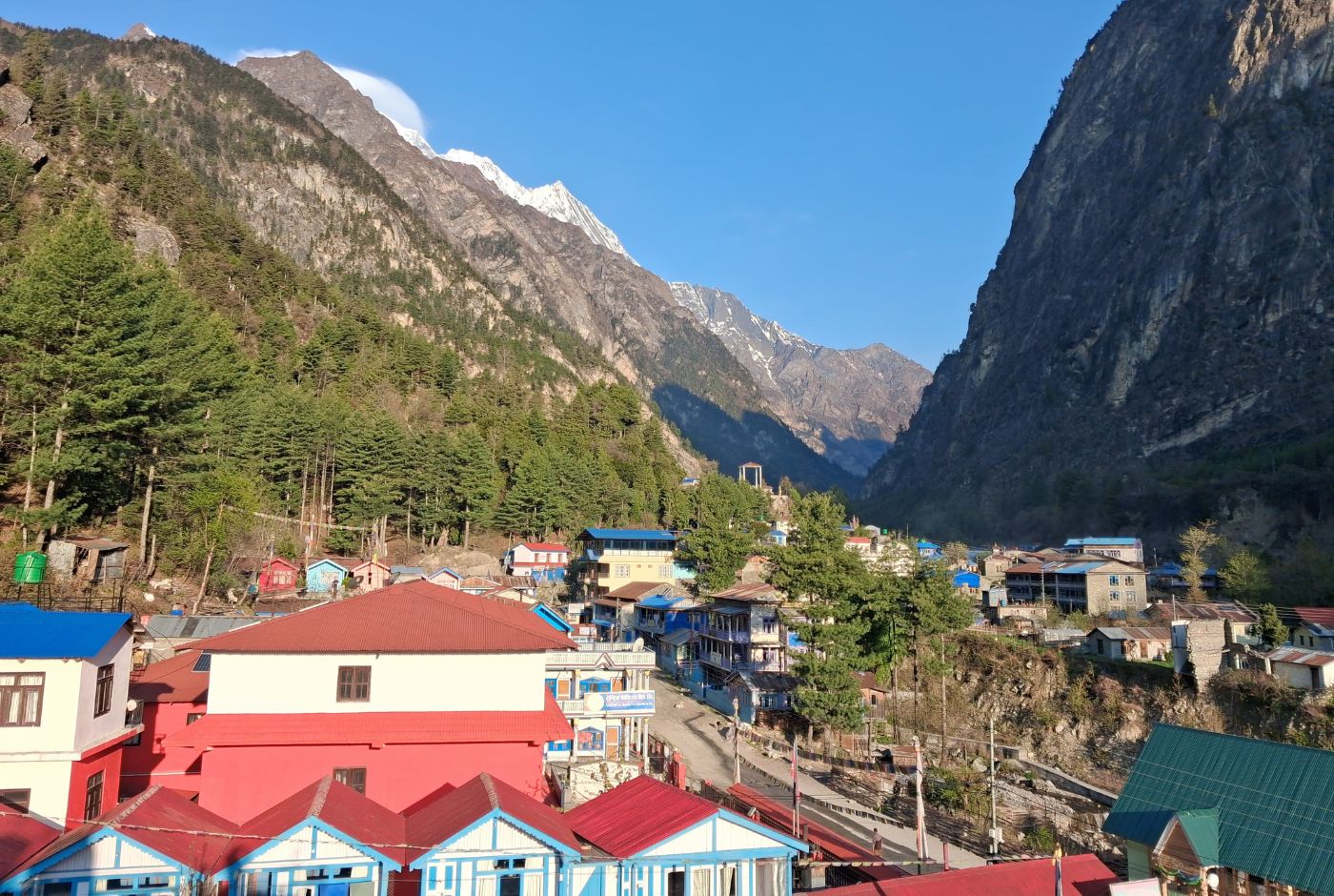
Chame is one of the first places on the Annapurna Circuit where the trek starts to feel noticeably different. By the time trekkers arrive here, the lower green hills and terraced farmland have given way to pine forests, deeper gorges, and a cooler, drier atmosphere. Breathing takes slightly more effort on uphill sections than it did a day earlier, and the mountain environment feels closer and more present. This is the stage where altitude begins to register in practical ways, and pacing starts to matter more than it did below.
Chame is indeed ranked amoung the popular stops during Annapurna Circuit Trek.
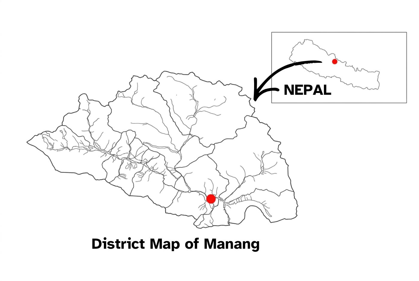
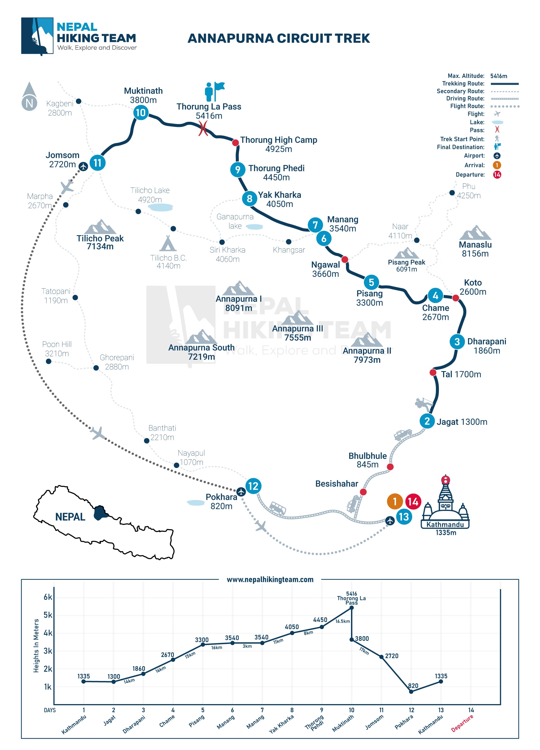
As the district headquarters of Manang, Chame is more substantial than most villages on this stretch of the route. It sits between Dharapani and Pisang along the Marsyangdi River valley and offers a well-equipped base before trekkers move into the more altitude-demanding sections ahead. Understanding where Chame fits into the overall route helps with pacing decisions, overnight planning, and altitude management in the days that follow.
This guide covers the Chame altitude, key distances from Dharapani, Pisang, and Manang, transport access from Kathmandu and Pokhara, what to expect as an overnight stop, and how Chame connects to the rest of the Annapurna Circuit.
Where Is Chame on the Annapurna Circuit Trek?
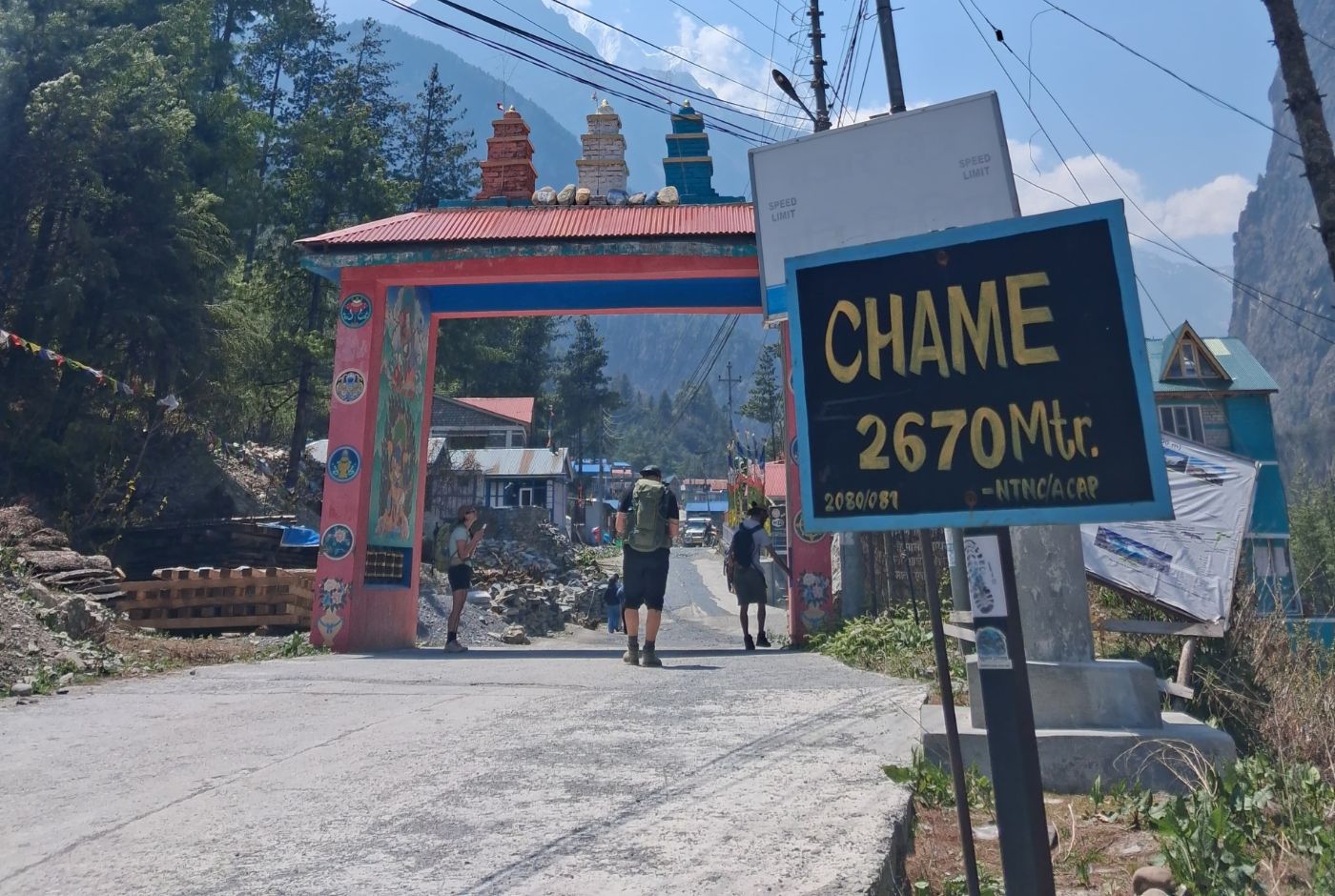
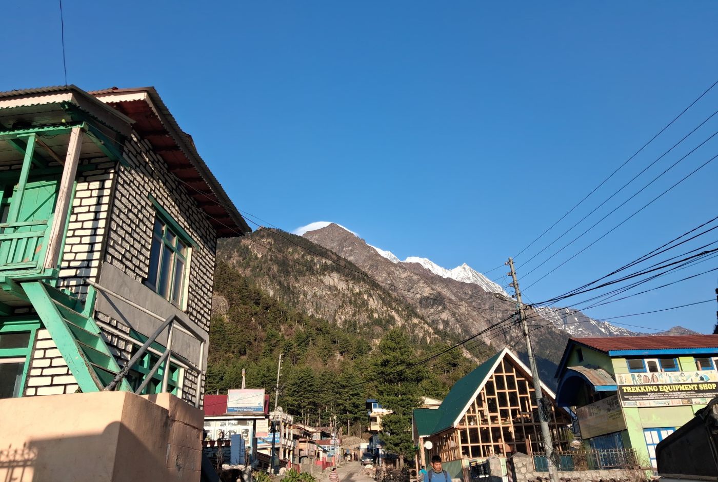
Chame sits at 2,670 m (8,759 ft) in Manang district, along the Marsyangdi River valley. It is the administrative headquarters of the district and one of the more substantial villages on the eastern half of the Annapurna Circuit. Compared to smaller stops like Tal or Bagarchhap, Chame feels structured and service-ready, with proper teahouses, lodges, and basic shops.
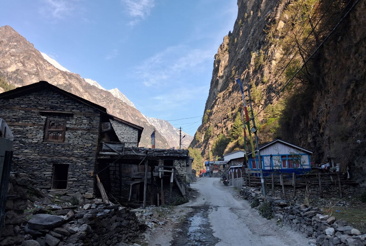
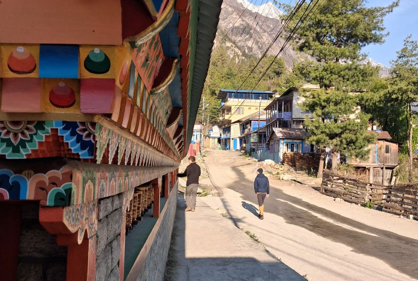
The walk into Chame from Dharapani passes through pine and fir forests, crosses suspension bridges over river tributaries, and moves through smaller settlements before the valley begins to widen. On clear days, the surrounding ridgelines and peaks feel closer and more immediate than in earlier sections of the trek. The air is cooler, the vegetation is thinner, and the mountain presence is more obvious.
Chame is not a dramatic high-altitude stop by Himalayan standards, but it marks a clear step in the character of the trek. From here, trekkers move toward Pisang and then Manang, with each stage gaining altitude more noticeably. Getting the pacing right from Chame onward matters more than it did on the lower sections of the circuit.
Updates: Interest in New Annapurna Trekking Trails (NATT)
Interest in the Natural Annapurna Trekking Trails (NATT) has grown significantly since 2026 as trekkers actively avoid road sections and seek quieter, more traditional paths. As a result, many itineraries now start from Dharapani instead of lower points, shifting the trekking flow higher up the valley. This change has reduced foot traffic in earlier road-linked sections while increasing Chame's importance as a key overnight stop and transition point into the upper, road-free trails.
From Chame onward, trekkers follow higher routes through Upper Pisang, Ngawal, and Manang, where the trekking experience feels closer to the original Annapurna Circuit.
Dharapani to Chame Distance: How Far Is the Trek?
The distance between Dharapani and Chame is approximately 15 to 16 km, which most trekkers cover in 6 to 7 hours. The day is not technically difficult, but it is not flat either. Much of the effort tends to come in the earlier part of the day, where the trail climbs through forested sections with stone steps and occasional waterfalls. After rain, these sections can be wet and slippery, and the pace tends to slow.
The route passes through Bagarchhap and continues toward Timang, where the scenery begins to open up into something more alpine. The valley feels wider here, the peaks more visible, and the atmosphere noticeably cooler than the lower sections. For many trekkers, Timang is one of the more memorable points of the day, even though it is not the final destination.
After Timang, the trail continues through a mix of forest paths and sections that overlap with the jeep road. The Koto checkpoint serves as a natural pause in the day, and most trekkers stop briefly before continuing to Chame. Walking the trail rather than taking a jeep remains the better choice here, not only for the experience but for the gradual altitude gain that the body needs.
The walking trail regularly diverts away from the road through quieter pine forest sections, and these diversions are worth taking. The road version of the route is faster but strips away most of what makes this section worthwhile.
Chame to Pisang Distance: What the Next Day Looks Like
The distance from Chame to Pisang is approximately 14 to 15 km, which takes most trekkers 4 to 6 hours depending on conditions and pace. The route passes through Bratang and sections of pine forest before the valley opens dramatically, with Annapurna II and the surrounding peaks dominating the skyline. Temperatures drop noticeably in the morning and evening from this stage onward, and the landscape feels more exposed and less sheltered than the forested sections before Chame.
Pisang is divided into Lower Pisang at 3,200 m and Upper Pisang at approximately 3,300 m. The choice between them is not only about scenery. Lower Pisang works well for trekkers who want a more straightforward day, better facilities, and direct valley access. Upper Pisang suits those who are moving well, want stronger panoramic views, and plan to continue on the higher route toward Manang via Ghyaru and Ngawal. The extra climb to Upper Pisang is noticeable toward the end of the day, and the decision is usually based on how the body is responding to altitude rather than preference alone.
Though the trail is not technically challenging, the increasing altitude can make this day feel harder than the distance suggests. Trekkers who pushed too fast in the Dharapani to Chame section often feel it more acutely here.
Chame to Upper Pisang Distance: Is It Worth Going Higher?
The distance from Chame to Upper Pisang is approximately 15 km and takes around 5 to 6 hours at a steady pace. The route follows the same valley as the Lower Pisang trail before branching uphill toward the end of the day. That final climb to Upper Pisang is steeper than it looks on a map, and it tends to feel more demanding when the body is already carrying altitude fatigue from earlier in the day.
Upper Pisang is worth the extra effort for trekkers who are already coping well with altitude and want to set up a stronger position for the days ahead. The higher route via Ghyaru and Ngawal offers better acclimatization and outstanding ridge views toward Manang. For trekkers already feeling tired or noticing early altitude symptoms, Lower Pisang is the more sensible overnight choice without losing the structure of the trek.
The decision is less about ambition and more about reading how the body is responding. The Annapurna Circuit becomes more demanding beyond Pisang, and arriving at Upper Pisang already exhausted serves no one.
Chame to Manang Distance: Can You Reach Manang in One Go?
The total distance from Chame to Manang is approximately 30 to 35 km, depending on the route. A strong walker could physically cover it in a single day, but for most trekkers this is poor strategy. The elevation gain from Chame at 2,670 m to Manang at 3,540 m may sound gradual on paper, but covering it in one push without an overnight rest at Pisang increases fatigue and reduces the body's ability to adjust before the higher stages that follow.
Breaking the journey at Pisang is the standard approach for good reason. It distributes the elevation gain over two days, allows better sleep, and sets trekkers up more reliably for the acclimatization rest day in Manang and the eventual crossing of Thorong La Pass. The question is not really whether you can do Chame to Manang in one day. The question is whether doing so serves the overall trek. For most people, it does not.
Chame Altitude and Elevation: How High Is Chame?
Chame sits at approximately 2,670 m or 8,760 ft above sea level. This places it in the mid-altitude range where most trekkers begin to notice the first mild effects of elevation. Uphill sections feel heavier than they did lower on the trail. Appetite may be slightly reduced by evening. Sleep can be lighter than usual. These responses are normal at this altitude and are not necessarily warning signs, but they are signals worth paying attention to.
For trekkers who have ascended gradually from Jagat, Tal, and Dharapani, Chame does not usually cause serious altitude problems. The issue tends to arise when trekkers rush the earlier stages or arrive dehydrated. Mild headaches and fatigue at this altitude are often a sign of inadequate hydration or too fast a pace, rather than true altitude sickness. Chame is where disciplined pacing and consistent fluid intake start to matter more than they did on the lower trail.
From Chame onward, the forest thins, the air becomes cooler and drier, and the sun is stronger on open sections. The high-mountain environment begins to assert itself more clearly here. Trekkers who notice these environmental shifts and adjust their behavior accordingly tend to arrive at Manang in better condition than those who ignore them.
How to Reach Chame: Kathmandu, Pokhara, and Besisahar Distances
Reaching Chame requires a combination of road travel that most trekkers treat as a practical access stage rather than a scenic experience. The journey is long regardless of starting point, and road conditions beyond Besisahar are the defining factor in how the day goes.
| Route | Distance | Travel Time | Common Transport Options |
|---|---|---|---|
| Kathmandu to Chame | 230–240 km | 16–20 hours (often split over 2 days) | Local bus or microbus to Besisahar, private or shared jeep to Chame |
| Pokhara to Chame | 180 km | 14–18 hours (often split over 2 days) | Local bus or jeep to Besisahar, shared or private jeep to Chame |
| Besisahar to Chame | 65 km | 4–6 hours | Standard local jeep or private jeep |
Most trekkers travel to Besisahar first and switch to a jeep from there, as jeep is the standard transport option beyond Besisahar. The road from Besisahar to Chame is rough, narrow, and partially unpaved. It is not a comfortable drive, and the final stretch can be slow, especially in wet or unstable conditions. The road beyond Besisahar should be treated as a mountain track, not a highway.
Get the detailed knowledge about the distance and duration of each section of ACT in our blog: Annapurna Circuit Trek distance Guide.
Road conditions vary significantly throughout the year. Monsoon season brings landslide risk. Winter can bring snow-related closures on higher sections. Starting early, allowing buffer time, and using an experienced driver are practical steps that reduce the likelihood of delays or getting stuck on a difficult section.
What Chame Is Like as an Overnight Stop
Chame is one of the larger villages on the eastern half of the Annapurna Circuit, and arriving here after the walk from Dharapani usually brings a clear sense of relief. The accommodation is more varied than at earlier stops on the route. Most stays are in teahouses, guesthouses, or family-run lodges where rooms are simple but functional, with twin beds and shared or attached bathrooms depending on the property. Some lodges have been built with better insulation and room comfort than the typical setup found in smaller villages below, and this becomes noticeable on cold evenings.
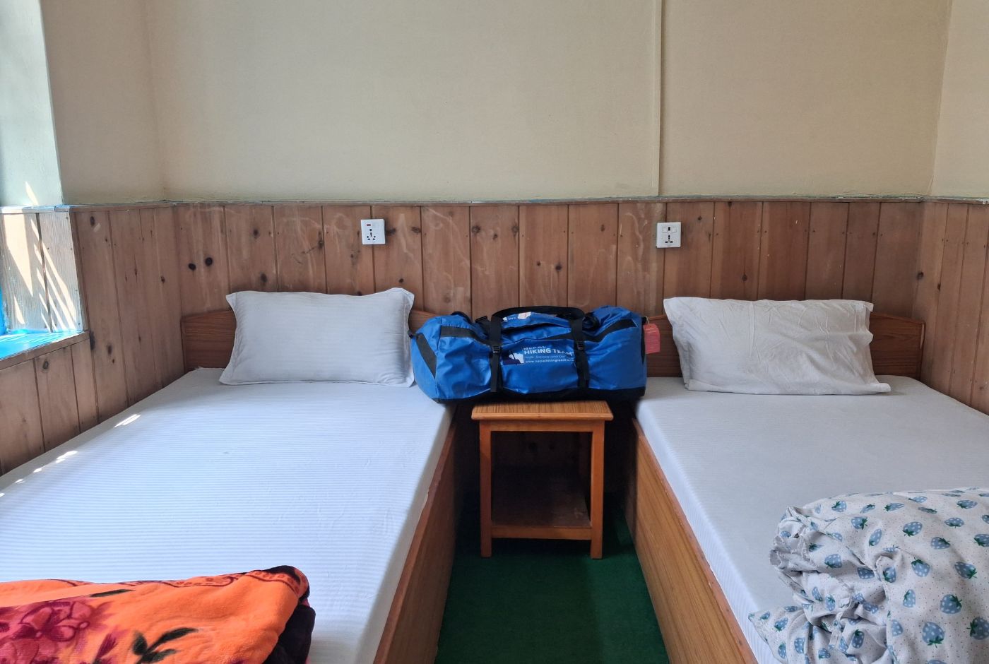
Comfort levels vary more across Chame's lodges than in the smaller villages before it. Some places have attached bathrooms, better bedding, and well-insulated rooms that make a real difference after a cold night at altitude. Wi-Fi and device charging are available in some lodges, usually for an extra charge and with variable reliability. Power interruptions can still happen. During peak trekking seasons, the better rooms tend to fill earlier than standard rooms, so arriving with some time in hand helps. For trekkers who want a more comfortable overnight stop before continuing toward Pisang and Manang, Chame also has higher-end options than most villages on this section of the circuit. Mountain Lodges of Nepal operates in Chame and provides a more hotel-like level of comfort for those who prefer that standard.
Most trekkers spend the majority of the evening in the dining room rather than their bedroom. Nights at this altitude are cold enough that the warmth of a dining hall, a pot of tea, and a hot meal matters considerably more than the quality of the mattress. Dining halls are where trekkers gather, compare notes on the next day's route, and wind down after a long day on the trail. The social rhythm of the teahouse circuit becomes more noticeable from Chame onward than it was in the villages below.
There are natural hot springs located a short walk from the main village. They are simple and small rather than a developed facility, but a welcome extra for trekkers who arrive with enough time and energy after a long day.
The rest and the features of Chame before tougher sections of the ACT are indeed among the top reasons why you should choose to trek the Annapurna Circuit.
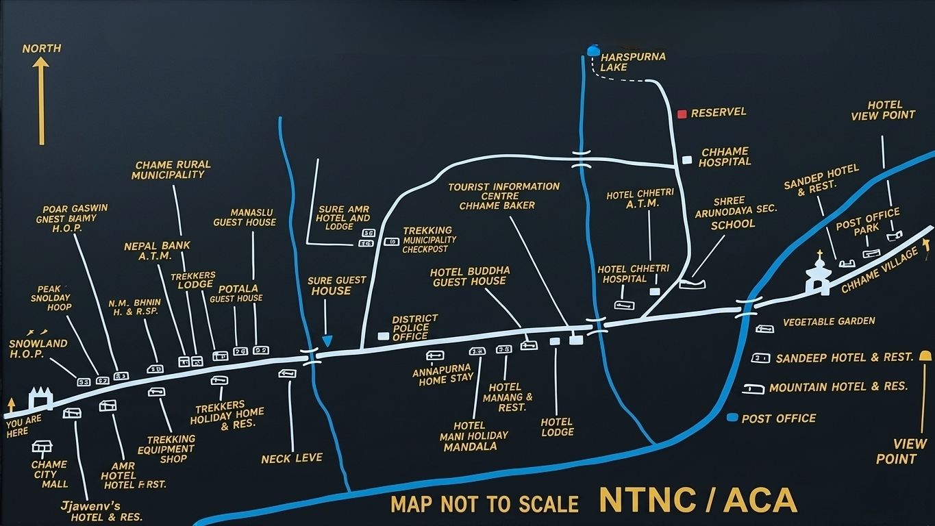
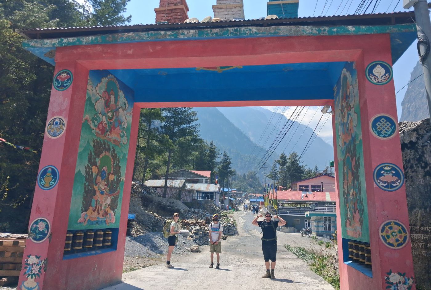
Chame functions as a compact trekking settlement with accommodation, services, and local institutions clustered along the main village line. Basic supplies, a gear shop, and bakery options are available here. The village has a clinic and a police post, which provide reassurance for trekkers heading into higher terrain. Chame is home to Gurung and Manangi communities, and Tibetan Buddhist influence is visible in the chortens, prayer wheels, and small monasteries around the village.
This concentration of services, combined with the village's cultural character, makes Chame one of the more self-contained stops on this section of the circuit. It is not only a place to sleep for the night. It is one of the first genuine resupply and recovery points on the Annapurna Circuit, with a wider range of accommodation, a practical cluster of services, and a village structure that supports trekkers before the terrain and altitude grow more demanding. For many, this is where the circuit begins to feel more alpine and more seriously logistical than the lower sections of the route.
From Chame to Khangsar and Tilicho Lake: Is This the Same Route?
Tilicho Lake is not a direct continuation from Chame, and this is a common source of confusion for trekkers planning their itinerary. Chame is still an early stage on the circuit, and the diversion to Tilicho Lake begins well beyond it.
From Chame, trekkers continue along the main Annapurna Circuit trail toward Pisang and then Manang over two days. Khangsar lies approximately 8 to 10 km from Manang and is the gateway to the Tilicho Lake diversion. From Khangsar, trekkers proceed to Tilicho Base Camp before ascending to the lake itself. This entire side route from Manang takes two to three additional days and requires its own acclimatization consideration.
In total, the route from Chame to Tilicho Lake spans three to four days, not as a single stretch but as a multi-stage journey that first follows the main circuit and then branches off deliberately toward the lake. Trekkers planning to include Tilicho Lake should build this as a planned extension, not assume it flows naturally from the main trail near Chame.
Sample Annapurna Circuit Route Through Chame
The Chame section of the Annapurna Circuit is typically covered over three days, structured to balance distance, elevation gain, and acclimatization.
Day 1: Dharapani to Chame
Distance: 15 to 17 km. Time: 5 to 7 hours. The day starts with the most demanding effort, as the main climb comes early through pine and fir forests, stone steps, and river crossings. The valley narrows before Timang and then begins to open into a broader alpine landscape as trekkers approach Chame. Arriving in Chame is a well-earned overnight stop that marks a clear shift in the character of the trek.
Day 2: Chame to Pisang or Upper Pisang
Distance: 14 to 15 km. Time: 4 to 6 hours. The route passes through Bratang and opens into a wider valley with strong mountain views. The decision between Lower Pisang and Upper Pisang should be based on how the body is responding to altitude and what the next day's strategy requires. Upper Pisang connects to the higher route toward Manang and offers better acclimatization for trekkers planning to use the Ghyaru and Ngawal trail.
Day 3: Pisang or Upper Pisang to Manang
Distance: 14 to 16 km. Time: 5 to 7 hours. This stage continues the altitude progression into Manang at 3,540 m. Trekkers who paced the previous two days well arrive in Manang in better condition for the rest day ahead. The higher route via Ghyaru and Ngawal is the recommended option for those who stayed at Upper Pisang, offering ridge views and a more gradual climb that supports acclimatization before the higher sections of the circuit.
Chame Concluding Notes
Chame is more than a stop along the trail; it sets the rhythm for everything that follows. The valley opens with pine forests, steady rivers, and clear mountain views. This is where trekkers feel the shift from road travel into the true walking journey.
A well-planned trek makes a visible difference here. Timing the walk, choosing the right teahouse, and adjusting for altitude all begin in Chame. When you choose a reliable trekking team for ACT, the experience stays smooth, safe, and focused on the trail itself.
Chame rewards those who arrive prepared and walk with awareness. The right guidance ensures each day ahead builds steadily, making the Annapurna Circuit trek both manageable and deeply rewarding.
Post a Comment