
The Annapurna Circuit Trek is rated moderate to challenging. The difficulty does not come from technical climbing but from its long duration, sustained altitude gain, and the demands of crossing Thorong La Pass at 17,769 ft / 5,416 m. Trekkers walk between 5 and 8 hours most days for 12 to 18 days, crossing multiple climate zones, high suspension bridges, and remote high-altitude terrain before descending into the rain-shadow valleys of Mustang.
The challenge of Annapurna Circuit Trek builds gradually. Lower sections are physically tiring due to heat, long walking hours, and stone stair climbs. From Chame onward, altitude begins to influence breathing, pace, and recovery. The section above Manang is where most trekkers feel the clearest shift in effort. With proper acclimatization, a well-paced itinerary, and experienced guide support, the trek is achievable for well-prepared trekkers, including those attempting a long Himalayan route for the first time.
Quick Difficulty Summary
| Factor | Details |
|---|---|
| Difficulty Level | Moderate to challenging |
| Highest Point | Thorong La Pass: 17,769 ft / 5,416 m |
| Trek Duration | 12 to 18 days depending on itinerary and route variations |
| Total Distance | Approximately 99 to 143 miles / 160 to 230 km, depending on road use and side trips |
| Daily Walking Hours | 5 to 8 hours per day |
| Technical Skills Required | None |
| Main Challenges | Altitude, cumulative fatigue, Thorong La Pass, long descent to Muktinath, variable terrain and weather |
| Key Acclimatization Stop | Manang: 11,545 ft / 3,519 m |
| Hardest Day | Thorong Phedi to Muktinath via Thorong La Pass |
Why Is the Annapurna Circuit Trek Difficult?
Altitude. The circuit climbs steadily from the lower Marsyangdi Valley, around 2,500 to 2,800 ft / 760 to 850 m, to 17,769 ft / 5,416 m at Thorong La Pass. Above 11,500 ft / 3,500 m, reduced oxygen begins to affect breathing, sleep, appetite, and the body's ability to recover overnight. This effect intensifies above 14,700 ft / 4,500 m near Thorong Phedi and the pass itself.
Long duration and cumulative fatigue. Walking 5 to 8 hours daily for nearly two weeks means fatigue accumulates even when individual days feel manageable. By the time trekkers reach the pass section, several days of high-altitude exertion have already been logged. This is why itinerary design and rest days matter as much as physical fitness.
Terrain variety. The route crosses subtropical forest floors, stone-paved village paths, rocky moraines, riverbed trails, exposed ridge sections, and high alpine terrain above the treeline. Each terrain type requires different effort and attention underfoot.
Weather and temperature shifts. The circuit passes through multiple climate zones. Warm, humid lower valleys give way to dry, windy high-altitude terrain above Manang. Temperatures around Thorong La Pass can drop well below freezing, especially before dawn during the pre-summit start.
Remote lodging and limited infrastructure. Above Manang, teahouse facilities become more basic. Altitude affects sleep quality regardless of comfort, and the reduced access to familiar food, reliable heating, and consistent rest adds an element of mental endurance to the physical challenge.
Mental endurance. The Annapurna Circuit is a long journey through increasingly remote terrain. Trekkers who struggle on the circuit often cite mental fatigue as much as physical strain. Staying motivated through rest days, weather delays, early morning starts, and the slow pace that altitude demands is part of what makes this trek genuinely challenging.
Annapurna Circuit Difficulty by Route Section
Lower Valley and Road Access Section
Difficulty: Easy to Moderate
The opening section from Besisahar into the Marsyangdi Valley introduces trekkers to the circuit through forests, terraced farmland, and riverside paths. Altitude is low and the trail is generally well-graded, making this one of the more comfortable sections of the route.
That said, long walking hours, heat in the warmer months, and occasional stone stair climbs mean this section should not be treated as a warm-up in the casual sense. The legs begin working from the first day. Parts of this lower section now follow jeep tracks where road construction has altered the traditional path. Dust, vehicle movement, and mixed trail conditions on road sections can affect walking rhythm and comfort even where the terrain is flat.
Jagat to Chame
Difficulty: Moderate
From Jagat, the trail enters a narrower gorge environment and the walking becomes more varied. The route passes through villages, crosses suspension bridges, and begins gaining altitude more consistently. Trekkers will notice the landscape shifting toward alpine character as they approach Chame.
By the time trekkers reach Chame at around 9,200 ft / 2,800 m, the body is beginning its introduction to thinner air, though the effects at this elevation are mild for most people. The terrain is engaging but not technically demanding.
Chame to Pisang
Difficulty: Moderate
This section marks the entry into the Annapurna mountain views proper, with the route climbing through forest and opening into wide valley views of the Annapurna and Lamjung ranges. The trail gains elevation more noticeably here, and breathing begins to feel slightly more effortful for some trekkers.
The walking is still manageable, but the combination of elevation gain and longer trail distances means trekkers should maintain a steady, controlled pace rather than pushing for speed.
Pisang to Manang via Ghyaru and Ngawal
Difficulty: Moderate to Challenging
There are two route options between Pisang and Manang. The lower road route is shorter and less strenuous. The upper trail via Ghyaru and Ngawal climbs significantly higher, passes through traditional high-altitude villages, and delivers wide views of the Annapurna massif and Pisang Peak.
The upper route is harder, involving a steep climb out of Pisang and sustained ridge walking at altitude. For trekkers who are acclimatizing well, this route is strongly worthwhile. For those already feeling the effects of altitude, the lower road may be the more sensible choice. Nepal Hiking Team's guides assess each trekker's condition and help make this call based on real-time observation rather than a fixed plan.
Manang Acclimatization
Difficulty: Variable depending on acclimatization hike chosen
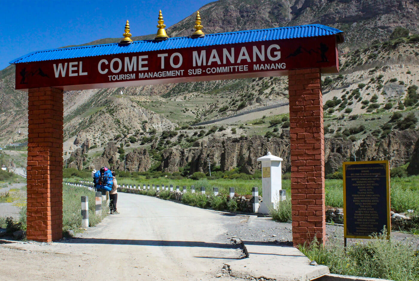
A rest day in Manang at 11,545 ft / 3,519 m is a standard and essential part of most Annapurna Circuit itineraries. The purpose is not passive rest but active acclimatization, walking higher than the overnight altitude during the day and returning to sleep lower.
Optional acclimatization hikes from Manang may include viewpoints above the village or the more demanding route toward Ice Lake. The Ice Lake hike reaches around 15,700 ft / 4,780 m and involves a steep ascent and descent, so it should only be attempted when trekkers are feeling strong and acclimatizing well.
Manang to Yak Kharka
Difficulty: Moderate to Challenging
Above Manang, the trail enters open, sparsely vegetated terrain and altitude effects become more apparent. Even on days where the distance covered is relatively short, effort levels rise because oxygen availability is lower. Short climbs that would feel straightforward at lower elevations require deliberate, measured pacing here.
Trekkers who have not fully acclimatized in Manang often notice headaches, reduced appetite, or disrupted sleep in this section. These are early signals that deserve attention rather than dismissal.
Yak Kharka to Thorong Phedi
Difficulty: Challenging
This section appears deceptively manageable on a map. The distances are shorter than earlier days, but the altitude makes the walking meaningfully harder. By this point, trekkers are approaching 14,500 ft / 4,420 m at Thorong Phedi, and every step of ascent costs more effort than it would at lower elevation.
Physical recovery overnight at this altitude is slower. Appetite is often reduced, which matters because the body needs fuel for the pass crossing the following day. This is a section where careful observation of how the body is responding matters as much as the walking itself.
Thorong Phedi to Muktinath via Thorong La Pass
Difficulty: Very Challenging
This is the hardest day of the Annapurna Circuit Trek. Trekkers begin the ascent in the early hours, typically between 3:00 AM and 5:00 AM, to reach the pass before afternoon winds arrive and to allow enough time for the descent to Muktinath in daylight.
The climb to the pass gains approximately 3,300 ft / 1,000 m from Thorong Phedi. The trail is steep in sections, with loose scree underfoot and possible snow or ice depending on the season. Cold temperatures, thin air, accumulated fatigue from previous days, and the pre-dawn start combine to make this section the most physically and mentally demanding stretch of the entire circuit.
The descent from Thorong La Pass to Muktinath is long and steep, dropping approximately 5,500 ft / 1,680 m. Many trekkers find this descent harder on the knees and leg muscles than the ascent, particularly after the exertion of reaching the pass. Trekking poles are strongly recommended for knee protection on the descent.
Muktinath to Jomsom and the Mustang Side
Difficulty: Easy to Moderate
After crossing Thorong La, altitude is no longer the primary challenge. The trail descends into the Mustang valley, and the physical demands shift from altitude management to managing accumulated fatigue and terrain underfoot.
This section includes riverbed walking, dusty jeep roads, and exposed sections subject to strong afternoon winds that funnel through the Kali Gandaki gorge. The wind in this valley can be surprisingly forceful and tiring to walk into for extended periods. Distances can be longer than they appear, and trekkers who expect the post-pass section to feel easy sometimes find it more draining than anticipated.
Optional Extension: Tatopani, Ghorepani, and Poon Hill
Difficulty: Challenging for a lower-altitude section
For itineraries that include this optional extension, the climb from Tatopani at approximately 3,900 ft / 1,190 m up to Ghorepani at around 9,500 ft / 2,860 m is one of the most physically demanding lower-altitude sections of the entire circuit. The elevation gain is substantial and the trail involves long stone staircase sections that are hard on the knees and legs, particularly after the accumulated fatigue of the full circuit.
The pre-dawn climb to Poon Hill at 10,531 ft / 3,210 m is relatively short but steep, and trekkers arriving here after completing the full circuit will feel the difference in tired legs. The mountain views from Poon Hill, with the Annapurna and Dhaulagiri ranges at dawn, are widely considered among the finest in Nepal.
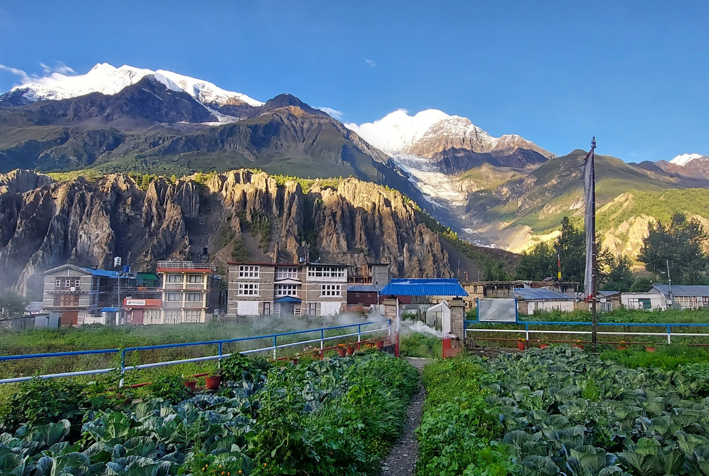
Why Manang Is the Turning Point
Manang at 11,545 ft / 3,519 m is the most important acclimatization stop on the Annapurna Circuit. Below Manang, most trekkers move at a comfortable pace without significant altitude-related disruption. Above Manang, the relationship between effort and outcome changes.
After leaving Manang, sleep quality often drops, with some trekkers experiencing restless nights, unusual dreams, or waking more frequently than normal. Appetite decreases, and the body's ability to recover overnight slows noticeably. Even modest climbs can require a pace slower than trekkers expect from themselves.
The acclimatization day in Manang is not optional in the sense that skipping it is technically possible, but doing so meaningfully increases the risk of altitude sickness between Manang and the pass. The body needs time to adjust to reduced oxygen levels before entering the higher sections toward Thorong La Pass. An extra day in Manang, combined with an active acclimatization hike to a higher elevation during the day, is the single most effective step a trekker can take to improve their chances of crossing Thorong La safely.
Nepal Hiking Team's guides use Manang as an observation point, watching how each trekker is responding to altitude before making any decisions about whether to continue to the higher sections on schedule.
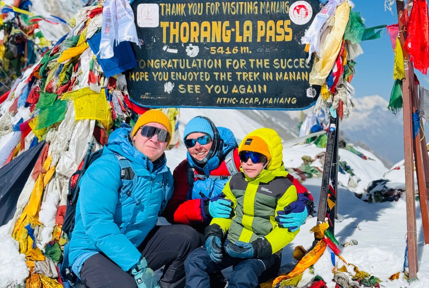
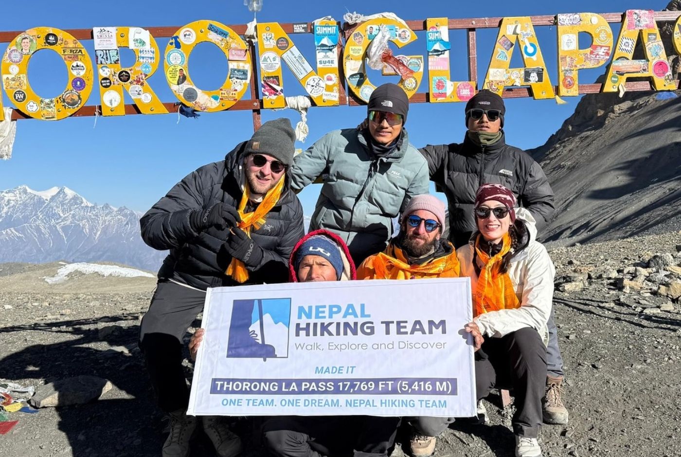
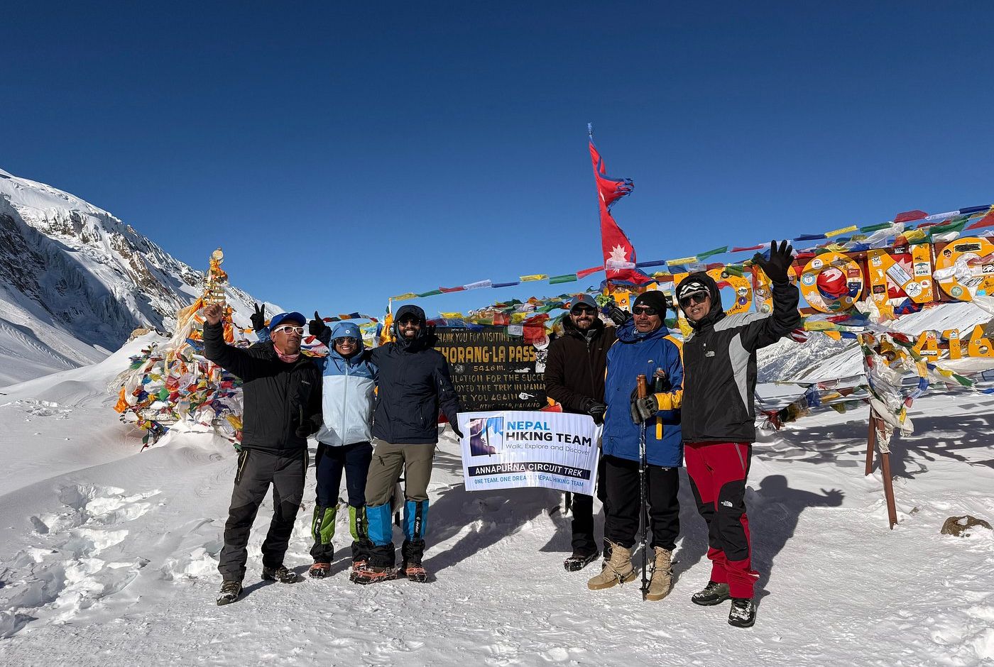
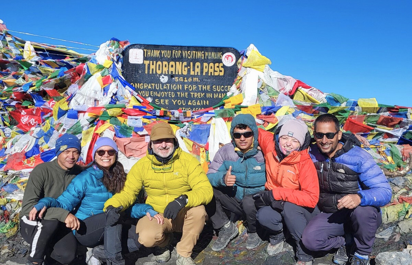
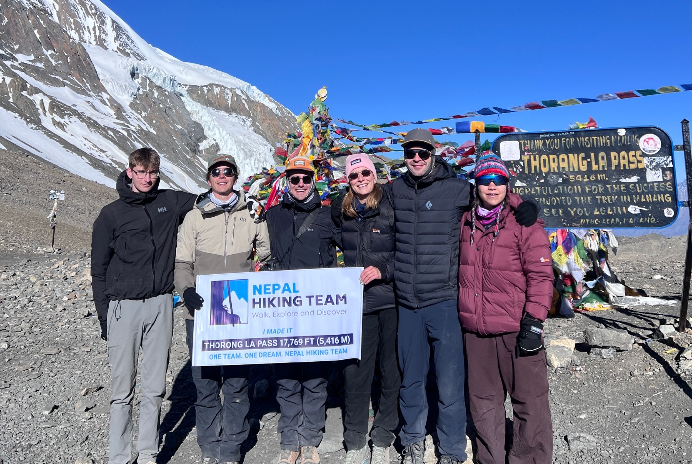
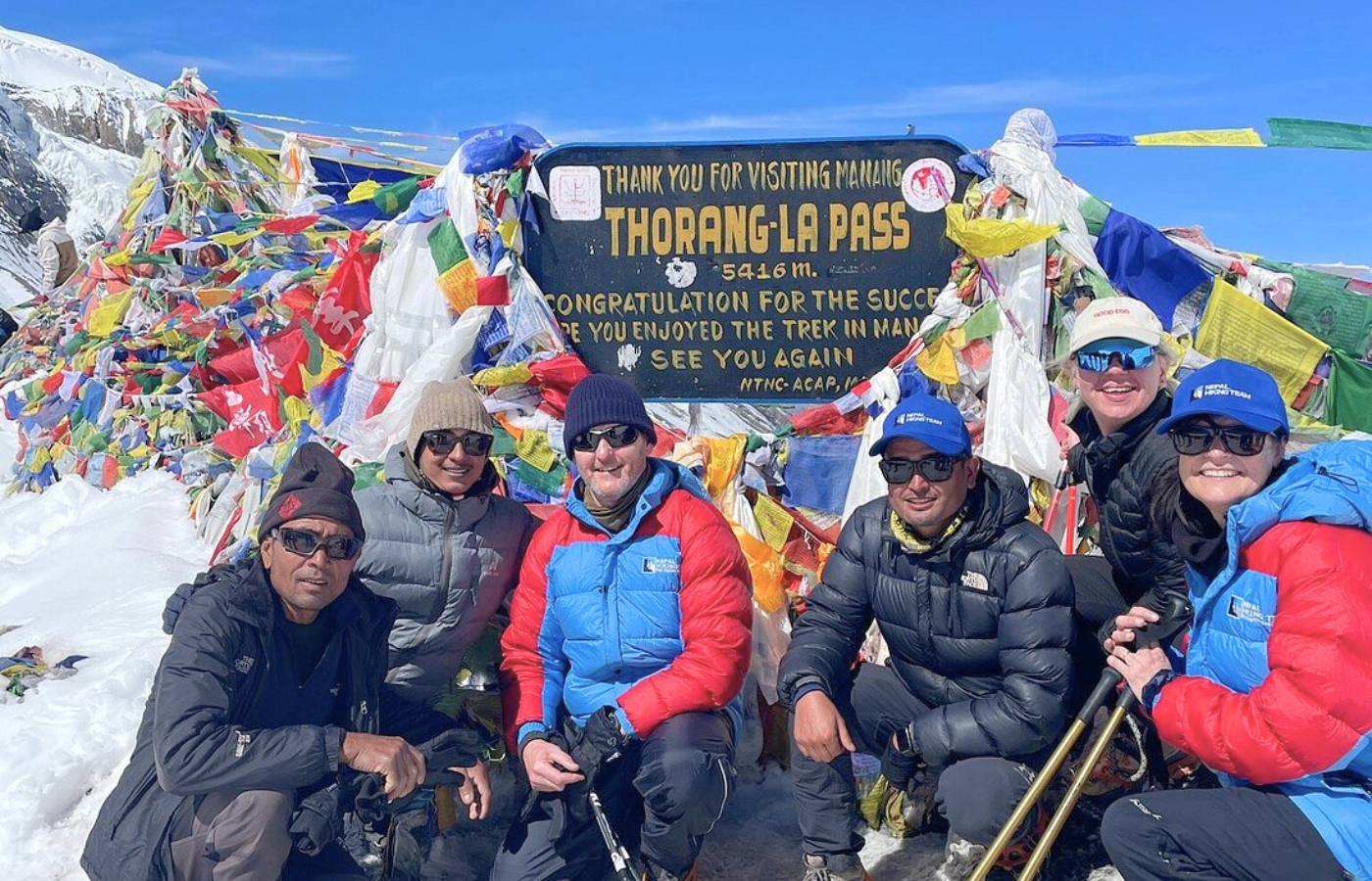
Thorong La Pass Difficulty
Thorong La Pass at 17,769 ft / 5,416 m is the highest point and the hardest day of the Annapurna Circuit Trek. Several factors combine to make the crossing demanding in a way that goes beyond what the elevation number alone suggests.
Early start. The ascent begins well before dawn to avoid afternoon winds and to ensure enough daylight for the full descent to Muktinath. Starting at 3:00 to 5:00 AM means trekkers begin their hardest day already tired from disrupted sleep at altitude.
Cold. Temperatures at the pass can drop to well below freezing before sunrise. Wind increases exposure and heat loss significantly. Layered clothing, insulated gloves, and a warm hat are not optional accessories at this elevation.
Thin air and slow pace. Above 16,000 ft / 4,880 m, oxygen availability is much lower than at sea level, so breathing becomes noticeably heavier with sustained effort. Trekkers who set off too fast in the early section of the climb often struggle more in the final approach to the pass. Controlled, consistent pacing is essential.
Snow and ice. Depending on the season, sections of the trail between Thorong Phedi and the pass may carry snow or ice. In spring and autumn, conditions are generally manageable. In winter, the crossing becomes significantly more serious and requires assessment before departure.
Long descent. The drop from the pass to Muktinath is steep and long. After an already demanding ascent, this descent places heavy load on the quadriceps and knees. Trekking poles are highly recommended, and taking the descent at a measured pace rather than rushing down protects both the joints and the ankles on loose terrain.
Altitude Sickness Risk on the Annapurna Circuit
Acute Mountain Sickness (AMS) is a genuine and serious risk on the Annapurna Circuit. It occurs when the body cannot adjust quickly enough to reduced oxygen at altitude, and it becomes a meaningful concern above 9,800 ft / 3,000 m, with the highest risk zone above 11,500 ft / 3,500 m.
Common symptoms of AMS include:
- Persistent headache, particularly after walking or upon waking
- Nausea or vomiting
- Dizziness or light-headedness
- Loss of appetite, especially noticeable at mealtimes
- Poor sleep quality or frequent waking at night
- Unusual tiredness that does not resolve with rest
AMS does not discriminate by fitness level. Strong, experienced trekkers can develop symptoms while less fit trekkers acclimatize well. The key variable is the pace of ascent, not physical condition.
Nepal Hiking Team's guides are trained to monitor these symptoms throughout the trek. When symptoms appear, guides respond by slowing the pace, adding additional rest stops, holding trekkers at the same altitude for an extra day, or, when necessary, organizing a descent to a lower elevation. This flexibility in itinerary management is often the difference between a safe crossing and a medical situation.
| Altitude Zone | Elevation Range | Risk Level |
|---|---|---|
| Early Risk Zone | 8,200 – 11,500 ft / 2,500 – 3,500 m | Mild symptoms possible if ascent is too fast, mainly around Chame or Pisang |
| High Risk Zone | 11,500 – 14,760 ft / 3,500 – 4,500 m | Manang is the critical adaptation point; symptoms become more common above this elevation |
| Very High Risk Zone | 14,760 ft / 4,500 m and above | Near Thorong Phedi and the pass, oxygen levels drop sharply; all symptoms must be taken seriously |
Daily Walking Hours and Cumulative Fatigue
On the Annapurna Circuit, trekkers typically walk between 5 and 8 hours per day and cover approximately 6 to 9 miles / 10 to 15 km. These figures are consistent across most sections of the route, though the effort required to cover the same distance increases significantly as altitude rises.
On a flat trail at low elevation, 6 miles in 5 hours feels routine. At 14,000 ft / 4,270 m, the same 6 miles may require 7 hours and feel considerably harder. Trekkers who gauge the circuit's difficulty purely by daily distance often underestimate how much altitude changes the equation.
Cumulative fatigue is one of the less visible challenges of the Annapurna Circuit. After 7 to 10 days of sustained daily walking, the legs carry residual tiredness that does not fully resolve overnight. Rest breaks become longer, walking pace naturally slows, and recovery at altitude is slower than at sea level. This accumulation is most noticeable in the approach to Thorong La Pass, when the body is simultaneously at its most fatigued and at its highest elevation.
A well-organized itinerary accounts for this by building rest days into the schedule rather than treating every day as a walking day. Rushing the itinerary to save time compresses recovery and increases both altitude risk and injury risk in the later stages of the trek.
Terrain, Road Sections, and Trail Conditions
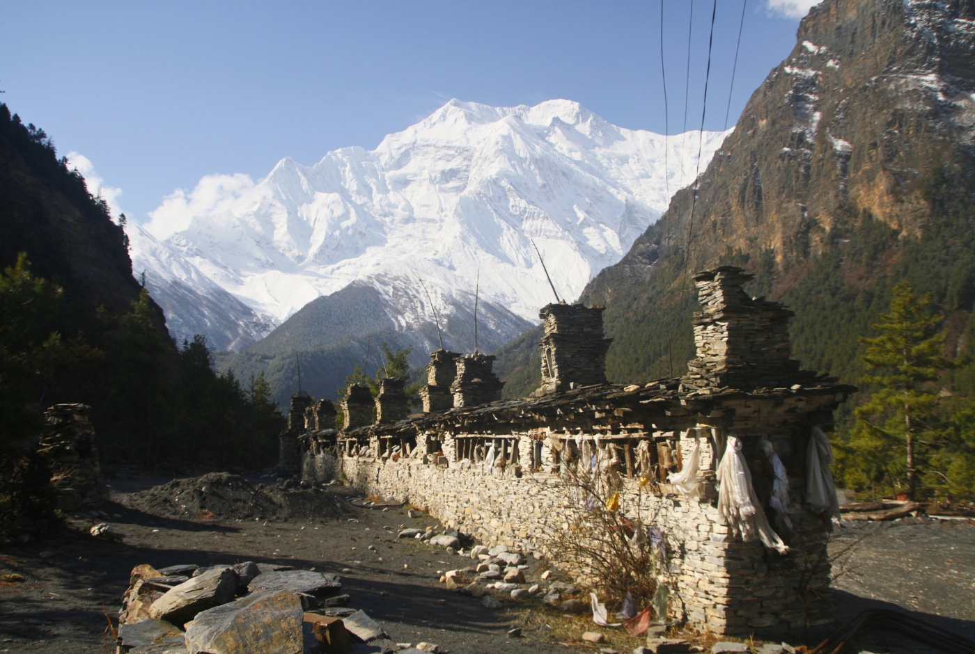
The Annapurna Circuit crosses a remarkable variety of terrain within a single route. Lower sections pass through subtropical forest, terraced farmland, and riverside trails. As altitude increases, the landscape shifts to open rocky valleys, high-altitude shrubland, and eventually bare alpine terrain above the treeline. Each transition brings a different type of walking and a different set of demands.
Stone steps are a consistent feature of the trail through villages and on steeper hillside sections. While they provide stable footing on ascent, long descents on stone stairs are hard on the knees, especially after many days of walking. Uneven rocky paths in the upper sections require sustained attention underfoot, particularly when trekkers are tired.
Suspension bridges are a practical reality throughout the lower and mid sections of the circuit. Most are sturdy and well-maintained, though crossing them with a heavy pack requires balance and confidence.
Road sections, particularly between Besisahar and Chame and on the Mustang side after the pass, are where jeep tracks have replaced parts of the original trail. These sections are not physically harder than mountain paths, but the dust, occasional vehicle traffic, and loss of natural trail character can be mentally tiring after days on traditional mountain paths. Many trekkers choose available alternative trails where they exist to avoid the roads.
For detail information refer yo out blog Annapurna Circuit Trek Distance.
Weather and Temperature Challenges
Weather on the Annapurna Circuit changes with elevation and season. The lower valleys are warm and humid, particularly in spring and the pre-monsoon period. From Manang upward, temperatures drop noticeably, and the terrain transitions into a high-altitude semi-desert climate that can feel both cold and dry simultaneously.
Above Manang, mornings are sharp even in clear weather. Nights regularly fall below freezing at Yak Kharka and Thorong Phedi. A layered clothing system is essential, not because conditions are unpredictable in the dramatic sense, but because temperature varies significantly between the effort of walking uphill and the cold of stopping for a rest at altitude.
Near Thorong La Pass, wind is the variable that changes conditions most rapidly. A calm morning at Thorong Phedi can give way to strong, cold winds near the summit. Afternoon winds in the pass area and in the Kali Gandaki gorge below Muktinath are common and can make walking harder and colder than the air temperature suggests.
| Season | Conditions | Difficulty Impact |
|---|---|---|
| Spring (March – May) | Mild temperatures, rhododendron bloom, occasional afternoon cloud | Comfortable trekking; good pass conditions for well-prepared trekkers |
| Autumn (September – November) | Clear skies, dry trails, stable weather | Best overall conditions; safest and most reliable for the pass crossing |
| Winter (December – February) | Freezing temperatures, snow at high altitude, icy trails, strong wind | Thorong La Pass becomes significantly more demanding; some years the pass is closed |
| Monsoon (June – August) | Heavy rain, humid lower sections, slippery trails, landslide risk, reduced visibility | Lower sections are more difficult and less reliable; trail conditions deteriorate |
How Fit Do You Need to Be?
The Annapurna Circuit does not require technical mountain skills. Trekkers do not need to use ropes, crampons, or climbing equipment under normal conditions. What the trek does require is sustained endurance, leg strength, and the mental resilience to maintain effort over many consecutive days.
Trekkers should be comfortable walking for 5 to 8 hours on varied terrain without significant difficulty at low elevation before arriving in Nepal. If that kind of day currently feels hard at home, it will feel considerably harder at altitude with a pack.
Recommended preparation in the 6 to 8 weeks before the trek includes:
- Regular long walks and day hikes, gradually increasing distance
- Stair climbing with a loaded daypack to condition the knees and build leg endurance
- Cardio exercise such as running, cycling, or swimming to develop aerobic capacity
- Uphill hiking on uneven terrain to simulate real trail conditions
- Leg strengthening exercises including squats, lunges, and step-ups
Consistency in training matters more than intensity. A trekker who walks regularly for two months will arrive in significantly better condition than one who completes a few intense sessions in the final weeks. Training with the actual footwear and daypack planned for the trek also allows time to address any fitting issues before departure.
Who May Find the Annapurna Circuit Trek Difficult?
The circuit is a sustained challenge, and certain trekkers are more likely to find it significantly harder than average:
- Trekkers with no previous multi-day hiking experience may underestimate cumulative fatigue and the demands of walking for consecutive days with a pack
- Travelers arriving directly from sea level who begin the trek within a day or two of arrival give their bodies little time to begin adjusting before altitude becomes a factor
- Trekkers following rushed itineraries of fewer than 14 days that eliminate acclimatization stops face meaningfully higher altitude sickness risk, particularly around and above Manang
- Trekkers carrying heavy personal backpacks without porter support will feel the additional weight most acutely in the high sections and during the long descent from the pass
- Those attempting the pass crossing in winter face additional hazards from snow, ice, reduced daylight, and the possibility of trail closure
- Trekkers adding side trips such as Tilicho Lake to an already full itinerary without accounting for the additional effort those extensions require
How Nepal Hiking Team Helps Manage the Difficulty
Nepal Hiking Team designs the Annapurna Circuit itinerary around steady, realistic pacing rather than minimum days. This means building in the Manang acclimatization stop as a fixed element of the plan, not something trekkers can choose to skip for convenience.
Guides monitor each trekker's condition throughout the route, paying particular attention to how individuals respond as altitude increases above Manang. When symptoms of AMS appear, guides adjust pace, add rest time, or hold the group at the same elevation. The decision to attempt Thorong La Pass on any given day is always assessed in the context of weather conditions and the health of the trekking group, not fixed to a calendar date.
Porter support means trekkers carry only what they need each day, reducing physical strain over the full duration of the trek. This matters most in the high sections, where carrying even a few extra pounds has a disproportionate effect on effort and recovery.
For trekkers who are unsure about any section of the route, alternative trail options and flexible pacing are available. The goal is a safe crossing and a worthwhile experience, not adherence to a fixed schedule.
Final Verdict
The Annapurna Circuit Trek is genuinely challenging. The altitude, duration, and physical demands of Thorong La Pass are real, and trekkers who approach the circuit without adequate preparation will find it harder than necessary. None of this makes the trek inaccessible.
With proper physical preparation, a realistic itinerary that includes acclimatization time, experienced guide support, and a willingness to pace carefully rather than rush, the Annapurna Circuit is achievable for a wide range of trekkers. The difficulty is what gives the route its character. The effort is significant, but it is also what makes the route feel so rewarding when crossed with proper preparation.
Post a Comment