
The Langtang Valley Trek covers around 65–80 km / 40–50 miles on the standard route from Syabrubesi to Kyanjin Gompa and back, usually completed in 7–10 days. Trekkers walk 5–7 hours daily through forests, Tamang villages, yak pastures, and glacial valleys beneath Langtang Lirung. For those adding Gosaikunda Lake, the route extends into a longer 14–16 day journey of about 110–130 km / 68–81 miles, crossing sacred alpine lakes and higher terrain before descending toward the Helambu region.
This guide breaks down the Langtang Valley trek distance by stage, explains how long each section takes on the trail, and helps you understand the difference between the standard round-trip route and the extended options available at Kyanjin Gompa.
Total Langtang Valley Trek Distance
The standard Langtang Valley trek distance is approximately 65 to 75 kilometers round trip. This covers the trekking route only, from Syabrubesi to Kyanjin Gompa and back along the same trail. The one-way distance from Syabrubesi to Kyanjin Gompa is roughly 31 to 37 kilometers, depending on exact route variations and where you measure from in Syabrubesi.
The drive from Kathmandu to Syabrubesi adds approximately 122 kilometers each way by road. That road distance is separate from the trekking distance and typically takes 7 to 8 hours by private jeep or 11 to 12 hours by local bus.
When trekkers ask about Langtang Valley trek total distance, the answer depends on what they include. The core trekking distance of 65 to 75 kilometers refers to walking days only, from the trailhead to Kyanjin Gompa and back. If you complete both Kyanjin Ri and Tserko Ri side hikes, you can add another 11 to 15 kilometers to that figure. The Langshisha Kharka extension adds approximately 14 kilometers round trip from Kyanjin Gompa.
How Long Does the Langtang Valley Trek Take
The standard Langtang Valley Trek takes 6 to 8 trekking days. This range accounts for different fitness levels, pacing preferences, and itinerary designs. A 6-day itinerary is possible for trekkers who move efficiently and skip the high-altitude side hikes. An 8-day itinerary allows a rest or acclimatization day at Kyanjin Gompa and time for at least one side hike.
Most experienced trekkers and guides recommend at least 7 days for the standard route. This gives you a full day at Kyanjin Gompa for either Kyanjin Ri or Tserko Ri, without rushing the descent stages.
Daily walking time on the Langtang trek is typically 5 to 7 hours, with shorter days on the Mundu to Kyanjin Gompa section and the longest walking day on the return leg from Kyanjin Gompa to Lama Hotel.
Langtang Valley Trek Distance Day by Day
The table below covers the standard 8-day itinerary including the Tserko Ri side hike. Days 1 and 8 are road travel days. Trekking days run from Day 2 through Day 7.
Day-by-Day Distance Overview
| Day | Route | Elevation | Distance | Duration |
|---|---|---|---|---|
| Day 1 | Kathmandu to Syabrubesi (Drive) | 1,550 m / 5,085 ft | 122 km / 75.8 miles | 7–8 hrs |
| Day 2 | Syabrubesi to Lama Hotel | 2,470 m / 8,104 ft | 11 km / 6.8 miles | 5–6 hrs |
| Day 3 | Lama Hotel to Mundu via Langtang Village | 3,430 m / 11,253 ft | 14 km / 8.7 miles | 6–7 hrs |
| Day 4 | Mundu to Kyanjin Gompa | 3,870 m / 12,697 ft | 6 km / 3.7 miles | 3–4 hrs |
| Day 5 | Kyanjin Gompa: Tserko Ri Hike (Round Trip) | 4,984 m / 16,350 ft | 8 km / 5 miles | 6–7 hrs |
| Day 6 | Kyanjin Gompa to Lama Hotel | 2,470 m / 8,104 ft | 20 km / 12.4 miles | 6–7 hrs |
| Day 7 | Lama Hotel to Syabrubesi | 1,550 m / 5,085 ft | 11 km / 6.8 miles | 4–5 hrs |
| Day 8 | Syabrubesi to Kathmandu (Drive) | 1,400 m / 4,593 ft | 122 km / 75.8 miles | 7–8 hrs |
The trekking days add up to approximately 70 kilometers of walking on the standard itinerary including the Tserko Ri hike. Without the side hike on Day 5, the total trail distance is closer to 62 kilometers.
Kathmandu to Syabrubesi: Road Distance and Travel Time
The drive from Kathmandu to Syabrubesi covers approximately 122 kilometers, or about 75.8 miles. By private jeep, the journey takes 7 to 8 hours. By local bus, expect 11 to 12 hours depending on stops and road conditions.
The route follows the Trishuli River valley and passes through Dhunche before descending to Syabrubesi. Road conditions near the trailhead can be narrow and uneven, particularly after the monsoon season. This road section is not counted as part of the Langtang Valley trek distance, since it is a vehicle journey rather than a walking stage.
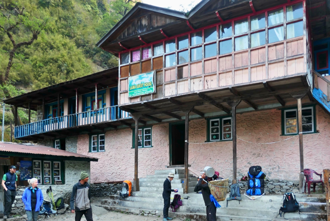
Syabrubesi to Lama Hotel: Trek Distance and Trail Details
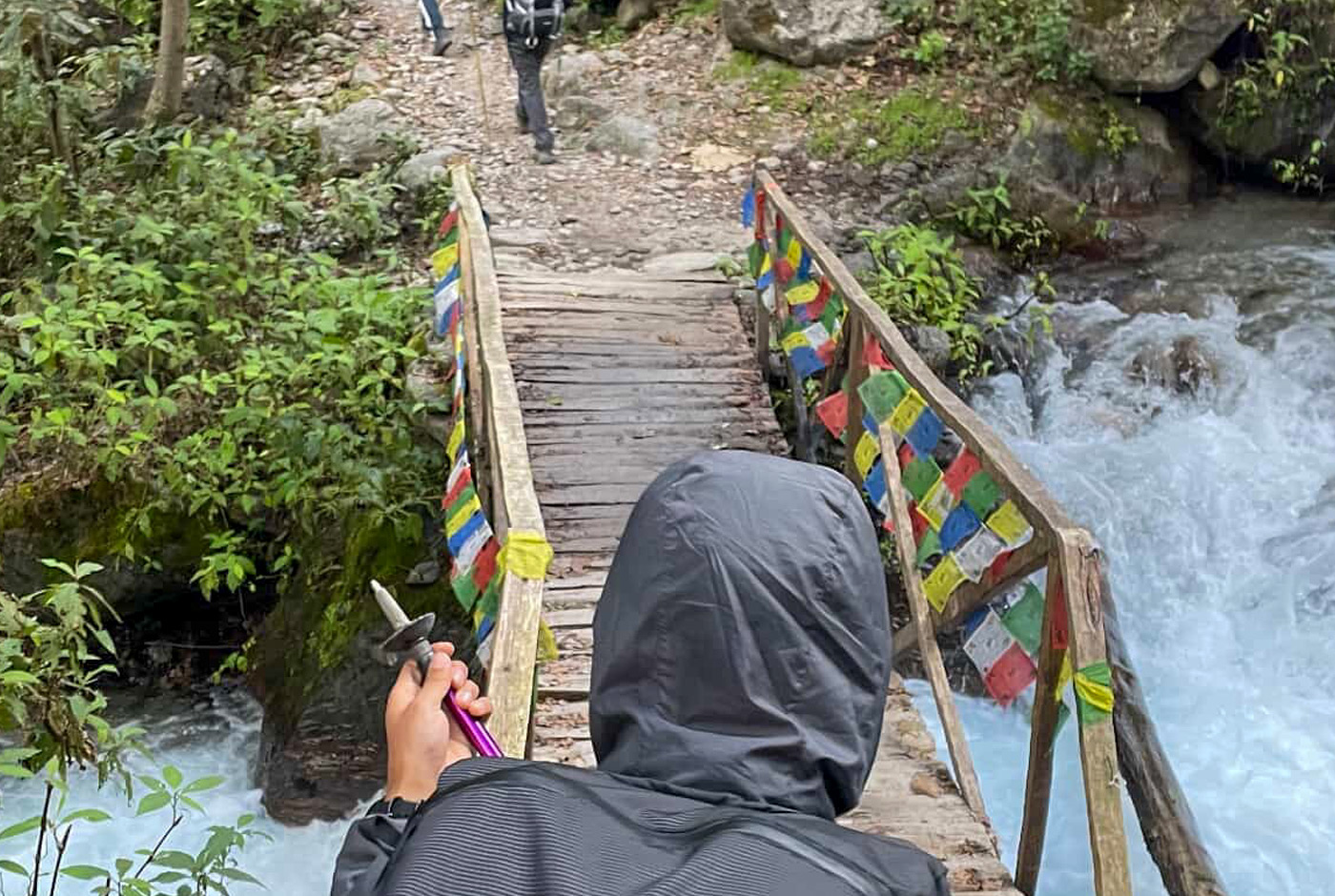
The first trekking day covers 11 kilometers from Syabrubesi to Lama Hotel, with a walking time of 5 to 6 hours. The trail follows the Langtang River through dense bamboo and rhododendron forest, crossing several suspension bridges along the way. This section involves steady ascent with moderate difficulty.
Syabrubesi to Lama Hotel: Section Breakdown
| Route | Elevation | Distance | Duration |
|---|---|---|---|
| Syabrubesi to Pahiro (Bamboo) | 1,970 m / 5,463 ft | 5.5 km / 3.4 miles | 3–4 hrs |
| Pahiro to Rimche | 2,400 m / 7,874 ft | 2.5 km / 1.5 miles | 1–2 hrs |
| Rimche to Lama Hotel | 2,470 m / 8,104 ft | 3 km / 1.9 miles | 1–2 hrs |
Lama Hotel to Mundu via Langtang Village: Trek Distance
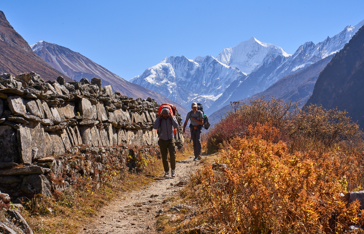
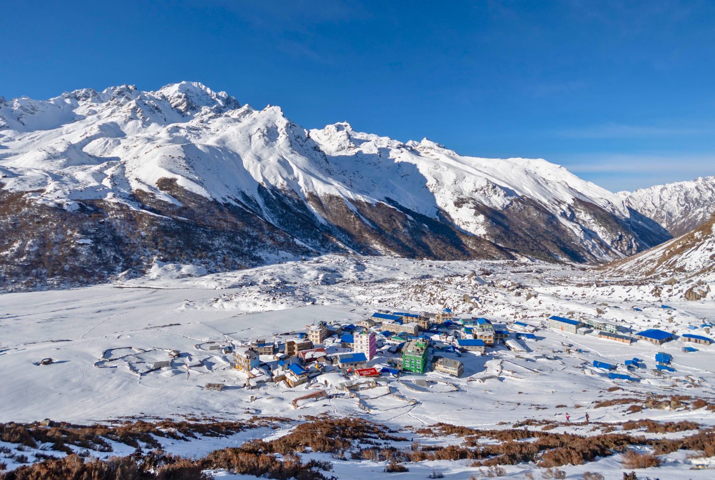
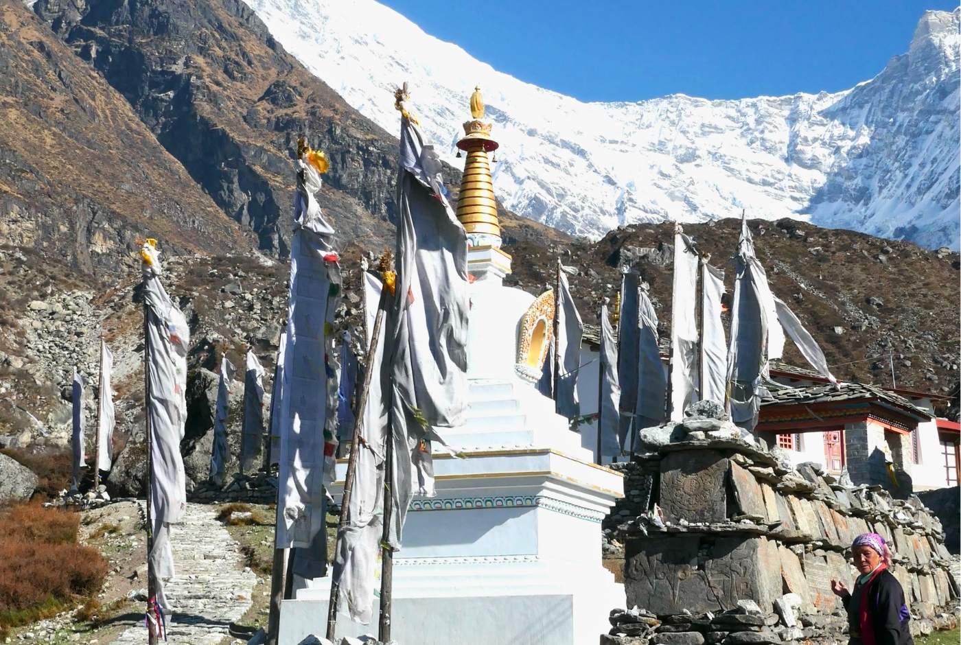
This is the longest single trekking day on the ascent, covering 14 kilometers over 6 to 7 hours. The trail climbs through oak, maple, and rhododendron forest before opening into alpine terrain beyond Ghoda Tabela. Langtang Village, rebuilt after the 2015 earthquake, sits at 3,430 meters and features traditional Tibetan-style architecture and yak pastures. Mundu is a short walk beyond the village.
Lama Hotel to Mundu: Section Breakdown
| Route | Elevation | Distance | Duration |
|---|---|---|---|
| Lama Hotel to Ghoda Tabela | 3,020 m / 9,908 ft | 6 km / 3.7 miles | 3–4 hrs |
| Ghoda Tabela to Langtang Village | 3,430 m / 11,253 ft | 5 km / 3.1 miles | 2–3 hrs |
| Langtang Village to Mundu | 3,550 m / 11,647 ft | 1.5 km / 0.9 miles | 0.5–1 hr |
Mundu to Kyanjin Gompa: Distance and Elevation
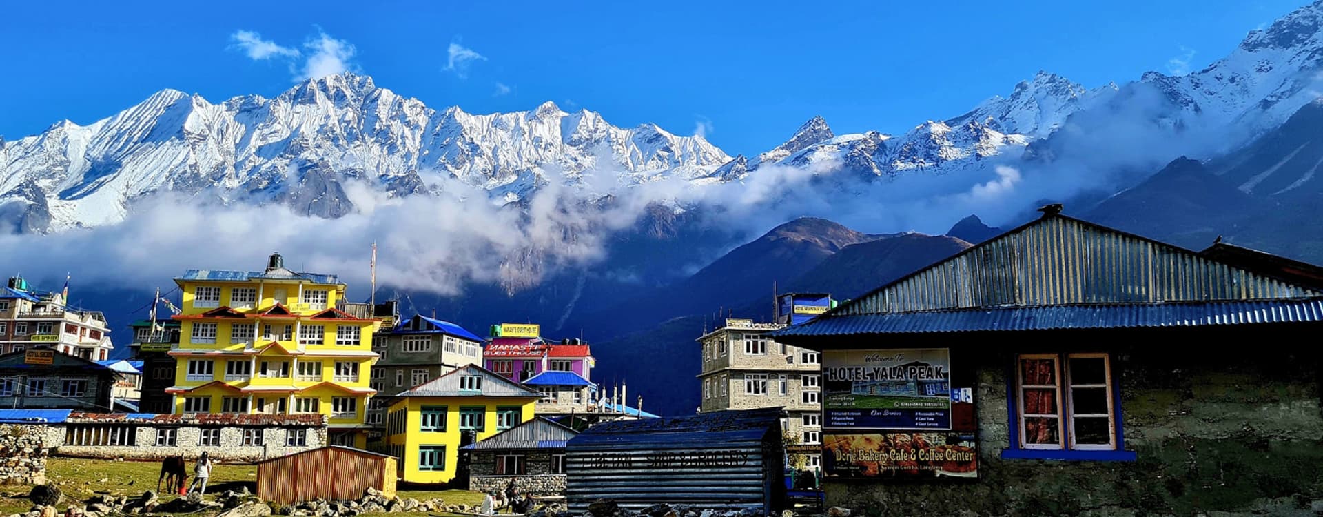
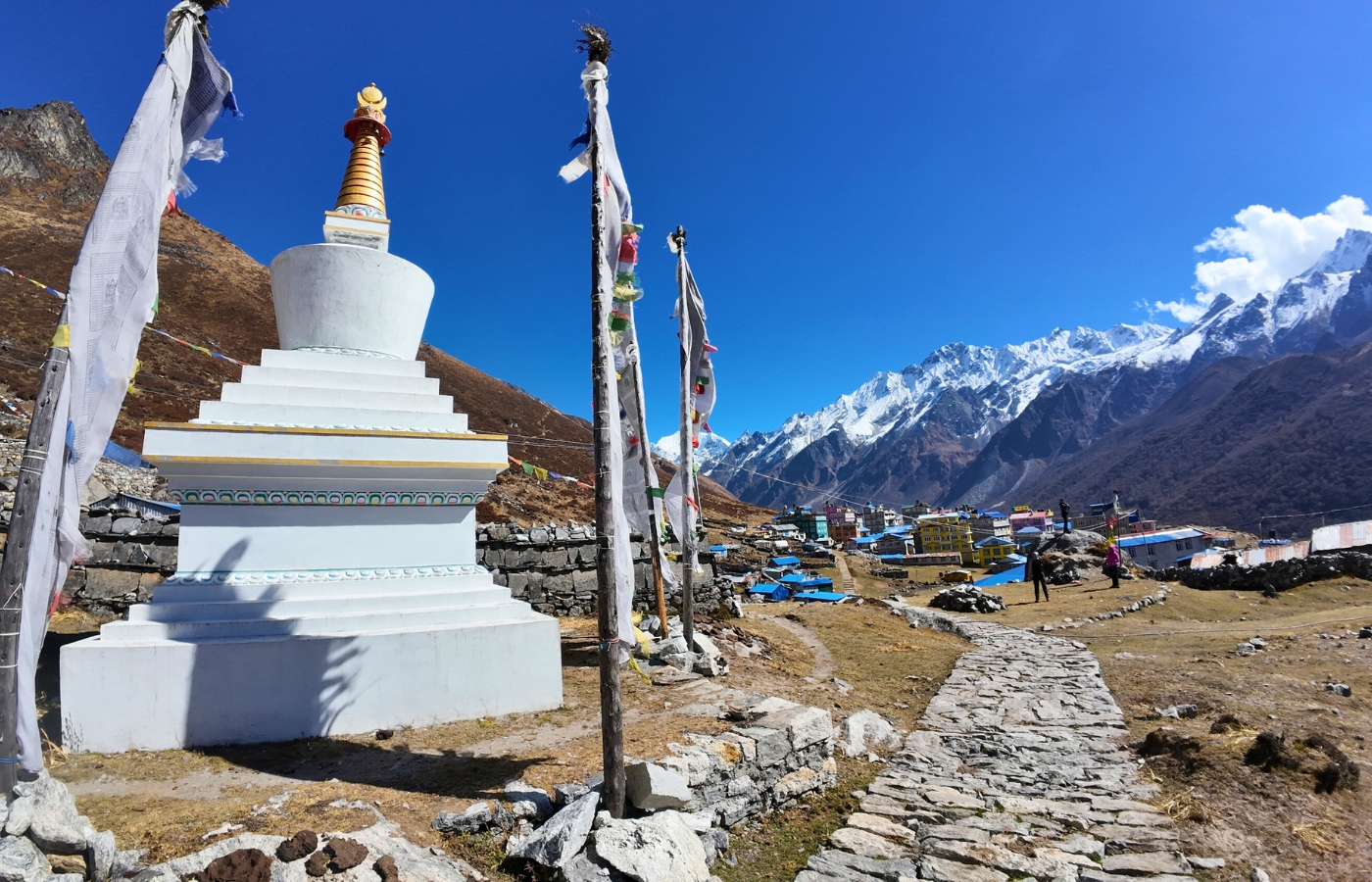
The trail from Mundu to Kyanjin Gompa is 6 kilometers and takes 3 to 4 hours. This is a relatively short day by distance, but the terrain becomes more open and arid as the landscape transitions fully into high alpine. Langtang Lirung and the Langtang Glacier dominate the skyline along this section. Kyanjin Gompa sits at 3,870 meters and serves as the endpoint of the standard Syabrubesi to Kyanjin Gompa route.
Mundu to Kyanjin Gompa: Section Breakdown
| Route | Elevation | Distance | Duration |
|---|---|---|---|
| Mundu to Sindum | 3,850 m / 12,631 ft | 2 km / 1.2 miles | 1–1.5 hrs |
| Sindum to Kyanjin Gompa | 3,870 m / 12,697 ft | 1.5 km / 0.9 miles | 1–1.5 hrs |
What the Distance Feels Like on the Trail
Distance in the Langtang Valley does not translate the same way it does on flat ground. The trail rises from roughly 1,500 meters near the lower trailhead area to 3,870 meters at Kyanjin Gompa. That elevation gain of over 2,300 meters is spread across approximately 31 to 37 kilometers of uphill trekking. Ten kilometers in this terrain, with altitude, variable footing, and river crossings, requires meaningfully more effort than ten kilometers on a flat path.
The descent is faster, which is why a long day like Kyanjin Gompa to Lama Hotel covers 20 kilometers in roughly the same walking hours as shorter ascent days. Trekkers who allow 5 to 7 hours per day and maintain a steady pace generally find the itinerary manageable. Pushing too fast on ascent days increases the risk of altitude-related fatigue above 3,000 meters.
Optional Side Hikes: Distance and Time Added
The standard Langtang Valley trek distance of 65 to 75 kilometers refers to the main trail only, from Syabrubesi to Kyanjin Gompa and back. The side hikes available from Kyanjin Gompa are separate from this figure and are completed as day hikes while staying at the same teahouse.
| Side Hike | Highest Elevation | Round-Trip Distance | Duration |
|---|---|---|---|
| Kyanjin Ri | 4,773 m / 15,659 ft | 4 km / 2.5 miles | 3–4 hrs |
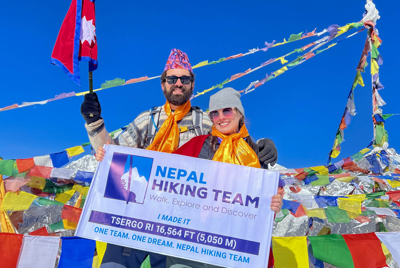
| Tserko Ri | 4,984 m / 16,352 ft | 7 km / 4.3 miles | 6–7 hrs |
| Langshisha Kharka | ~4,200 m / ~13,780 ft | 14 km / 8.7 miles | 5–6 hrs |
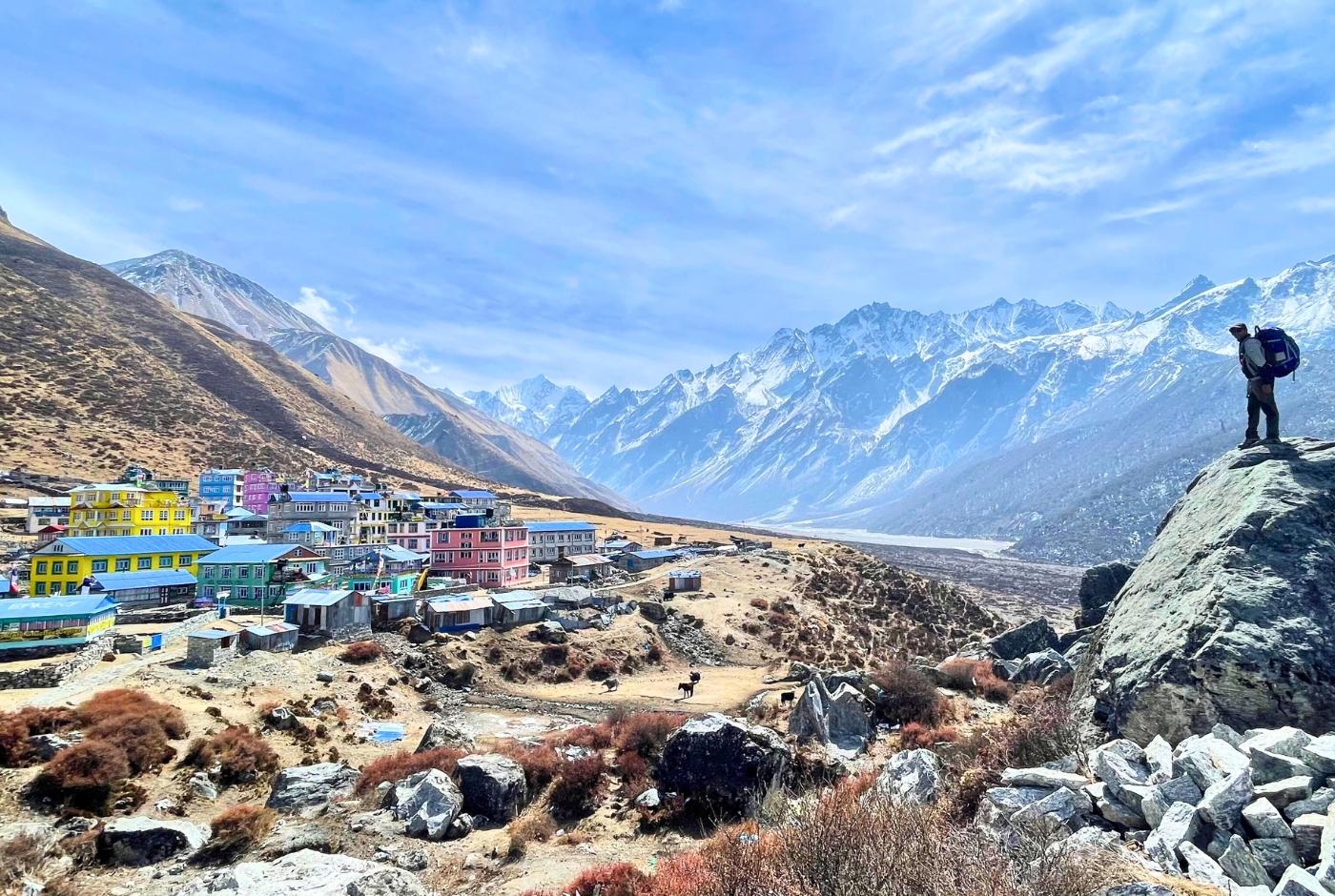
Kyanjin Ri
Kyanjin Ri rises from 3,870 meters at Kyanjin Gompa to 4,773 meters at the summit. The round-trip distance is approximately 4 kilometers and takes 3 to 4 hours. The ascent is steep but the route is straightforward. Views from the top span the full Langtang Valley, including Langtang Lirung, Ganesh Himal, and the surrounding glacier systems.
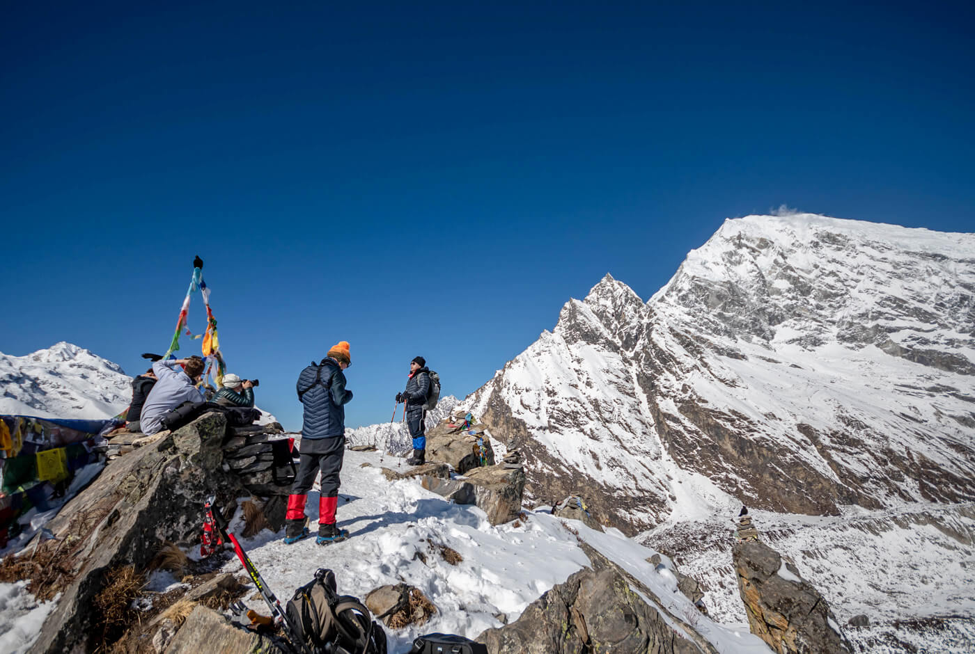
Tserko Ri
Tserko Ri is a more demanding hike, climbing from 3,870 meters to approximately 4,984 meters. The round-trip covers about 7 to 8 kilometers and takes 6 to 7 hours in total, with 4 to 5 hours for the ascent alone. This is one of the highest viewpoints accessible from Kyanjin Gompa without technical equipment and offers wide glacier views across the Langtang range.
Langshisha Kharka
Langshisha Kharka is a valley extension beyond Kyanjin Gompa at approximately 4,200 meters. The round-trip covers about 14 kilometers and takes 5 to 6 hours. This route is less frequented than Kyanjin Ri or Tserko Ri and suits trekkers who want to explore the upper valley floor rather than gain significant elevation. It does not add an extra overnight stop on a standard itinerary.
Kyanjin Gompa to Lama Hotel: The Longest Walking Day
The descent from Kyanjin Gompa to Lama Hotel is 20 kilometers and takes 6 to 7 hours. This is the longest walking day of the trek by distance. The route retraces the ascent path, moving from open alpine terrain through forest zones as elevation drops. Despite the length, the descent is generally easier on the lungs than the ascent days, though it requires care on steeper sections.
Kyanjin Gompa to Lama Hotel: Section Breakdown
| Route | Elevation | Distance | Duration |
|---|---|---|---|
| Kyanjin Gompa to Langtang Village | 3,430 m / 11,253 ft | 6 km / 3.7 miles | 2–2.5 hrs |
| Langtang Village to Ghoda Tabela | 3,020 m / 9,908 ft | 5 km / 3.1 miles | 1.5–2 hrs |
| Ghoda Tabela to Lama Hotel | 2,470 m / 8,104 ft | 9 km / 5.6 miles | 2.5–3 hrs |
Lama Hotel to Syabrubesi: Final Trekking Day
The last trekking day covers 11 kilometers from Lama Hotel back to Syabrubesi, taking 4 to 5 hours. The trail descends through bamboo, pine, oak, and rhododendron forest while following the Langtang River. This section is the reverse of Day 2 and is generally considered easier going downhill.
Lama Hotel to Syabrubesi: Section Breakdown
| Route | Elevation | Distance | Duration |
|---|---|---|---|
| Lama Hotel to Bamboo | 1,960 m / 6,430 ft | 3 km / 1.9 miles | 1–1.5 hrs |
| Bamboo to Rimche | 2,450 m / 8,038 ft | 4 km / 2.5 miles | 1.5–2 hrs |
| Rimche to Syabrubesi | 1,550 m / 5,085 ft | 4 km / 2.4 miles | 1.5 hrs |
Choosing the Right Itinerary Length
A 6-day itinerary suits fit trekkers who want to complete the standard route efficiently and are not planning any side hikes at Kyanjin Gompa. These trekkers move at a strong pace and have prior experience at altitude.
A 7-day itinerary is the practical minimum for most trekkers. It allows one full day at Kyanjin Gompa, which gives you time for either Kyanjin Ri or a shorter exploration around the valley, without compressing any of the main walking days.
An 8-day itinerary is the recommended length for trekkers who want to complete both Kyanjin Ri and Tserko Ri, spend time at Kyanjin Gompa village, acclimatize comfortably above 3,500 meters, or travel at a slower pace that allows for photography, rest stops, and village exploration. The additional day adds roughly 7 to 8 kilometers of hiking on a side hike and removes time pressure from the descent stages.
The difference between a minimum itinerary and a comfortable one is rarely more than one or two days. On a trek of 65 to 75 kilometers with this much elevation gain, that extra time makes a measurable difference to how the trail feels. Learn more on our blog: Top treks in the Langtang Region of Nepal.
Syabrubesi to Kathmandu: Return Drive
The return drive from Syabrubesi to Kathmandu follows the Pasang Lhamu Highway via Dhunche and Trishuli Bazaar. The road distance is approximately 122 kilometers and takes 7 to 8 hours. Road conditions vary by season and recent weather.
Planning Your Langtang Valley Trek: Distance and Duration Summary
The Langtang Valley Trek is approximately 65 to 75 kilometers round trip by trail, from Syabrubesi to Kyanjin Gompa and back. In miles, that is 40 to 47 miles of trekking. Most itineraries run 6 to 8 days, with daily walking times of 5 to 7 hours. The route rises from around 1,500 meters at the lower trailhead area to 3,870 meters at Kyanjin Gompa, with the option to push higher on side hikes to 4,773 meters at Kyanjin Ri or nearly 5,000 meters at Tserko Ri.
The total trekking distance increases by 11 to 25 kilometers if you include one or more of the Kyanjin Gompa side hikes. Trekkers who plan by both distance and days will find that an 8-day itinerary offers the most flexibility, while a 7-day schedule works well for those who want the standard route with one viewpoint hike. The route does not require technical skills, but the steady elevation gain and length reward proper pacing and adequate time on the trail.
Selecting a reliable travel agency is also important for getting the most out of the Langtang Valley Trek. Nepal Hiking Team helps you plan the route properly, manage logistics smoothly, and trek with experienced guides who understand the trail, altitude, and daily pacing.
Post a Comment